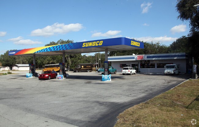
Property Record
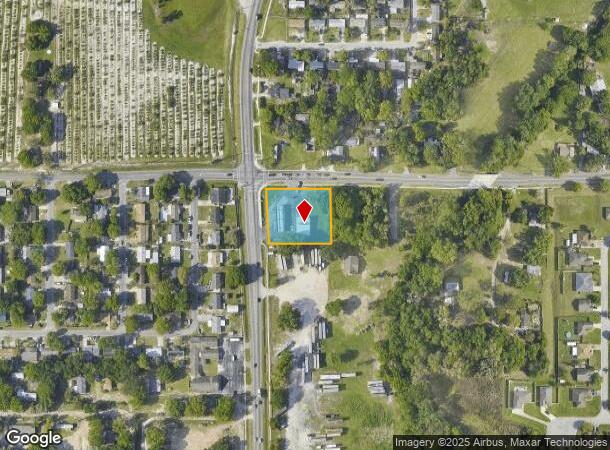
2477 Rifle Range Rd, Winter Haven, FL 33880

NEARBY LISTINGS FOR SALE OR LEASE
Property Detail
2477 Rifle Range Rd
Lakeland-Winter Haven, FL
Wahneta Farms
26-29-16-689000-014901
WAHNETA FARMS PB 1 PG 82A 82B LOT 149 BEG NW COR SEC 16 RUN E 34.22 FT TO WLY R/W ST RD 655 S 03 DEG 07 MIN 50 SEC E ALONG R/W 25.04 FT TO POB CONT S 03 DEG 07 MIN 50 SEC E ALONG R/W 184.02 FT TO CURVE SLY ALONG CURVE 15.98 FT E 215.59 FT N 199.69 FT
Servicestation
Polk
X
Florida
12105C0530G
149
2024
0.95 AC
2025
Polk County
014502
Tampa/St Petersburg
2,542 SF
DEMOGRAPHICS near 2477 Rifle Range Rd
1 Mile
3 Mile
5 Mile
2024 Total Population
5,065
28,280
95,745
2029 Population
6,135
34,047
114,791
Pop Growth 2024-2029
+ 21.13%
+ 20.39%
+ 19.89%
Average Age
35
38
41
2024 Total Households
1,618
9,987
36,929
HH Growth 2024-2029
+ 21.01%
+ 20.26%
+ 19.78%
Median Household Inc
$44,967
$53,536
$55,759
Avg Household Size
3.10
2.80
2.50
2024 Avg HH Vehicles
2.00
2.00
2.00
Median Home Value
$204,348
$218,390
$216,278
Median Year Built
1988
1987
1985
Nearby Places
Map Layers
Map Styles
 Street
 Aerial
- Restaurants
- Banks
- Shops
- Fitness
- Groceries
PUBLIC TRANSPORTATION
COMMUTER RAIL
Winter Haven (Silver Meteor - Amtrak, Silver Star - Amtrak)
DRIVE
WALK
Distance
Winter Haven (Silver Meteor - Amtrak, Silver Star - Amtrak)
5 min
2.9 mi
Freight Ports
Port of Tampa Bay
DRIVE
WALK
Distance
Port of Tampa Bay
69 min
52.1 mi
Nearby Properties
Address
Land Use
TOTAL SIZE
Lot Size
Zoning
Address
Land Use
TOTAL SIZE
Lot Size
Zoning
1,221,145 SF
179.12 AC
Address
Land Use
TOTAL SIZE
Lot Size
Zoning
467,391 SF
101.16 AC
Address
Land Use
TOTAL SIZE
Lot Size
Zoning
407,400 SF
22.33 AC
Address
Land Use
TOTAL SIZE
Lot Size
Zoning
504,548 SF
26.82 AC
BR
Address
Land Use
TOTAL SIZE
Lot Size
Zoning
332,360 SF
72.50 AC
Address
Land Use
TOTAL SIZE
Lot Size
Zoning
303,642 SF
96.19 AC
RC
Address
Land Use
TOTAL SIZE
Lot Size
Zoning
135,118 SF
7.26 AC
Address
Land Use
TOTAL SIZE
Lot Size
Zoning
85,378 SF
4.20 AC
BR
Address
Land Use
TOTAL SIZE
Lot Size
Zoning
155,373 SF
72.76 AC
Address
Land Use
TOTAL SIZE
Lot Size
Zoning
225,126 SF
24.54 AC
Address
Land Use
TOTAL SIZE
Lot Size
Zoning
65,152 SF
57.04 AC
RC
Address
Land Use
TOTAL SIZE
Lot Size
Zoning
322,165 SF
16.88 AC
Address
Land Use
TOTAL SIZE
Lot Size
Zoning
71,172 SF
5.03 AC
Address
Land Use
TOTAL SIZE
Lot Size
Zoning
109,512 SF
5 AC
Address
Land Use
TOTAL SIZE
Lot Size
Zoning
73,880 SF
23.17 AC
Address
Land Use
TOTAL SIZE
Lot Size
Zoning
70,900 SF
1.62 AC
Address
Land Use
TOTAL SIZE
Lot Size
Zoning
57,387 SF
9.84 AC
RC
Address
Land Use
TOTAL SIZE
Lot Size
Zoning
113,100 SF
11.49 AC
C3
Address
Land Use
TOTAL SIZE
Lot Size
Zoning
58,500 SF
4.86 AC
Address
Land Use
TOTAL SIZE
Lot Size
Zoning
47,578 SF
1.09 AC
Address
Land Use
TOTAL SIZE
Lot Size
Zoning
59,974 SF
6.06 AC
RC
Address
Land Use
TOTAL SIZE
Lot Size
Zoning
63,072 SF
7.02 AC
RP
Address
Land Use
TOTAL SIZE
Lot Size
Zoning
60,910 SF
9.04 AC
Address
Land Use
TOTAL SIZE
Lot Size
Zoning
38,592 SF
4.71 AC
R4
Address
Land Use
TOTAL SIZE
Lot Size
Zoning
88,192 SF
18.31 AC
Address
Land Use
TOTAL SIZE
Lot Size
Zoning
82,702 SF
9.06 AC
Address
Land Use
TOTAL SIZE
Lot Size
Zoning
41,286 SF
6.44 AC
BA
Address
Land Use
TOTAL SIZE
Lot Size
Zoning
86,598 SF
4.34 AC
C3
Address
Land Use
TOTAL SIZE
Lot Size
Zoning
17,179 SF
3.99 AC
BA
Address
Land Use
TOTAL SIZE
Lot Size
Zoning
60,328 SF
3.01 AC
The World's #1 Commercial Real Estate Marketplace
Connect with us
© 2025 CoStar Group
The information above has been obtained from sources believed reliable. While we do not doubt its accuracy we have not verified it and make no guarantee, warranty or representation about it. It is your responsibility to independently confirm its accuracy and completeness. Any projections, opinions, assumptions, or estimates used are for example only and do not represent the current or future performance of the property. The value of this transaction to you depends on tax and other factors which should be evaluated by your tax, financial, and legal advisors. You and your advisors should conduct a careful, independent investigation of the property to determine to your satisfaction the suitability of the property for your needs.