Property Record
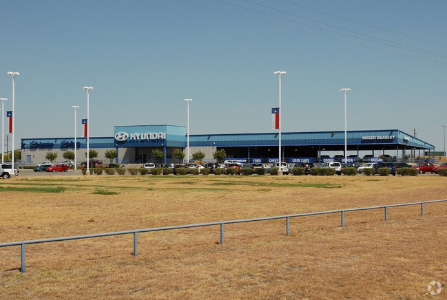
24795 Interstate 35, Kyle, TX 78640

Save to a Folder
{{folder.Name}}
{{folder.ListingIds.length}} Properties
{{folder.ListingIds.length}} Property
Create a New Folder
Property Detail
24795 Interstate 35
R89059
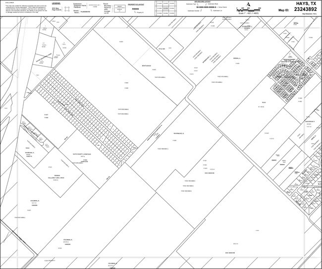
A0473 JAMES W WILLIAMS SURVEY, ACRES 19.50
Commercialnec
Hays
B and X Area of moderate flood hazard, usually the area between the limits of the 100-year and 500-year floods.
Texas
2024
19.50 AC
2025
Hays County
010917
Austin
27,012 SF
Austin-Round Rock-San Marcos, TX
NEARBY LISTINGS FOR SALE OR LEASE
DEMOGRAPHICS near 24795 Interstate 35
1 mile
3 mile
5 mile
2025 Total Population
3,297
34,390
88,712
2030 Population
3,977
40,630
103,537
Pop Growth 2025-2030
+ 20.62%
+ 18.14%
+ 16.71%
Average Age
37
36
34
2025 Total Households
1,128
11,455
32,296
HH Growth 2025-2030
+ 21.54%
+ 19.25%
+ 17.41%
Median Household Inc
$111,100
$95,829
$84,415
Avg Household Size
2.90
2.90
2.70
2025 Avg HH Vehicles
2.00
2.00
2.00
Median Home Value
$404,957
$352,539
$351,493
Median Year Built
2011
2010
2010
Nearby Places
Map Layers
Map Styles
 Street
 Aerial
Layers
 Traffic
 Biking
Places
Listings with unknown addresses are not visible on the map
- Restaurants
- Banks
- Shops
- Fitness
- Groceries
PUBLIC TRANSPORTATION
AIRPORT
Austin-Bergstrom International
Drive
Walk
Distance
Austin-Bergstrom International
41 min
29.2 mi
Nearby Properties
Address
Land Use
TOTAL SIZE
Lot Size
Zoning
Address
Land Use
TOTAL SIZE
Lot Size
Zoning
1,647,300 SF
96.81 AC
Address
Land Use
TOTAL SIZE
Lot Size
Zoning
40.48 AC
Address
Land Use
TOTAL SIZE
Lot Size
Zoning
301,745 SF
16.14 AC
Address
Land Use
TOTAL SIZE
Lot Size
Zoning
354,670 SF
13 AC
Address
Land Use
TOTAL SIZE
Lot Size
Zoning
300,779 SF
10.84 AC
Address
Land Use
TOTAL SIZE
Lot Size
Zoning
234,794 SF
10.07 AC
Address
Land Use
TOTAL SIZE
Lot Size
Zoning
4,173 SF
128.50 AC
Address
Land Use
TOTAL SIZE
Lot Size
Zoning
132,825 SF
52.74 AC
Address
Land Use
TOTAL SIZE
Lot Size
Zoning
203,840 SF
16.70 AC
Address
Land Use
TOTAL SIZE
Lot Size
Zoning
116,625 SF
19.01 AC
Address
Land Use
TOTAL SIZE
Lot Size
Zoning
97,976 SF
12.20 AC
Address
Land Use
TOTAL SIZE
Lot Size
Zoning
229,600 SF
16.50 AC
Address
Land Use
TOTAL SIZE
Lot Size
Zoning
36,219 SF
18.14 AC
Address
Land Use
TOTAL SIZE
Lot Size
Zoning
162,768 SF
13.52 AC
Address
Land Use
TOTAL SIZE
Lot Size
Zoning
303.50 AC
Address
Land Use
TOTAL SIZE
Lot Size
Zoning
169,025 SF
17.45 AC
Address
Land Use
TOTAL SIZE
Lot Size
Zoning
2,748 SF
72.33 AC
Address
Land Use
TOTAL SIZE
Lot Size
Zoning
118,080 SF
9.69 AC
Address
Land Use
TOTAL SIZE
Lot Size
Zoning
115,080 SF
10.63 AC
Address
Land Use
TOTAL SIZE
Lot Size
Zoning
19,340 SF
2.28 AC
Address
Land Use
TOTAL SIZE
Lot Size
Zoning
89,700 SF
7.84 AC
Address
Land Use
TOTAL SIZE
Lot Size
Zoning
89,700 SF
8.71 AC
Address
Land Use
TOTAL SIZE
Lot Size
Zoning
29,171 SF
3.23 AC
Address
Land Use
TOTAL SIZE
Lot Size
Zoning
17,610 SF
1.96 AC
Address
Land Use
TOTAL SIZE
Lot Size
Zoning
49,536 SF
2.36 AC
Address
Land Use
TOTAL SIZE
Lot Size
Zoning
82,180 SF
6.68 AC
Address
Land Use
TOTAL SIZE
Lot Size
Zoning
192 SF
47.74 AC
Address
Land Use
TOTAL SIZE
Lot Size
Zoning
20,700 SF
14.42 AC
Address
Land Use
TOTAL SIZE
Lot Size
Zoning
118.83 AC
The World's #1 Commercial Real Estate Marketplace
Connect with us
© 2026 CoStar Group
The information above has been obtained from sources believed reliable. While we do not doubt its accuracy we have not verified it and make no guarantee, warranty or representation about it. It is your responsibility to independently confirm its accuracy and completeness. Any projections, opinions, assumptions, or estimates used are for example only and do not represent the current or future performance of the property. The value of this transaction to you depends on tax and other factors which should be evaluated by your tax, financial, and legal advisors. You and your advisors should conduct a careful, independent investigation of the property to determine to your satisfaction the suitability of the property for your needs.