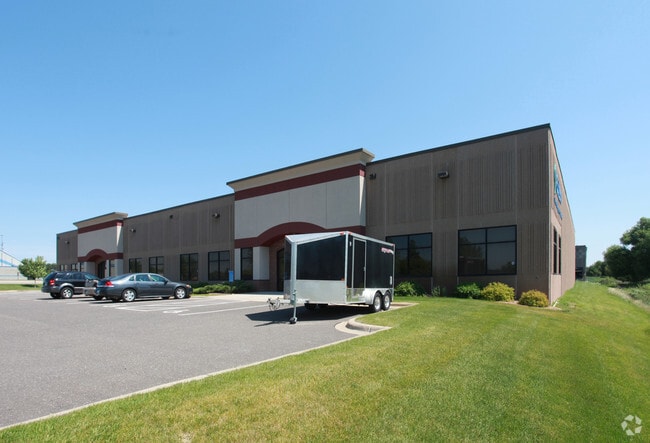
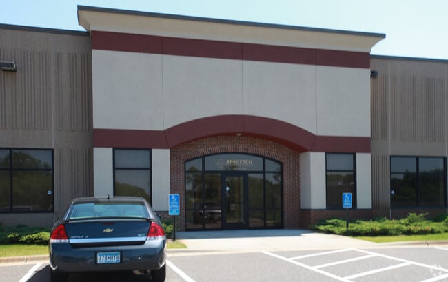
Property Record
248 Apollo Dr, Circle Pines, MN 55014

Property Detail
248 Apollo Dr
18-31-22-42-0012
THAT PRT OF NW1/4 OF SE1/4 OF SEC 18 TWP 31 RGE 22 LYG NWLY OF I 35W & LYG SELY OF CSAH NO 12 (APOLLO DR), EX THAT PRT THEREO
Industrialgeneral
ANOKA
B and X Area of moderate flood hazard, usually the area between the limits of the 100-year and 500-year floods.
Minnesota
2025
4.60 AC
2026
North Central
050229
Minneapolis/St Paul
25,664 SF
Minneapolis-St. Paul-Bloomington, MN-WI
NEARBY LISTINGS FOR SALE OR LEASE
-
-
View all Circle Pines listings for sale on LoopNet.com
DEMOGRAPHICS near 248 Apollo Dr
1 mile
3 mile
5 mile
2025 Total Population
5,228
30,903
84,025
2030 Population
5,359
32,089
86,833
Pop Growth 2025-2030
+ 2.51%
+ 3.84%
+ 3.34%
Average Age
41
40
40
2025 Total Households
1,451
10,486
29,522
HH Growth 2025-2030
+ 3.17%
+ 3.90%
+ 3.32%
Median Household Inc
$94,185
$112,365
$122,325
Avg Household Size
2.70
2.80
2.80
2025 Avg HH Vehicles
2.00
2.00
2.00
Median Home Value
$346,884
$383,744
$411,818
Median Year Built
1989
1989
1995
Nearby Places
Map Layers
Map Styles
 Street
 Aerial
Layers
 Traffic
 Biking
Places
Listings with unknown addresses are not visible on the map
- Restaurants
- Banks
- Shops
- Fitness
- Groceries
PUBLIC TRANSPORTATION
AIRPORT
Minneapolis-St Paul International/Wold-Chamberlain
Drive
Walk
Distance
Minneapolis-St Paul International/Wold-Chamberlain
41 min
26.6 mi
Freight Ports
Port Milwaukee
Drive
Walk
Distance
Port Milwaukee
386 min
348.8 mi
SALE & LEASE HISTORY
LISTING DATE
SALE/LEASE

Sep 24, 2016
For Lease
Sep 24, 2016
For Lease
Sep 23, 2016
For Sale
Nov 04, 2016
For Sale
Nearby Properties
Address
Land Use
TOTAL SIZE
Lot Size
Zoning
Address
Land Use
TOTAL SIZE
Lot Size
Zoning
226,201 SF
70.59 AC
Address
Land Use
TOTAL SIZE
Lot Size
Zoning
156,499 SF
81.20 AC
Address
Land Use
TOTAL SIZE
Lot Size
Zoning
239,389 SF
5.73 AC
Address
Land Use
TOTAL SIZE
Lot Size
Zoning
239,318 SF
Address
Land Use
TOTAL SIZE
Lot Size
Zoning
Address
Land Use
TOTAL SIZE
Lot Size
Zoning
195,000 SF
Address
Land Use
TOTAL SIZE
Lot Size
Zoning
152,721 SF
Address
Land Use
TOTAL SIZE
Lot Size
Zoning
248,816 SF
14.02 AC
Address
Land Use
TOTAL SIZE
Lot Size
Zoning
265,400 SF
13.53 AC
Address
Land Use
TOTAL SIZE
Lot Size
Zoning
74,366 SF
10 AC
Address
Land Use
TOTAL SIZE
Lot Size
Zoning
46,557 SF
9.27 AC
Address
Land Use
TOTAL SIZE
Lot Size
Zoning
190,377 SF
9.61 AC
Address
Land Use
TOTAL SIZE
Lot Size
Zoning
223,763 SF
24.89 AC
Address
Land Use
TOTAL SIZE
Lot Size
Zoning
120,000 SF
39.44 AC
Address
Land Use
TOTAL SIZE
Lot Size
Zoning
48,260 SF
10.38 AC
Address
Land Use
TOTAL SIZE
Lot Size
Zoning
180,712 SF
15.95 AC
Address
Land Use
TOTAL SIZE
Lot Size
Zoning
43,132 SF
37.89 AC
Address
Land Use
TOTAL SIZE
Lot Size
Zoning
52,981 SF
5.27 AC
Address
Land Use
TOTAL SIZE
Lot Size
Zoning
185,498 SF
25.01 AC
Address
Land Use
TOTAL SIZE
Lot Size
Zoning
32,314 SF
4.37 AC
Address
Land Use
TOTAL SIZE
Lot Size
Zoning
235,504 SF
30.54 AC
Address
Land Use
TOTAL SIZE
Lot Size
Zoning
243,028 SF
24.35 AC
Address
Land Use
TOTAL SIZE
Lot Size
Zoning
87,740 SF
5.98 AC
Address
Land Use
TOTAL SIZE
Lot Size
Zoning
91,397 SF
6.84 AC
Address
Land Use
TOTAL SIZE
Lot Size
Zoning
87,320 SF
8.74 AC
Address
Land Use
TOTAL SIZE
Lot Size
Zoning
Address
Land Use
TOTAL SIZE
Lot Size
Zoning
109,470 SF
12.67 AC
Address
Land Use
TOTAL SIZE
Lot Size
Zoning
120,680 SF
11.46 AC
Address
Land Use
TOTAL SIZE
Lot Size
Zoning
1.25 AC
Address
Land Use
TOTAL SIZE
Lot Size
Zoning
60,462 SF
39.19 AC
The World's #1 Commercial Real Estate Marketplace
Connect with us
© 2026 CoStar Group
The information above has been obtained from sources believed reliable. While we do not doubt its accuracy we have not verified it and make no guarantee, warranty or representation about it. It is your responsibility to independently confirm its accuracy and completeness. Any projections, opinions, assumptions, or estimates used are for example only and do not represent the current or future performance of the property. The value of this transaction to you depends on tax and other factors which should be evaluated by your tax, financial, and legal advisors. You and your advisors should conduct a careful, independent investigation of the property to determine to your satisfaction the suitability of the property for your needs.