Property Record
248 Us Highway 130, Bordentown, NJ 08505


NEARBY LISTINGS FOR SALE OR LEASE
Property Detail
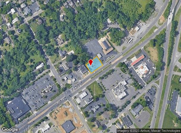
248 Us Highway 130
04-00120-0000-00005
Burlington
Commercialnec
New Jersey
X
5
34005C0039F
0.37 AC
2024
South Burlington County
2025
Philadelphia
704201
Philadelphia-Camden-Wilmington, PA-NJ-DE-MD
1,299 SF
DEMOGRAPHICS near 248 Us Highway 130
1 Mile
3 Mile
5 Mile
2024 Total Population
7,800
26,320
88,819
2029 Population
7,941
26,791
88,835
Pop Growth 2024-2029
+ 1.81%
+ 1.79%
+ 0.02%
Average Age
43
39
40
2024 Total Households
3,387
8,994
32,273
HH Growth 2024-2029
+ 2.01%
+ 2.07%
(0.02%)
Median Household Inc
$95,211
$103,473
$86,795
Avg Household Size
2.30
2.60
2.60
2024 Avg HH Vehicles
2.00
2.00
2.00
Median Home Value
$280,933
$333,979
$279,163
Median Year Built
1957
1977
1961
Nearby Places
Map Layers
Map Styles
 Street
 Aerial
- Restaurants
- Banks
- Shops
- Fitness
- Groceries
PUBLIC TRANSPORTATION
COMMUTER RAIL
Trenton Transit Center (Trenton Line - SEPTA)
DRIVE
WALK
Distance
Trenton Transit Center (Trenton Line - SEPTA)
13 min
7.8 mi
AIRPORT
Trenton Mercer
DRIVE
WALK
Distance
Trenton Mercer
23 min
13.7 mi
Freight Ports
Port of Philadelphia
DRIVE
WALK
Distance
Port of Philadelphia
39 min
29.9 mi
SALE & LEASE HISTORY
LISTING DATE
SALE/LEASE

Sep 17, 2021
For Sale
Nearby Properties
Address
Land Use
TOTAL SIZE
Lot Size
Zoning
Address
Land Use
TOTAL SIZE
Lot Size
Zoning
561.91 AC
AG
Address
Land Use
TOTAL SIZE
Lot Size
Zoning
89.60 AC
REO
Address
Land Use
TOTAL SIZE
Lot Size
Zoning
0.13 AC
Address
Land Use
TOTAL SIZE
Lot Size
Zoning
51.10 AC
Address
Land Use
TOTAL SIZE
Lot Size
Zoning
44.33 AC
Address
Land Use
TOTAL SIZE
Lot Size
Zoning
Address
Land Use
TOTAL SIZE
Lot Size
Zoning
47.99 AC
Address
Land Use
TOTAL SIZE
Lot Size
Zoning
Address
Land Use
TOTAL SIZE
Lot Size
Zoning
32.71 AC
HC
Address
Land Use
TOTAL SIZE
Lot Size
Zoning
32.75 AC
Address
Land Use
TOTAL SIZE
Lot Size
Zoning
263,232 SF
39.16 AC
CI
Address
Land Use
TOTAL SIZE
Lot Size
Zoning
154 AC
C-2
Address
Land Use
TOTAL SIZE
Lot Size
Zoning
1,128 SF
32.88 AC
REO
Address
Land Use
TOTAL SIZE
Lot Size
Zoning
2,350 SF
8.80 AC
PVD2
Address
Land Use
TOTAL SIZE
Lot Size
Zoning
Address
Land Use
TOTAL SIZE
Lot Size
Zoning
2,131 SF
19.76 AC
REO
Address
Land Use
TOTAL SIZE
Lot Size
Zoning
45.80 AC
Address
Land Use
TOTAL SIZE
Lot Size
Zoning
18,672 SF
9.10 AC
MFG
Address
Land Use
TOTAL SIZE
Lot Size
Zoning
11.50 AC
PUD
Address
Land Use
TOTAL SIZE
Lot Size
Zoning
15,096 SF
21.76 AC
AT
Address
Land Use
TOTAL SIZE
Lot Size
Zoning
145.03 AC
C
Address
Land Use
TOTAL SIZE
Lot Size
Zoning
Address
Land Use
TOTAL SIZE
Lot Size
Zoning
Address
Land Use
TOTAL SIZE
Lot Size
Zoning
17.28 AC
HC
Address
Land Use
TOTAL SIZE
Lot Size
Zoning
47.80 AC
Address
Land Use
TOTAL SIZE
Lot Size
Zoning
Address
Land Use
TOTAL SIZE
Lot Size
Zoning
20,192 SF
38.19 AC
CG2
Address
Land Use
TOTAL SIZE
Lot Size
Zoning
15.95 AC
Address
Land Use
TOTAL SIZE
Lot Size
Zoning
9.61 AC
R1
Address
Land Use
TOTAL SIZE
Lot Size
Zoning
9.77 AC
The World's #1 Commercial Real Estate Marketplace
Connect with us
© 2025 CoStar Group
The information above has been obtained from sources believed reliable. While we do not doubt its accuracy we have not verified it and make no guarantee, warranty or representation about it. It is your responsibility to independently confirm its accuracy and completeness. Any projections, opinions, assumptions, or estimates used are for example only and do not represent the current or future performance of the property. The value of this transaction to you depends on tax and other factors which should be evaluated by your tax, financial, and legal advisors. You and your advisors should conduct a careful, independent investigation of the property to determine to your satisfaction the suitability of the property for your needs.