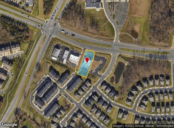
Property Record
24820 Community Corner Plz, Chantilly, VA 20152


NEARBY LISTINGS FOR SALE OR LEASE
Property Detail
24820 Community Corner Plz
Washington-Arlington-Alexandria, DC-VA-MD-WV
Commmunity Corner Sub
205-40-1742
COMMMUNITY CORNER SUB WAIVER LOT 1 201904010015531/2P
Regionalshoppingcenterormallwithanchorstore
Loudoun
X
Virginia
51107C0370E
1
2025
0.69 AC
2025
Leesburg/West Loudoun
611807
Washington, DC
4,900 SF
DEMOGRAPHICS near 24820 Community Corner Plz
1 Mile
3 Mile
5 Mile
2024 Total Population
16,053
75,479
125,209
2029 Population
17,345
81,667
135,306
Pop Growth 2024-2029
+ 8.05%
+ 8.20%
+ 8.06%
Average Age
34
34
34
2024 Total Households
5,170
22,574
37,546
HH Growth 2024-2029
+ 8.30%
+ 8.35%
+ 8.16%
Median Household Inc
$163,945
$180,803
$188,776
Avg Household Size
3.10
3.30
3.30
2024 Avg HH Vehicles
2.00
2.00
2.00
Median Home Value
$661,753
$723,925
$735,792
Median Year Built
2009
2010
2010
Nearby Places
Map Layers
Map Styles
 Street
 Aerial
- Restaurants
- Banks
- Shops
- Fitness
- Groceries
PUBLIC TRANSPORTATION
AIRPORT
Washington Dulles International
DRIVE
WALK
Distance
Washington Dulles International
23 min
11.4 mi
Ronald Reagan Washington Ntl
DRIVE
WALK
Distance
Ronald Reagan Washington Ntl
52 min
32.8 mi
Freight Ports
Port of Baltimore
DRIVE
WALK
Distance
Port of Baltimore
93 min
68.1 mi
SALE & LEASE HISTORY
LISTING DATE
SALE/LEASE

May 16, 2018
For Lease
Nearby Properties
Address
Land Use
TOTAL SIZE
Lot Size
Zoning
Address
Land Use
TOTAL SIZE
Lot Size
Zoning
525,482 SF
39.73 AC
PDGI
Address
Land Use
TOTAL SIZE
Lot Size
Zoning
669,358 SF
39.88 AC
IP
Address
Land Use
TOTAL SIZE
Lot Size
Zoning
538,565 SF
135.31 AC
PDIP
Address
Land Use
TOTAL SIZE
Lot Size
Zoning
778,426 SF
48.02 AC
CLI
Address
Land Use
TOTAL SIZE
Lot Size
Zoning
695,321 SF
63.54 AC
PDGI
Address
Land Use
TOTAL SIZE
Lot Size
Zoning
204,014 SF
23.47 AC
PDIP
Address
Land Use
TOTAL SIZE
Lot Size
Zoning
252,600 SF
33.26 AC
PDIP
Address
Land Use
TOTAL SIZE
Lot Size
Zoning
759,405 SF
64.76 AC
IP
Address
Land Use
TOTAL SIZE
Lot Size
Zoning
49.36 AC
IP
Address
Land Use
TOTAL SIZE
Lot Size
Zoning
536,602 SF
117.49 AC
TR3UBF
Address
Land Use
TOTAL SIZE
Lot Size
Zoning
415,477 SF
97.76 AC
TR1UBF
Address
Land Use
TOTAL SIZE
Lot Size
Zoning
222,313 SF
36.21 AC
PDOP
Address
Land Use
TOTAL SIZE
Lot Size
Zoning
327,400 SF
37.53 AC
PDGI
Address
Land Use
TOTAL SIZE
Lot Size
Zoning
48.30 AC
PDIP
Address
Land Use
TOTAL SIZE
Lot Size
Zoning
59.20 AC
IP
Address
Land Use
TOTAL SIZE
Lot Size
Zoning
181,718 SF
10.23 AC
R16
Address
Land Use
TOTAL SIZE
Lot Size
Zoning
303,168 SF
41.95 AC
PDCCRC
Address
Land Use
TOTAL SIZE
Lot Size
Zoning
264,902 SF
60.25 AC
PDH4
Address
Land Use
TOTAL SIZE
Lot Size
Zoning
54 AC
PDTC
Address
Land Use
TOTAL SIZE
Lot Size
Zoning
192,413 SF
30.38 AC
TR3UBF
Address
Land Use
TOTAL SIZE
Lot Size
Zoning
234,264 SF
66.14 AC
PDGI
Address
Land Use
TOTAL SIZE
Lot Size
Zoning
39.89 AC
PDGI
Address
Land Use
TOTAL SIZE
Lot Size
Zoning
177,740 SF
36.92 AC
TR3LF
Address
Land Use
TOTAL SIZE
Lot Size
Zoning
1,848 SF
21.23 AC
PDIP
Address
Land Use
TOTAL SIZE
Lot Size
Zoning
97,113 SF
15 AC
PDCCSC
Address
Land Use
TOTAL SIZE
Lot Size
Zoning
169,872 SF
33.51 AC
PDH4
Address
Land Use
TOTAL SIZE
Lot Size
Zoning
72.66 AC
PDAAAR
Address
Land Use
TOTAL SIZE
Lot Size
Zoning
108,231 SF
26.10 AC
PDH4
The World's #1 Commercial Real Estate Marketplace
Connect with us
© 2025 CoStar Group
The information above has been obtained from sources believed reliable. While we do not doubt its accuracy we have not verified it and make no guarantee, warranty or representation about it. It is your responsibility to independently confirm its accuracy and completeness. Any projections, opinions, assumptions, or estimates used are for example only and do not represent the current or future performance of the property. The value of this transaction to you depends on tax and other factors which should be evaluated by your tax, financial, and legal advisors. You and your advisors should conduct a careful, independent investigation of the property to determine to your satisfaction the suitability of the property for your needs.