Property Record
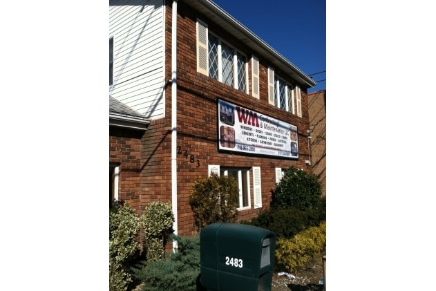
2483 Arthur Kill Rd, Staten Island, NY 10309

Property Detail
2483 Arthur Kill Rd
07153-0110
LAND EASEMENT
Commercialofficeresidentialmixeduse
Richmond
M2-1
New York
AE The base floodplain where base flood elevations are provided. AE Zones are now used on new format FIRMs instead of A1-A30 Zones.
110
2025
0.09 AC
2026
Staten Island
022602
Long Island (New York)
952 SF
New York-Jersey City-White Plains, NY-NJ
NEARBY LISTINGS FOR SALE OR LEASE
DEMOGRAPHICS near 2483 Arthur Kill Rd
1 mile
3 mile
5 mile
2025 Total Population
11,597
119,369
351,803
2030 Population
11,554
120,295
357,074
Pop Growth 2025-2030
(0.37%)
+ 0.78%
+ 1.50%
Average Age
41
41
41
2025 Total Households
4,188
41,759
123,767
HH Growth 2025-2030
(0.33%)
+ 0.75%
+ 1.63%
Median Household Inc
$112,289
$111,358
$99,626
Avg Household Size
2.70
2.80
2.80
2025 Avg HH Vehicles
2.00
2.00
2.00
Median Home Value
$697,280
$683,858
$631,504
Median Year Built
1988
1982
1975
Nearby Places
Map Layers
Map Styles
 Street
 Aerial
Layers
 Traffic
 Biking
Places
Listings with unknown addresses are not visible on the map
- Restaurants
- Banks
- Shops
- Fitness
- Groceries
PUBLIC TRANSPORTATION
COMMUTER RAIL
Prince's Bay (Staten Island Railway - New York MTA Subway (The Subway))
Drive
Walk
Distance
Prince's Bay (Staten Island Railway - New York MTA Subway (The Subway))
7 min
2.6 mi
Huguenot (Staten Island Railway - New York MTA Subway (The Subway))
Drive
Walk
Distance
Huguenot (Staten Island Railway - New York MTA Subway (The Subway))
8 min
2.7 mi
AIRPORT
Newark Liberty International
Drive
Walk
Distance
Newark Liberty International
28 min
16.4 mi
LaGuardia
Drive
Walk
Distance
LaGuardia
51 min
31.1 mi
John F Kennedy International
Drive
Walk
Distance
John F Kennedy International
54 min
33.6 mi
Freight Ports
New York Container Terminal
Drive
Walk
Distance
New York Container Terminal
13 min
7.0 mi
SALE & LEASE HISTORY
LISTING DATE
SALE/LEASE

Jan 17, 2026
For Lease
Nearby Properties
Address
Land Use
TOTAL SIZE
Lot Size
Zoning
Address
Land Use
TOTAL SIZE
Lot Size
Zoning
196.03 AC
HIA
Address
Land Use
TOTAL SIZE
Lot Size
Zoning
794,430 SF
36.09 AC
R50
Address
Land Use
TOTAL SIZE
Lot Size
Zoning
329,350 SF
15.99 AC
Address
Land Use
TOTAL SIZE
Lot Size
Zoning
Address
Land Use
TOTAL SIZE
Lot Size
Zoning
237 AC
M1-1
Address
Land Use
TOTAL SIZE
Lot Size
Zoning
118 AC
M3-1
Address
Land Use
TOTAL SIZE
Lot Size
Zoning
146 AC
PARK
Address
Land Use
TOTAL SIZE
Lot Size
Zoning
404,985 SF
15.32 AC
R25
Address
Land Use
TOTAL SIZE
Lot Size
Zoning
196,382 SF
25.95 AC
Address
Land Use
TOTAL SIZE
Lot Size
Zoning
102.29 AC
Address
Land Use
TOTAL SIZE
Lot Size
Zoning
348,466 SF
15.98 AC
LI
Address
Land Use
TOTAL SIZE
Lot Size
Zoning
360,082 SF
22.45 AC
R50
Address
Land Use
TOTAL SIZE
Lot Size
Zoning
365,784 SF
12.73 AC
HIA
Address
Land Use
TOTAL SIZE
Lot Size
Zoning
298,080 SF
13.79 AC
LI
Address
Land Use
TOTAL SIZE
Lot Size
Zoning
286,290 SF
21.24 AC
R50
Address
Land Use
TOTAL SIZE
Lot Size
Zoning
10,240 SF
22.96 AC
LI
Address
Land Use
TOTAL SIZE
Lot Size
Zoning
Address
Land Use
TOTAL SIZE
Lot Size
Zoning
232,134 SF
12.24 AC
LI
Address
Land Use
TOTAL SIZE
Lot Size
Zoning
1.64 AC
R-25
Address
Land Use
TOTAL SIZE
Lot Size
Zoning
245,272 SF
18.54 AC
R50
Address
Land Use
TOTAL SIZE
Lot Size
Zoning
263,925 SF
11.98 AC
R50
Address
Land Use
TOTAL SIZE
Lot Size
Zoning
7.24 AC
Address
Land Use
TOTAL SIZE
Lot Size
Zoning
411,000 SF
18.54 AC
R3X
Address
Land Use
TOTAL SIZE
Lot Size
Zoning
5,214 SF
93 AC
M3-1
Address
Land Use
TOTAL SIZE
Lot Size
Zoning
55.47 AC
Address
Land Use
TOTAL SIZE
Lot Size
Zoning
21,120 SF
14.45 AC
R50
Address
Land Use
TOTAL SIZE
Lot Size
Zoning
214,392 SF
11.79 AC
R50
Address
Land Use
TOTAL SIZE
Lot Size
Zoning
71.66 AC
M-3
Address
Land Use
TOTAL SIZE
Lot Size
Zoning
131,140 SF
10 AC
LI
Address
Land Use
TOTAL SIZE
Lot Size
Zoning
The World's #1 Commercial Real Estate Marketplace
Connect with us
© 2026 CoStar Group
The information above has been obtained from sources believed reliable. While we do not doubt its accuracy we have not verified it and make no guarantee, warranty or representation about it. It is your responsibility to independently confirm its accuracy and completeness. Any projections, opinions, assumptions, or estimates used are for example only and do not represent the current or future performance of the property. The value of this transaction to you depends on tax and other factors which should be evaluated by your tax, financial, and legal advisors. You and your advisors should conduct a careful, independent investigation of the property to determine to your satisfaction the suitability of the property for your needs.