Property Record
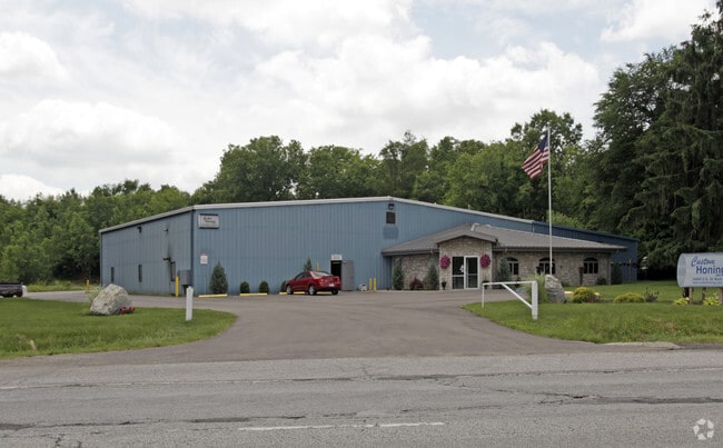
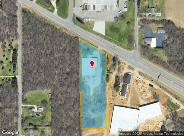
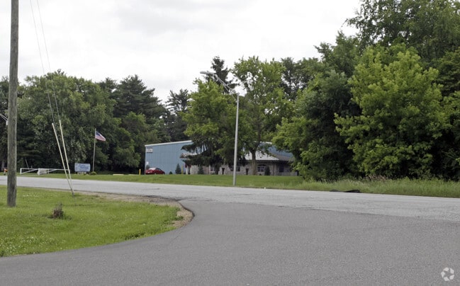
24840 Us Highway 20, South Bend, IN 46628
NEARBY LISTINGS FOR SALE OR LEASE
Property Detail
24840 Us Highway 20
South Bend-Mishawaka, IN-MI
Keller & Hall Minor Sub
71-03-30-352-002.000-008
LOT 2 KELLER & HALL MINOR SUB 00-01 SPLIT FR 035102 PER TR 7110 00-01 SET UP NEW MINOR SUB PER TRAN 8382 10-13-99
Industrialgeneral
St Joseph
X
Indiana
18141C0178D
2
2023
4.49 AC
2024
Outlying St Joseph County
011100
South Bend/Mishawaka
25,040 SF
DEMOGRAPHICS near 24840 Us Highway 20
1 Mile
3 Mile
5 Mile
2024 Total Population
236
12,588
60,225
2029 Population
232
12,422
60,245
Pop Growth 2024-2029
(1.69%)
(1.32%)
+ 0.03%
Average Age
42
41
38
2024 Total Households
92
4,901
22,448
HH Growth 2024-2029
(1.09%)
(1.39%)
(0.16%)
Median Household Inc
$67,500
$57,393
$49,106
Avg Household Size
2.50
2.50
2.50
2024 Avg HH Vehicles
2.00
2.00
2.00
Median Home Value
$180,262
$154,366
$125,565
Median Year Built
1993
1964
1958
Nearby Places
Map Layers
Map Styles
 Street
 Aerial
- Restaurants
- Banks
- Shops
- Fitness
- Groceries
PUBLIC TRANSPORTATION
COMMUTER RAIL
South Bend Airport Station (South Shore Line - Northern Indiana Commuter Transportation District (South Shore Line))
DRIVE
WALK
Distance
South Bend Airport Station (South Shore Line - Northern Indiana Commuter Transportation District (South Shore Line))
6 min
3.1 mi
South Bend Amtrak Station (Capitol Limited - Amtrak, Lake Shore Limited - Amtrak)
DRIVE
WALK
Distance
South Bend Amtrak Station (Capitol Limited - Amtrak, Lake Shore Limited - Amtrak)
9 min
5.1 mi
AIRPORT
South Bend International
DRIVE
WALK
Distance
South Bend International
13 min
3.3 mi
Freight Ports
Port Milwaukee
DRIVE
WALK
Distance
Port Milwaukee
211 min
175.8 mi
Nearby Properties
Address
Land Use
TOTAL SIZE
Lot Size
Zoning
Address
Land Use
TOTAL SIZE
Lot Size
Zoning
252,327 SF
131 SF
Address
Land Use
TOTAL SIZE
Lot Size
Zoning
232,200 SF
87 SF
Address
Land Use
TOTAL SIZE
Lot Size
Zoning
633,966 SF
87 SF
Address
Land Use
TOTAL SIZE
Lot Size
Zoning
213,400 SF
44 SF
Address
Land Use
TOTAL SIZE
Lot Size
Zoning
343,964 SF
131 SF
Address
Land Use
TOTAL SIZE
Lot Size
Zoning
225,000 SF
19.59 AC
Address
Land Use
TOTAL SIZE
Lot Size
Zoning
212,497 SF
131 SF
Address
Land Use
TOTAL SIZE
Lot Size
Zoning
111,803 SF
7.45 AC
Address
Land Use
TOTAL SIZE
Lot Size
Zoning
72,418 SF
131 SF
Address
Land Use
TOTAL SIZE
Lot Size
Zoning
79,451 SF
87 SF
Address
Land Use
TOTAL SIZE
Lot Size
Zoning
4,428 SF
0.02 AC
Address
Land Use
TOTAL SIZE
Lot Size
Zoning
204,880 SF
44 SF
Address
Land Use
TOTAL SIZE
Lot Size
Zoning
165,000 SF
87 SF
Address
Land Use
TOTAL SIZE
Lot Size
Zoning
397,100 SF
45.61 AC
Address
Land Use
TOTAL SIZE
Lot Size
Zoning
92,456 SF
44 SF
Address
Land Use
TOTAL SIZE
Lot Size
Zoning
84,398 SF
44 SF
Address
Land Use
TOTAL SIZE
Lot Size
Zoning
143,917 SF
87 SF
Address
Land Use
TOTAL SIZE
Lot Size
Zoning
266,881 SF
26.20 AC
Address
Land Use
TOTAL SIZE
Lot Size
Zoning
164,850 SF
44 SF
Address
Land Use
TOTAL SIZE
Lot Size
Zoning
499,104 SF
87 SF
Address
Land Use
TOTAL SIZE
Lot Size
Zoning
194,712 SF
14.81 AC
Address
Land Use
TOTAL SIZE
Lot Size
Zoning
211,200 SF
44 SF
Address
Land Use
TOTAL SIZE
Lot Size
Zoning
143,890 SF
87 SF
Address
Land Use
TOTAL SIZE
Lot Size
Zoning
58,827 SF
131 SF
Address
Land Use
TOTAL SIZE
Lot Size
Zoning
143,805 SF
8.44 AC
Address
Land Use
TOTAL SIZE
Lot Size
Zoning
152,807 SF
87 SF
Address
Land Use
TOTAL SIZE
Lot Size
Zoning
81,900 SF
2.69 AC
Address
Land Use
TOTAL SIZE
Lot Size
Zoning
45,191 SF
44 SF
Address
Land Use
TOTAL SIZE
Lot Size
Zoning
34,056 SF
3.54 AC
Address
Land Use
TOTAL SIZE
Lot Size
Zoning
121,264 SF
11.21 AC
The World's #1 Commercial Real Estate Marketplace
Connect with us
© 2025 CoStar Group
The information above has been obtained from sources believed reliable. While we do not doubt its accuracy we have not verified it and make no guarantee, warranty or representation about it. It is your responsibility to independently confirm its accuracy and completeness. Any projections, opinions, assumptions, or estimates used are for example only and do not represent the current or future performance of the property. The value of this transaction to you depends on tax and other factors which should be evaluated by your tax, financial, and legal advisors. You and your advisors should conduct a careful, independent investigation of the property to determine to your satisfaction the suitability of the property for your needs.