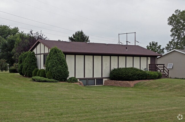
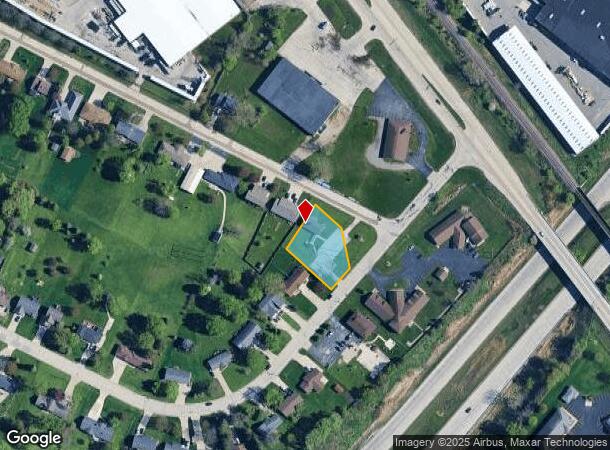
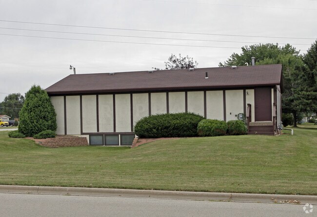
Property Record
2485 Bluestone Pl, Green Bay, WI 54311
NEARBY LISTINGS FOR SALE OR LEASE
Property Detail
2485 Bluestone Pl
Green Bay, WI
Vanden Berghs Subd
B-734-3
23,249 SQ FT LOT 3 OF 13 CSM 155 BNG PRT OF LOT 1 BLK 8 OF VANDEN BERGHS SUBD #5
Commercialnec
Brown
X
Wisconsin
55009C0279F
3,1
2024
0.53 AC
2024
Green Bay
020704
Green Bay
DEMOGRAPHICS near 2485 Bluestone Pl
1 Mile
3 Mile
5 Mile
2024 Total Population
5,660
43,879
106,816
2029 Population
5,730
44,503
108,716
Pop Growth 2024-2029
+ 1.24%
+ 1.42%
+ 1.78%
Average Age
41
40
39
2024 Total Households
2,380
18,018
43,165
HH Growth 2024-2029
+ 1.18%
+ 1.40%
+ 1.85%
Median Household Inc
$69,971
$63,281
$61,772
Avg Household Size
2.30
2.40
2.30
2024 Avg HH Vehicles
2.00
2.00
2.00
Median Home Value
$257,069
$213,929
$210,389
Median Year Built
1993
1987
1978
Nearby Places
Map Layers
Map Styles
 Street
 Aerial
- Restaurants
- Banks
- Shops
- Fitness
- Groceries
PUBLIC TRANSPORTATION
AIRPORT
Green Bay/Austin Straubel International
DRIVE
WALK
Distance
Green Bay/Austin Straubel International
20 min
11.0 mi
Appleton International
DRIVE
WALK
Distance
Appleton International
54 min
41.5 mi
SALE & LEASE HISTORY
LISTING DATE
SALE/LEASE

Jun 04, 2018
For Sale
Nearby Properties
Address
Land Use
TOTAL SIZE
Lot Size
Zoning
Address
Land Use
TOTAL SIZE
Lot Size
Zoning
67.93 AC
Address
Land Use
TOTAL SIZE
Lot Size
Zoning
17,534 SF
70.63 AC
OR, R1
Address
Land Use
TOTAL SIZE
Lot Size
Zoning
1,632 SF
30.52 AC
R1
Address
Land Use
TOTAL SIZE
Lot Size
Zoning
11.21 AC
R1
Address
Land Use
TOTAL SIZE
Lot Size
Zoning
10.97 AC
Address
Land Use
TOTAL SIZE
Lot Size
Zoning
5.90 AC
Address
Land Use
TOTAL SIZE
Lot Size
Zoning
19.22 AC
Address
Land Use
TOTAL SIZE
Lot Size
Zoning
31.38 AC
Address
Land Use
TOTAL SIZE
Lot Size
Zoning
15.51 AC
Address
Land Use
TOTAL SIZE
Lot Size
Zoning
29.42 AC
Address
Land Use
TOTAL SIZE
Lot Size
Zoning
19.28 AC
Address
Land Use
TOTAL SIZE
Lot Size
Zoning
9.15 AC
Address
Land Use
TOTAL SIZE
Lot Size
Zoning
19.25 AC
Address
Land Use
TOTAL SIZE
Lot Size
Zoning
8.87 AC
Address
Land Use
TOTAL SIZE
Lot Size
Zoning
19.96 AC
Address
Land Use
TOTAL SIZE
Lot Size
Zoning
9.51 AC
Address
Land Use
TOTAL SIZE
Lot Size
Zoning
48.24 AC
Address
Land Use
TOTAL SIZE
Lot Size
Zoning
7.44 AC
Address
Land Use
TOTAL SIZE
Lot Size
Zoning
13.76 AC
Address
Land Use
TOTAL SIZE
Lot Size
Zoning
6.56 AC
Address
Land Use
TOTAL SIZE
Lot Size
Zoning
10.31 AC
Address
Land Use
TOTAL SIZE
Lot Size
Zoning
9.64 AC
Address
Land Use
TOTAL SIZE
Lot Size
Zoning
13.30 AC
Address
Land Use
TOTAL SIZE
Lot Size
Zoning
28.23 AC
Address
Land Use
TOTAL SIZE
Lot Size
Zoning
10.79 AC
Address
Land Use
TOTAL SIZE
Lot Size
Zoning
2.07 AC
Address
Land Use
TOTAL SIZE
Lot Size
Zoning
225.80 AC
Address
Land Use
TOTAL SIZE
Lot Size
Zoning
24.86 AC
Address
Land Use
TOTAL SIZE
Lot Size
Zoning
980 SF
11.16 AC
R1
Address
Land Use
TOTAL SIZE
Lot Size
Zoning
6.44 AC
The World's #1 Commercial Real Estate Marketplace
Connect with us
© 2026 CoStar Group
The information above has been obtained from sources believed reliable. While we do not doubt its accuracy we have not verified it and make no guarantee, warranty or representation about it. It is your responsibility to independently confirm its accuracy and completeness. Any projections, opinions, assumptions, or estimates used are for example only and do not represent the current or future performance of the property. The value of this transaction to you depends on tax and other factors which should be evaluated by your tax, financial, and legal advisors. You and your advisors should conduct a careful, independent investigation of the property to determine to your satisfaction the suitability of the property for your needs.