Property Record
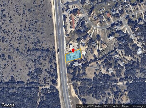
24870 Blanco Rd, San Antonio, TX 78260


NEARBY LISTINGS FOR SALE OR LEASE
Property Detail
24870 Blanco Rd
San Antonio-New Braunfels, TX
Timberwood Park Un 12
04847-268-0130
CB 4847B BLK 68 LOT 13
Officebuilding
Bexar
X
Texas
48029C0120G
13
2024
0.55 AC
2025
Far North Central
191804
San Antonio
5,098 SF
DEMOGRAPHICS near 24870 Blanco Rd
1 Mile
3 Mile
5 Mile
2024 Total Population
2,230
37,398
100,389
2029 Population
2,420
39,885
107,457
Pop Growth 2024-2029
+ 8.52%
+ 6.65%
+ 7.04%
Average Age
38
38
38
2024 Total Households
681
12,268
35,486
HH Growth 2024-2029
+ 8.37%
+ 6.68%
+ 7.25%
Median Household Inc
$150,524
$119,242
$110,138
Avg Household Size
3.20
3.00
2.80
2024 Avg HH Vehicles
2.00
2.00
2.00
Median Home Value
$441,428
$371,846
$381,624
Median Year Built
2007
2005
2005
Nearby Places
Map Layers
Map Styles
 Street
 Aerial
- Restaurants
- Banks
- Shops
- Fitness
- Groceries
PUBLIC TRANSPORTATION
AIRPORT
San Antonio International
DRIVE
WALK
Distance
San Antonio International
20 min
13.8 mi
Freight Ports
Calhoun Port
DRIVE
WALK
Distance
Calhoun Port
195 min
162.7 mi
SALE & LEASE HISTORY
LISTING DATE
SALE/LEASE

Feb 19, 2019
For Sale
Aug 26, 2024
For Sale
Nearby Properties
Address
Land Use
TOTAL SIZE
Lot Size
Zoning
Address
Land Use
TOTAL SIZE
Lot Size
Zoning
116,135 SF
17.35 AC
Address
Land Use
TOTAL SIZE
Lot Size
Zoning
225,204 SF
32.21 AC
Address
Land Use
TOTAL SIZE
Lot Size
Zoning
330,888 SF
19.58 AC
Address
Land Use
TOTAL SIZE
Lot Size
Zoning
303,085 SF
12.42 AC
Address
Land Use
TOTAL SIZE
Lot Size
Zoning
284,202 SF
13.59 AC
Address
Land Use
TOTAL SIZE
Lot Size
Zoning
364,922 SF
23.73 AC
Address
Land Use
TOTAL SIZE
Lot Size
Zoning
271,721 SF
13.72 AC
Address
Land Use
TOTAL SIZE
Lot Size
Zoning
203,966 SF
7.52 AC
Address
Land Use
TOTAL SIZE
Lot Size
Zoning
78,896 SF
8.49 AC
Address
Land Use
TOTAL SIZE
Lot Size
Zoning
43,892 SF
4.58 AC
Address
Land Use
TOTAL SIZE
Lot Size
Zoning
85,910 SF
10.44 AC
Address
Land Use
TOTAL SIZE
Lot Size
Zoning
99,291 SF
2.26 AC
Address
Land Use
TOTAL SIZE
Lot Size
Zoning
87,090 SF
2.77 AC
Address
Land Use
TOTAL SIZE
Lot Size
Zoning
34,352 SF
3.71 AC
Address
Land Use
TOTAL SIZE
Lot Size
Zoning
72,160 SF
7.70 AC
Address
Land Use
TOTAL SIZE
Lot Size
Zoning
34.92 AC
Address
Land Use
TOTAL SIZE
Lot Size
Zoning
64,132 SF
13.78 AC
Address
Land Use
TOTAL SIZE
Lot Size
Zoning
Address
Land Use
TOTAL SIZE
Lot Size
Zoning
25,262 SF
3.02 AC
Address
Land Use
TOTAL SIZE
Lot Size
Zoning
11,487 SF
1.54 AC
Address
Land Use
TOTAL SIZE
Lot Size
Zoning
17.77 AC
Address
Land Use
TOTAL SIZE
Lot Size
Zoning
8,740 SF
6.36 AC
Address
Land Use
TOTAL SIZE
Lot Size
Zoning
46,113 SF
2.69 AC
Address
Land Use
TOTAL SIZE
Lot Size
Zoning
Address
Land Use
TOTAL SIZE
Lot Size
Zoning
63,467 SF
3.18 AC
Address
Land Use
TOTAL SIZE
Lot Size
Zoning
15,966 SF
1.72 AC
Address
Land Use
TOTAL SIZE
Lot Size
Zoning
18,969 SF
2.92 AC
Address
Land Use
TOTAL SIZE
Lot Size
Zoning
39,528 SF
3.71 AC
Address
Land Use
TOTAL SIZE
Lot Size
Zoning
13,172 SF
9.97 AC
Address
Land Use
TOTAL SIZE
Lot Size
Zoning
The World's #1 Commercial Real Estate Marketplace
Connect with us
© 2025 CoStar Group
The information above has been obtained from sources believed reliable. While we do not doubt its accuracy we have not verified it and make no guarantee, warranty or representation about it. It is your responsibility to independently confirm its accuracy and completeness. Any projections, opinions, assumptions, or estimates used are for example only and do not represent the current or future performance of the property. The value of this transaction to you depends on tax and other factors which should be evaluated by your tax, financial, and legal advisors. You and your advisors should conduct a careful, independent investigation of the property to determine to your satisfaction the suitability of the property for your needs.