Property Record
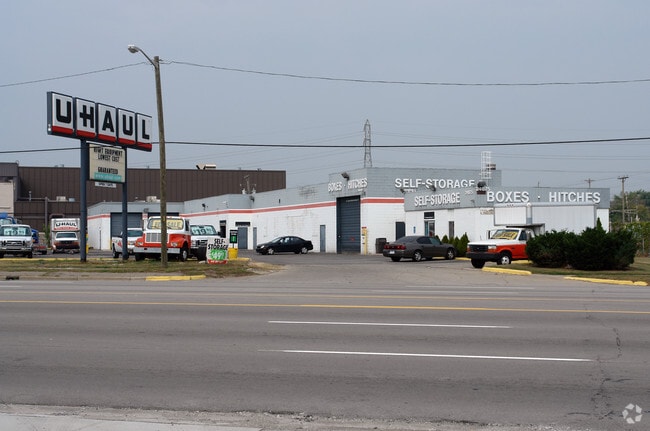
24875 Groesbeck Hwy, Warren, MI 48089


NEARBY LISTINGS FOR SALE OR LEASE
Property Detail
24875 Groesbeck Hwy
12-13-25-102-004
T1N,R12E SEC 25 COMM AT N 1/4 POST SEC 25; TH S88*53'20"W 1569 FT; TH S2*30'W 270 FT TO PT OF BEG; TH N88*53'20"E 323 FT; TH
Autorepair
Macomb
X
Michigan
26163C0130F
1.52 AC
2025
Macomb West
2025
Detroit
262900
Detroit-Warren-Dearborn, MI
11,302 SF
DEMOGRAPHICS near 24875 Groesbeck Hwy
1 Mile
3 Mile
5 Mile
2024 Total Population
10,801
146,686
379,741
2029 Population
10,696
145,381
377,154
Pop Growth 2024-2029
(0.97%)
(0.89%)
(0.68%)
Average Age
38
38
39
2024 Total Households
4,185
56,936
149,576
HH Growth 2024-2029
(0.96%)
(0.97%)
(0.80%)
Median Household Inc
$57,791
$49,786
$51,621
Avg Household Size
2.50
2.50
2.50
2024 Avg HH Vehicles
2.00
2.00
2.00
Median Home Value
$115,712
$120,013
$132,878
Median Year Built
1958
1957
1958
Nearby Places
Map Layers
Map Styles
 Street
 Aerial
- Restaurants
- Banks
- Shops
- Fitness
- Groceries
PUBLIC TRANSPORTATION
AIRPORT
Windsor International
DRIVE
WALK
Distance
Windsor International
48 min
22.0 mi
Detroit Metro Wayne County
DRIVE
WALK
Distance
Detroit Metro Wayne County
51 min
31.5 mi
Nearby Properties
Address
Land Use
TOTAL SIZE
Lot Size
Zoning
Address
Land Use
TOTAL SIZE
Lot Size
Zoning
260,164 SF
Address
Land Use
TOTAL SIZE
Lot Size
Zoning
238,144 SF
12.15 AC
MZ
Address
Land Use
TOTAL SIZE
Lot Size
Zoning
450,958 SF
Address
Land Use
TOTAL SIZE
Lot Size
Zoning
661,151 SF
37.28 AC
MZ
Address
Land Use
TOTAL SIZE
Lot Size
Zoning
323,858 SF
20.66 AC
R-3
Address
Land Use
TOTAL SIZE
Lot Size
Zoning
303,770 SF
23.62 AC
R-3
Address
Land Use
TOTAL SIZE
Lot Size
Zoning
182,866 SF
5.08 AC
PD
Address
Land Use
TOTAL SIZE
Lot Size
Zoning
401,671 SF
19.40 AC
MZ
Address
Land Use
TOTAL SIZE
Lot Size
Zoning
198,064 SF
11.11 AC
MZ
Address
Land Use
TOTAL SIZE
Lot Size
Zoning
1,261,658 SF
71.94 AC
M-2
Address
Land Use
TOTAL SIZE
Lot Size
Zoning
362,350 SF
22.39 AC
M-2
Address
Land Use
TOTAL SIZE
Lot Size
Zoning
162,597 SF
17.94 AC
C-2
Address
Land Use
TOTAL SIZE
Lot Size
Zoning
Address
Land Use
TOTAL SIZE
Lot Size
Zoning
362,895 SF
14.85 AC
M-2
Address
Land Use
TOTAL SIZE
Lot Size
Zoning
442,148 SF
11.22 AC
AD
Address
Land Use
TOTAL SIZE
Lot Size
Zoning
204,620 SF
13.73 AC
R-3
Address
Land Use
TOTAL SIZE
Lot Size
Zoning
287,360 SF
21.42 AC
AD
Address
Land Use
TOTAL SIZE
Lot Size
Zoning
426,764 SF
38.46 AC
R-M
Address
Land Use
TOTAL SIZE
Lot Size
Zoning
197,670 SF
42.84 AC
M4
Address
Land Use
TOTAL SIZE
Lot Size
Zoning
166,064 SF
6.33 AC
M-3
Address
Land Use
TOTAL SIZE
Lot Size
Zoning
181,076 SF
8.16 AC
R-3
Address
Land Use
TOTAL SIZE
Lot Size
Zoning
109,494 SF
7.54 AC
O
Address
Land Use
TOTAL SIZE
Lot Size
Zoning
92,800 SF
6.71 AC
R-3
Address
Land Use
TOTAL SIZE
Lot Size
Zoning
105,354 SF
2.33 AC
B-3
Address
Land Use
TOTAL SIZE
Lot Size
Zoning
160,600 SF
9.62 AC
R-3
Address
Land Use
TOTAL SIZE
Lot Size
Zoning
167,589 SF
16.80 AC
B-3
Address
Land Use
TOTAL SIZE
Lot Size
Zoning
193,020 SF
13.62 AC
RM-1
Address
Land Use
TOTAL SIZE
Lot Size
Zoning
184,986 SF
13.49 AC
MZ
Address
Land Use
TOTAL SIZE
Lot Size
Zoning
119,898 SF
14.65 AC
B-2
Address
Land Use
TOTAL SIZE
Lot Size
Zoning
133,611 SF
11.74 AC
B-3
The World's #1 Commercial Real Estate Marketplace
Connect with us
© 2025 CoStar Group
The information above has been obtained from sources believed reliable. While we do not doubt its accuracy we have not verified it and make no guarantee, warranty or representation about it. It is your responsibility to independently confirm its accuracy and completeness. Any projections, opinions, assumptions, or estimates used are for example only and do not represent the current or future performance of the property. The value of this transaction to you depends on tax and other factors which should be evaluated by your tax, financial, and legal advisors. You and your advisors should conduct a careful, independent investigation of the property to determine to your satisfaction the suitability of the property for your needs.