Property Record
249 Clinton Ave, Toms River, NJ 08753


Save to a Folder
{{folder.Name}}
{{folder.ListingIds.length}} Properties
{{folder.ListingIds.length}} Property
Create a New Folder
Current Lease Availabilities
Property Detail
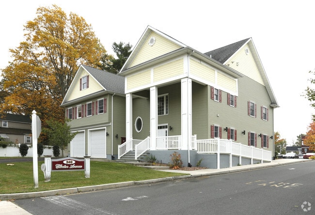
249 Clinton Ave
08-00680-0000-00109
.777AC
Commercialnec
Ocean
VO
New Jersey
B and X Area of moderate flood hazard, usually the area between the limits of the 100-year and 500-year floods.
109
2025
0.78 AC
2026
Ocean County
723100
Northern New Jersey
4,032 SF
Lakewood-New Brunswick, NJ
NEARBY LISTINGS FOR SALE OR LEASE
DEMOGRAPHICS near 249 Clinton Ave
1 mile
3 mile
5 mile
2025 Total Population
8,314
69,068
134,142
2030 Population
8,500
70,075
136,689
Pop Growth 2025-2030
+ 2.24%
+ 1.46%
+ 1.90%
Average Age
39
40
43
2025 Total Households
3,204
25,159
51,951
HH Growth 2025-2030
+ 1.75%
+ 0.86%
+ 1.36%
Median Household Inc
$95,929
$94,297
$86,618
Avg Household Size
2.50
2.60
2.50
2025 Avg HH Vehicles
2.00
2.00
2.00
Median Home Value
$399,113
$363,759
$355,227
Median Year Built
1965
1975
1976
Nearby Places
Map Layers
Map Styles
 Street
 Aerial
Layers
 Traffic
 Biking
Places
Listings with unknown addresses are not visible on the map
- Restaurants
- Banks
- Shops
- Fitness
- Groceries
Nearby Properties
Address
Land Use
TOTAL SIZE
Lot Size
Zoning
Address
Land Use
TOTAL SIZE
Lot Size
Zoning
70.33 AC
RC
Address
Land Use
TOTAL SIZE
Lot Size
Zoning
14,748 SF
56.53 AC
MF8
Address
Land Use
TOTAL SIZE
Lot Size
Zoning
38.17 AC
HMS
Address
Land Use
TOTAL SIZE
Lot Size
Zoning
83.07 AC
R400
Address
Land Use
TOTAL SIZE
Lot Size
Zoning
22,175 SF
30.21 AC
RC
Address
Land Use
TOTAL SIZE
Lot Size
Zoning
15.67 AC
RC
Address
Land Use
TOTAL SIZE
Lot Size
Zoning
14,136 SF
11.85 AC
VO
Address
Land Use
TOTAL SIZE
Lot Size
Zoning
260 SF
326.26 AC
SPLT
Address
Land Use
TOTAL SIZE
Lot Size
Zoning
165,024 SF
22.43 AC
HB
Address
Land Use
TOTAL SIZE
Lot Size
Zoning
8,118 SF
72.32 AC
R75
Address
Land Use
TOTAL SIZE
Lot Size
Zoning
8.21 AC
VO
Address
Land Use
TOTAL SIZE
Lot Size
Zoning
1,332 SF
13.76 AC
EM18
Address
Land Use
TOTAL SIZE
Lot Size
Zoning
18,890 SF
24.59 AC
SPLT
Address
Land Use
TOTAL SIZE
Lot Size
Zoning
11,304 SF
25.56 AC
MF8
Address
Land Use
TOTAL SIZE
Lot Size
Zoning
57,008 SF
8.85 AC
SPLT
Address
Land Use
TOTAL SIZE
Lot Size
Zoning
19,836 SF
13.03 AC
EM18
Address
Land Use
TOTAL SIZE
Lot Size
Zoning
7,436 SF
22.36 AC
MF8
Address
Land Use
TOTAL SIZE
Lot Size
Zoning
2,176 SF
22.96 AC
MF8
Address
Land Use
TOTAL SIZE
Lot Size
Zoning
15.68 AC
MF8
Address
Land Use
TOTAL SIZE
Lot Size
Zoning
8,512 SF
25.67 AC
RC
Address
Land Use
TOTAL SIZE
Lot Size
Zoning
2,549 SF
16.02 AC
RC
Address
Land Use
TOTAL SIZE
Lot Size
Zoning
26,832 SF
11.09 AC
RC
Address
Land Use
TOTAL SIZE
Lot Size
Zoning
4,264 SF
189.71 AC
R400
Address
Land Use
TOTAL SIZE
Lot Size
Zoning
44.86 AC
SPLT
Address
Land Use
TOTAL SIZE
Lot Size
Zoning
41,100 SF
14.63 AC
RC
Address
Land Use
TOTAL SIZE
Lot Size
Zoning
8,968 SF
26.36 AC
RMF
Address
Land Use
TOTAL SIZE
Lot Size
Zoning
6,098 SF
7.66 AC
EM18
Address
Land Use
TOTAL SIZE
Lot Size
Zoning
4,275 SF
5.47 AC
HMS
Address
Land Use
TOTAL SIZE
Lot Size
Zoning
8.82 AC
O15
Address
Land Use
TOTAL SIZE
Lot Size
Zoning
1,029 SF
31.93 AC
SPLT
The World's #1 Commercial Real Estate Marketplace
Connect with us
© 2026 CoStar Group
The information above has been obtained from sources believed reliable. While we do not doubt its accuracy we have not verified it and make no guarantee, warranty or representation about it. It is your responsibility to independently confirm its accuracy and completeness. Any projections, opinions, assumptions, or estimates used are for example only and do not represent the current or future performance of the property. The value of this transaction to you depends on tax and other factors which should be evaluated by your tax, financial, and legal advisors. You and your advisors should conduct a careful, independent investigation of the property to determine to your satisfaction the suitability of the property for your needs.