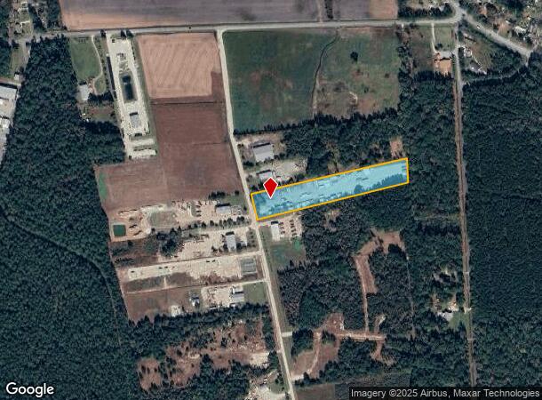
Property Record
249 Complex Rd, Rocky Point, NC 28457


NEARBY LISTINGS FOR SALE OR LEASE
-
-
View all Rocky Point listings for lease on LoopNet.com
Property Detail
249 Complex Rd
3223-84-3512-0000
5.00AC PB 42/132&136 SURVEY FOR PHOENIX
Warehouse
Pender
X
North Carolina
3720322300J
5 AC
2024
West Pender County
2024
Wilmington
920601
Wilmington, NC
7,200 SF
DEMOGRAPHICS near 249 Complex Rd
1 Mile
3 Mile
5 Mile
2024 Total Population
2,410
7,017
12,508
2029 Population
2,929
8,352
14,687
Pop Growth 2024-2029
+ 21.54%
+ 19.03%
+ 17.42%
Average Age
40
40
40
2024 Total Households
912
2,615
4,702
HH Growth 2024-2029
+ 21.71%
+ 19.08%
+ 17.44%
Median Household Inc
$58,128
$56,494
$54,992
Avg Household Size
2.60
2.60
2.50
2024 Avg HH Vehicles
2.00
2.00
2.00
Median Home Value
$219,242
$229,297
$225,210
Median Year Built
1997
1995
1996
Nearby Places
Map Layers
Map Styles
 Street
 Aerial
- Restaurants
- Banks
- Shops
- Fitness
- Groceries
PUBLIC TRANSPORTATION
AIRPORT
Wilmington International
DRIVE
WALK
Distance
Wilmington International
23 min
11.1 mi
Freight Ports
Port of Wilmington
DRIVE
WALK
Distance
Port of Wilmington
32 min
19.0 mi
SALE & LEASE HISTORY
LISTING DATE
SALE/LEASE

Oct 24, 2017
For Lease
Mar 21, 2017
For Sale
Nearby Properties
Address
Land Use
TOTAL SIZE
Lot Size
Zoning
Address
Land Use
TOTAL SIZE
Lot Size
Zoning
78,771 SF
59.13 AC
R-15,RESID
Address
Land Use
TOTAL SIZE
Lot Size
Zoning
139,693 SF
20 AC
OI
Address
Land Use
TOTAL SIZE
Lot Size
Zoning
3,150 SF
10.39 AC
B-2,BUSINE
Address
Land Use
TOTAL SIZE
Lot Size
Zoning
134,836 SF
38.48 AC
GI
Address
Land Use
TOTAL SIZE
Lot Size
Zoning
37,886 SF
4.26 AC
B-2,BUSINE
Address
Land Use
TOTAL SIZE
Lot Size
Zoning
12,275 SF
1.87 AC
B-2,BUSINE
Address
Land Use
TOTAL SIZE
Lot Size
Zoning
1,120 SF
106.68 AC
SEEMAP
Address
Land Use
TOTAL SIZE
Lot Size
Zoning
115.91 AC
RA,RURAL A
Address
Land Use
TOTAL SIZE
Lot Size
Zoning
17,427 SF
2.04 AC
B-2,BUSINE
Address
Land Use
TOTAL SIZE
Lot Size
Zoning
10,200 SF
6.01 AC
B-2,BUSINE
Address
Land Use
TOTAL SIZE
Lot Size
Zoning
630 SF
50.40 AC
I-2,INDUST
Address
Land Use
TOTAL SIZE
Lot Size
Zoning
6,954 SF
1.22 AC
O&I,OFFICE
Address
Land Use
TOTAL SIZE
Lot Size
Zoning
8.42 AC
R-15,RESID
Address
Land Use
TOTAL SIZE
Lot Size
Zoning
3,210 SF
0.88 AC
B-2,BUSINE
Address
Land Use
TOTAL SIZE
Lot Size
Zoning
3.99 AC
R-15,RESID
Address
Land Use
TOTAL SIZE
Lot Size
Zoning
2,993 SF
3.92 AC
B-2,BUSINE
Address
Land Use
TOTAL SIZE
Lot Size
Zoning
2,100 SF
3.55 AC
RA,RURAL A
Address
Land Use
TOTAL SIZE
Lot Size
Zoning
18.03 AC
RA,RURAL A
Address
Land Use
TOTAL SIZE
Lot Size
Zoning
1,792 SF
1.33 AC
B-2,BUSINE
Address
Land Use
TOTAL SIZE
Lot Size
Zoning
4,418 SF
0.53 AC
B-2,BUSINE
Address
Land Use
TOTAL SIZE
Lot Size
Zoning
Address
Land Use
TOTAL SIZE
Lot Size
Zoning
6,716 SF
0.51 AC
B-2,BUSINE
Address
Land Use
TOTAL SIZE
Lot Size
Zoning
3,840 SF
9.81 AC
RA,RURAL A
Address
Land Use
TOTAL SIZE
Lot Size
Zoning
20,000 SF
13.86 AC
IT
Address
Land Use
TOTAL SIZE
Lot Size
Zoning
1,680 SF
1.26 AC
B-2,BUSINE
Address
Land Use
TOTAL SIZE
Lot Size
Zoning
16.33 AC
I-2,INDUST
Address
Land Use
TOTAL SIZE
Lot Size
Zoning
2,599 SF
0.90 AC
B-2,BUSINE
Address
Land Use
TOTAL SIZE
Lot Size
Zoning
13.42 AC
RA,RURAL A
Address
Land Use
TOTAL SIZE
Lot Size
Zoning
7,555 SF
0.50 AC
B-2,BUSINE
Address
Land Use
TOTAL SIZE
Lot Size
Zoning
2,362 SF
1.49 AC
B-2,BUSINE
The World's #1 Commercial Real Estate Marketplace
Connect with us
© 2026 CoStar Group
The information above has been obtained from sources believed reliable. While we do not doubt its accuracy we have not verified it and make no guarantee, warranty or representation about it. It is your responsibility to independently confirm its accuracy and completeness. Any projections, opinions, assumptions, or estimates used are for example only and do not represent the current or future performance of the property. The value of this transaction to you depends on tax and other factors which should be evaluated by your tax, financial, and legal advisors. You and your advisors should conduct a careful, independent investigation of the property to determine to your satisfaction the suitability of the property for your needs.