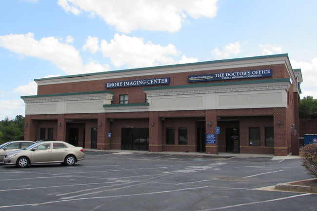
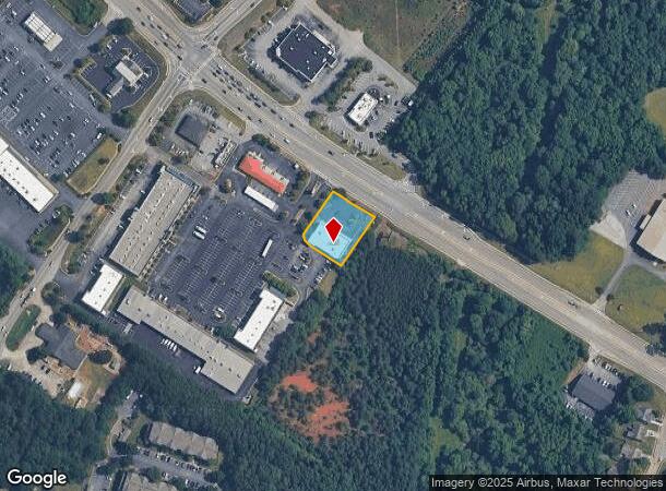
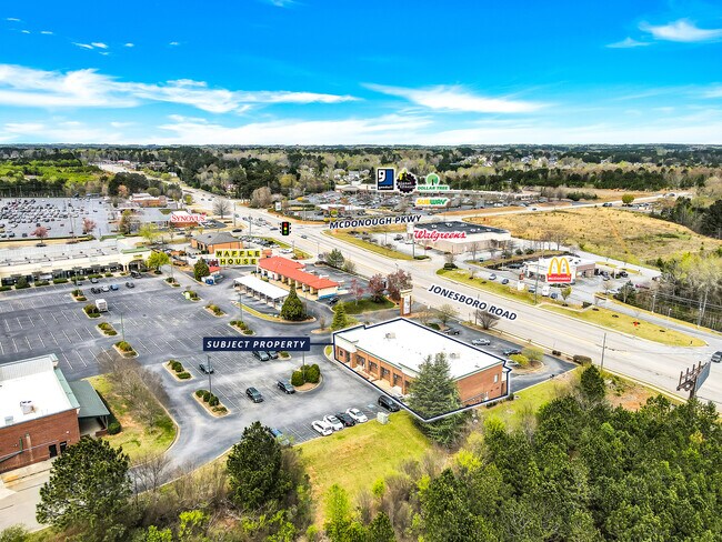
Property Record
249 Jonesboro Rd, Mcdonough, GA 30253
NEARBY LISTINGS FOR SALE OR LEASE
Property Detail
249 Jonesboro Rd
091G-01-001-005
LAND LOT: 125 /LAND DISTRICT: 7
Officebuilding
Henry
X
Georgia
13151C0158D
1
2025
0.61 AC
2025
South Clayton/Henry Cnty
070317
Atlanta
12,360 SF
Atlanta-Sandy Springs-Roswell, GA
DEMOGRAPHICS near 249 Jonesboro Rd
1 Mile
3 Mile
5 Mile
2024 Total Population
10,857
50,044
93,945
2029 Population
11,894
55,029
102,995
Pop Growth 2024-2029
+ 9.55%
+ 9.96%
+ 9.63%
Average Age
35
37
37
2024 Total Households
4,029
18,132
32,956
HH Growth 2024-2029
+ 9.66%
+ 10.08%
+ 9.75%
Median Household Inc
$57,623
$70,423
$78,601
Avg Household Size
2.70
2.70
2.80
2024 Avg HH Vehicles
2.00
2.00
2.00
Median Home Value
$208,968
$226,143
$248,572
Median Year Built
2001
2002
2002
Nearby Places
Map Layers
Map Styles
 Street
 Aerial
- Restaurants
- Banks
- Shops
- Fitness
- Groceries
PUBLIC TRANSPORTATION
AIRPORT
Hartsfield - Jackson Atlanta International
DRIVE
WALK
Distance
Hartsfield - Jackson Atlanta International
32 min
22.9 mi
Freight Ports
Georgia Ports - Savannah
DRIVE
WALK
Distance
Georgia Ports - Savannah
249 min
222.3 mi
SALE & LEASE HISTORY
LISTING DATE
SALE/LEASE

Oct 16, 2017
For Lease
Oct 04, 2022
For Lease
Oct 03, 2022
For Sale
Jul 21, 2022
For Lease
Apr 24, 2017
For Lease
Nearby Properties
Address
Land Use
TOTAL SIZE
Lot Size
Zoning
Address
Land Use
TOTAL SIZE
Lot Size
Zoning
33,565 SF
44.68 AC
Address
Land Use
TOTAL SIZE
Lot Size
Zoning
3,973,920 SF
88.41 AC
I
Address
Land Use
TOTAL SIZE
Lot Size
Zoning
67,298 SF
30.88 AC
RM
Address
Land Use
TOTAL SIZE
Lot Size
Zoning
10,092 SF
46.06 AC
RM
Address
Land Use
TOTAL SIZE
Lot Size
Zoning
24,633 SF
39.67 AC
RM
Address
Land Use
TOTAL SIZE
Lot Size
Zoning
29,768 SF
50.81 AC
RM
Address
Land Use
TOTAL SIZE
Lot Size
Zoning
16,635 SF
24 AC
RM
Address
Land Use
TOTAL SIZE
Lot Size
Zoning
35,929 SF
38.16 AC
C3
Address
Land Use
TOTAL SIZE
Lot Size
Zoning
27,336 SF
27.95 AC
Address
Land Use
TOTAL SIZE
Lot Size
Zoning
21,880 SF
22.04 AC
RMH
Address
Land Use
TOTAL SIZE
Lot Size
Zoning
59,445 SF
20.17 AC
PD
Address
Land Use
TOTAL SIZE
Lot Size
Zoning
6,422 SF
24.67 AC
RM
Address
Land Use
TOTAL SIZE
Lot Size
Zoning
1,588,692 SF
44.95 AC
M1
Address
Land Use
TOTAL SIZE
Lot Size
Zoning
11,256 SF
34.51 AC
RM
Address
Land Use
TOTAL SIZE
Lot Size
Zoning
29,934 SF
18.18 AC
C2
Address
Land Use
TOTAL SIZE
Lot Size
Zoning
40,500 SF
27.66 AC
RA
Address
Land Use
TOTAL SIZE
Lot Size
Zoning
5,485 SF
27.03 AC
RM
Address
Land Use
TOTAL SIZE
Lot Size
Zoning
6,344 SF
21.40 AC
C1
Address
Land Use
TOTAL SIZE
Lot Size
Zoning
25,622 SF
17.43 AC
RMH
Address
Land Use
TOTAL SIZE
Lot Size
Zoning
1,456,864 SF
82.62 AC
Address
Land Use
TOTAL SIZE
Lot Size
Zoning
2,877,520 SF
53.73 AC
C2
Address
Land Use
TOTAL SIZE
Lot Size
Zoning
23,400 SF
29 AC
RM
Address
Land Use
TOTAL SIZE
Lot Size
Zoning
40,246 SF
13.73 AC
Address
Land Use
TOTAL SIZE
Lot Size
Zoning
498,160 SF
44.14 AC
M1
Address
Land Use
TOTAL SIZE
Lot Size
Zoning
3,114 SF
15.44 AC
RM
Address
Land Use
TOTAL SIZE
Lot Size
Zoning
63,279 SF
52.18 AC
C1
Address
Land Use
TOTAL SIZE
Lot Size
Zoning
76,608 SF
26.99 AC
R2
Address
Land Use
TOTAL SIZE
Lot Size
Zoning
997,015 SF
153.75 AC
M1
Address
Land Use
TOTAL SIZE
Lot Size
Zoning
5,104 SF
42.40 AC
The World's #1 Commercial Real Estate Marketplace
Connect with us
© 2025 CoStar Group
The information above has been obtained from sources believed reliable. While we do not doubt its accuracy we have not verified it and make no guarantee, warranty or representation about it. It is your responsibility to independently confirm its accuracy and completeness. Any projections, opinions, assumptions, or estimates used are for example only and do not represent the current or future performance of the property. The value of this transaction to you depends on tax and other factors which should be evaluated by your tax, financial, and legal advisors. You and your advisors should conduct a careful, independent investigation of the property to determine to your satisfaction the suitability of the property for your needs.