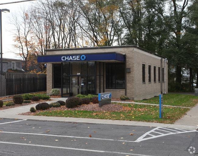
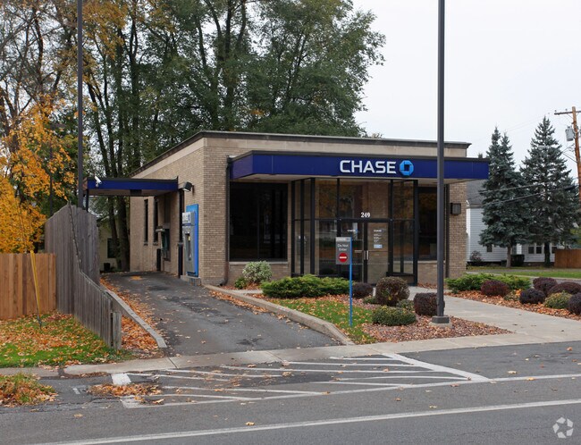
Property Record
249 N Main St, Minoa, NY 13116
NEARBY LISTINGS FOR SALE OR LEASE
-
-
View all Minoa listings for sale on LoopNet.com
Property Detail
249 N Main St
313805-002-000-0008-006-000-0000
FL 34
Storebuilding
Onondaga
X
New York
36067C0234F
6.000
2025
0.22 AC
2024
SE Outer Onondaga County
015400
Syracuse
1,920 SF
Syracuse, NY
DEMOGRAPHICS near 249 N Main St
1 Mile
3 Mile
5 Mile
2024 Total Population
3,995
12,116
47,300
2029 Population
3,926
11,854
46,228
Pop Growth 2024-2029
(1.73%)
(2.16%)
(2.27%)
Average Age
43
45
43
2024 Total Households
1,642
5,013
19,732
HH Growth 2024-2029
(1.83%)
(2.35%)
(2.40%)
Median Household Inc
$65,357
$82,856
$76,701
Avg Household Size
2.40
2.30
2.30
2024 Avg HH Vehicles
2.00
2.00
2.00
Median Home Value
$145,312
$172,868
$186,532
Median Year Built
1966
1969
1964
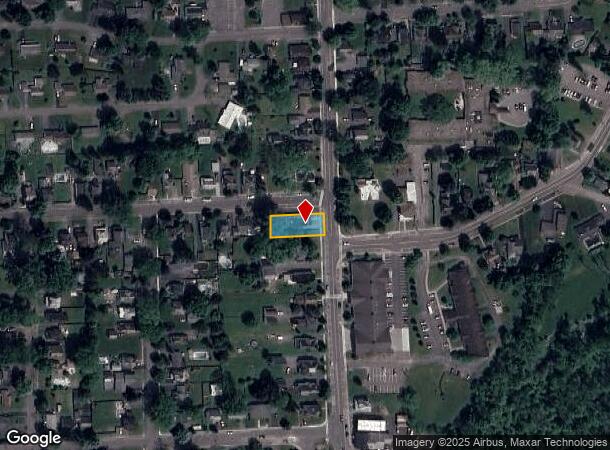
Nearby Places
Map Layers
Map Styles
 Street
 Aerial
- Restaurants
- Banks
- Shops
- Fitness
- Groceries
PUBLIC TRANSPORTATION
AIRPORT
Syracuse Hancock International
DRIVE
WALK
Distance
Syracuse Hancock International
23 min
12.5 mi
Freight Ports
Albany, NY Port
DRIVE
WALK
Distance
Albany, NY Port
173 min
142.8 mi
SALE & LEASE HISTORY
LISTING DATE
SALE/LEASE

Oct 13, 2023
For Sale
Jan 19, 2022
For Sale
Nearby Properties
Address
Land Use
TOTAL SIZE
Lot Size
Zoning
Address
Land Use
TOTAL SIZE
Lot Size
Zoning
175,424 SF
7.85 AC
RA
Address
Land Use
TOTAL SIZE
Lot Size
Zoning
174,750 SF
10.40 AC
06 - INDUS
Address
Land Use
TOTAL SIZE
Lot Size
Zoning
104,400 SF
12.84 AC
06 - INDUS
Address
Land Use
TOTAL SIZE
Lot Size
Zoning
3,909 SF
24.98 AC
RA
Address
Land Use
TOTAL SIZE
Lot Size
Zoning
145,588 SF
75.45 AC
RA
Address
Land Use
TOTAL SIZE
Lot Size
Zoning
5.39 AC
06 - INDUS
Address
Land Use
TOTAL SIZE
Lot Size
Zoning
141,151 SF
20.23 AC
06 - INDUS
Address
Land Use
TOTAL SIZE
Lot Size
Zoning
95.24 AC
05 - COMME
Address
Land Use
TOTAL SIZE
Lot Size
Zoning
110,976 SF
42.31 AC
06 - INDUS
Address
Land Use
TOTAL SIZE
Lot Size
Zoning
150,216 SF
50.42 AC
RA
Address
Land Use
TOTAL SIZE
Lot Size
Zoning
69,910 SF
16.01 AC
06 - INDUS
Address
Land Use
TOTAL SIZE
Lot Size
Zoning
24.71 AC
RA
Address
Land Use
TOTAL SIZE
Lot Size
Zoning
169,505 SF
23.78 AC
06 - INDUS
Address
Land Use
TOTAL SIZE
Lot Size
Zoning
3,000 SF
75.84 AC
C
Address
Land Use
TOTAL SIZE
Lot Size
Zoning
49,160 SF
7.23 AC
06 - INDUS
Address
Land Use
TOTAL SIZE
Lot Size
Zoning
37.08 AC
Address
Land Use
TOTAL SIZE
Lot Size
Zoning
1.86 AC
C
Address
Land Use
TOTAL SIZE
Lot Size
Zoning
68.78 AC
C
Address
Land Use
TOTAL SIZE
Lot Size
Zoning
15,040 SF
9.89 AC
IND
Address
Land Use
TOTAL SIZE
Lot Size
Zoning
37.36 AC
RA
Address
Land Use
TOTAL SIZE
Lot Size
Zoning
33.18 AC
C
Address
Land Use
TOTAL SIZE
Lot Size
Zoning
51,684 SF
17.68 AC
RA
Address
Land Use
TOTAL SIZE
Lot Size
Zoning
4,200 SF
25.34 AC
C
Address
Land Use
TOTAL SIZE
Lot Size
Zoning
11,414 SF
1.13 AC
C
Address
Land Use
TOTAL SIZE
Lot Size
Zoning
23.21 AC
C
Address
Land Use
TOTAL SIZE
Lot Size
Zoning
109,440 SF
7.63 AC
06 - INDUS
Address
Land Use
TOTAL SIZE
Lot Size
Zoning
54,386 SF
9.45 AC
C
Address
Land Use
TOTAL SIZE
Lot Size
Zoning
65.19 AC
C
Address
Land Use
TOTAL SIZE
Lot Size
Zoning
75.35 AC
Address
Land Use
TOTAL SIZE
Lot Size
Zoning
20.28 AC
C
The World's #1 Commercial Real Estate Marketplace
Connect with us
© 2026 CoStar Group
The information above has been obtained from sources believed reliable. While we do not doubt its accuracy we have not verified it and make no guarantee, warranty or representation about it. It is your responsibility to independently confirm its accuracy and completeness. Any projections, opinions, assumptions, or estimates used are for example only and do not represent the current or future performance of the property. The value of this transaction to you depends on tax and other factors which should be evaluated by your tax, financial, and legal advisors. You and your advisors should conduct a careful, independent investigation of the property to determine to your satisfaction the suitability of the property for your needs.