Property Record
2490 Pennington Rd, Pennington, NJ 08534

Save to a Folder
{{folder.Name}}
{{folder.ListingIds.length}} Properties
{{folder.ListingIds.length}} Property
Create a New Folder
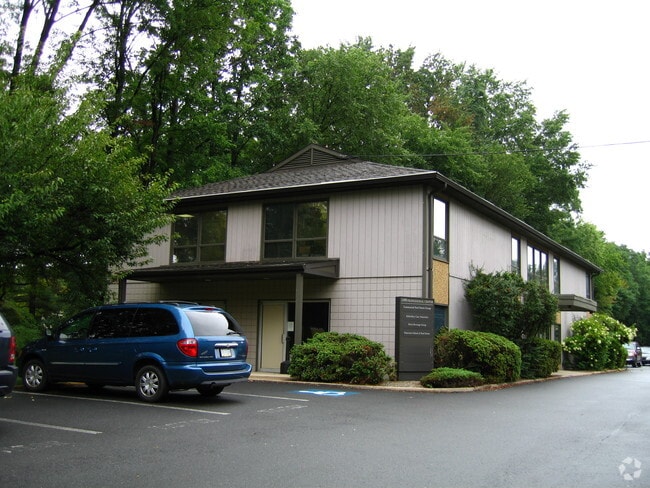
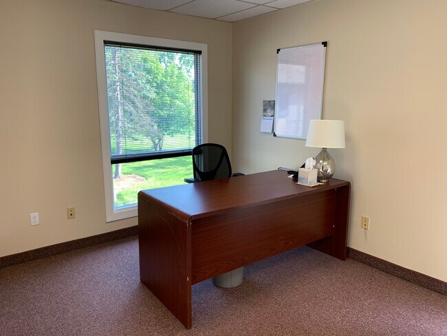
Property Detail
2490 Pennington Rd
Trenton-Princeton, NJ
ALSO LOT 35
06-00078-0000-00016
Mercer
Officebuilding
New Jersey
HBO
16
B and X Area of moderate flood hazard, usually the area between the limits of the 100-year and 500-year floods.
1.68 AC
2025
Trenton
2026
Northern New Jersey
003904
NEARBY LISTINGS FOR SALE OR LEASE
DEMOGRAPHICS near 2490 Pennington Rd
1 mile
3 mile
5 mile
2025 Total Population
4,081
34,940
103,265
2030 Population
4,204
36,061
106,865
Pop Growth 2025-2030
+ 3.01%
+ 3.21%
+ 3.49%
Average Age
44
42
42
2025 Total Households
1,641
13,043
40,014
HH Growth 2025-2030
+ 3.11%
+ 3.87%
+ 3.92%
Median Household Inc
$165,909
$123,410
$96,748
Avg Household Size
2.50
2.40
2.40
2025 Avg HH Vehicles
2.00
2.00
2.00
Median Home Value
$490,705
$448,096
$381,372
Median Year Built
1992
1980
1965
Nearby Places
Map Layers
Map Styles
 Street
 Aerial
Layers
 Traffic
 Biking
Places
Listings with unknown addresses are not visible on the map
- Restaurants
- Banks
- Shops
- Fitness
- Groceries
PUBLIC TRANSPORTATION
COMMUTER RAIL
West Trenton (R3 - Southeastern Pennsylvania Transportation Authority Regional Rail (SEPTA Regional Rail))
Drive
Walk
Distance
West Trenton (R3 - Southeastern Pennsylvania Transportation Authority Regional Rail (SEPTA Regional Rail))
10 min
5.4 mi
Drive
Walk
Distance
14 min
7.0 mi
AIRPORT
Trenton Mercer
Drive
Walk
Distance
Trenton Mercer
10 min
4.2 mi
Philadelphia International
Drive
Walk
Distance
Philadelphia International
66 min
46.1 mi
Freight Ports
Port of Philadelphia
Drive
Walk
Distance
Port of Philadelphia
46 min
32.5 mi
SALE & LEASE HISTORY
LISTING DATE
SALE/LEASE

Sep 25, 2016
For Lease
Nov 09, 2017
For Lease
Jun 26, 2020
For Lease
Jan 31, 2017
For Lease
Aug 16, 2019
For Sale
Nearby Properties
Address
Land Use
TOTAL SIZE
Lot Size
Zoning
Address
Land Use
TOTAL SIZE
Lot Size
Zoning
67.65 AC
R-1
Address
Land Use
TOTAL SIZE
Lot Size
Zoning
42 AC
R03
Address
Land Use
TOTAL SIZE
Lot Size
Zoning
5.97 AC
R-1
Address
Land Use
TOTAL SIZE
Lot Size
Zoning
13.86 AC
OP
Address
Land Use
TOTAL SIZE
Lot Size
Zoning
156.92 AC
R03
Address
Land Use
TOTAL SIZE
Lot Size
Zoning
42 AC
R03
Address
Land Use
TOTAL SIZE
Lot Size
Zoning
0.35 AC
OP
Address
Land Use
TOTAL SIZE
Lot Size
Zoning
13.36 AC
OP
Address
Land Use
TOTAL SIZE
Lot Size
Zoning
6.11 AC
R-1
Address
Land Use
TOTAL SIZE
Lot Size
Zoning
1,936 SF
22.40 AC
R100
Address
Land Use
TOTAL SIZE
Lot Size
Zoning
104.60 AC
IP-1
Address
Land Use
TOTAL SIZE
Lot Size
Zoning
7.85 AC
OP
Address
Land Use
TOTAL SIZE
Lot Size
Zoning
24.44 AC
AT
Address
Land Use
TOTAL SIZE
Lot Size
Zoning
Address
Land Use
TOTAL SIZE
Lot Size
Zoning
38.82 AC
R100
Address
Land Use
TOTAL SIZE
Lot Size
Zoning
0.32 AC
OP
Address
Land Use
TOTAL SIZE
Lot Size
Zoning
4.23 AC
R-1
Address
Land Use
TOTAL SIZE
Lot Size
Zoning
Address
Land Use
TOTAL SIZE
Lot Size
Zoning
12.54 AC
IP-1
Address
Land Use
TOTAL SIZE
Lot Size
Zoning
7,567 SF
34.70 AC
R-1
Address
Land Use
TOTAL SIZE
Lot Size
Zoning
6.37 AC
OP
Address
Land Use
TOTAL SIZE
Lot Size
Zoning
6.09 AC
OP
Address
Land Use
TOTAL SIZE
Lot Size
Zoning
8.73 AC
OP
Address
Land Use
TOTAL SIZE
Lot Size
Zoning
8.35 AC
OP
Address
Land Use
TOTAL SIZE
Lot Size
Zoning
6.01 AC
OP
Address
Land Use
TOTAL SIZE
Lot Size
Zoning
11,885 SF
20.25 AC
R-2
Address
Land Use
TOTAL SIZE
Lot Size
Zoning
20.93 AC
HBO
Address
Land Use
TOTAL SIZE
Lot Size
Zoning
36,490 SF
71.33 AC
IP1
Address
Land Use
TOTAL SIZE
Lot Size
Zoning
0.27 AC
OP
Address
Land Use
TOTAL SIZE
Lot Size
Zoning
6.65 AC
R-1
The World's #1 Commercial Real Estate Marketplace
Connect with us
© 2026 CoStar Group
The information above has been obtained from sources believed reliable. While we do not doubt its accuracy we have not verified it and make no guarantee, warranty or representation about it. It is your responsibility to independently confirm its accuracy and completeness. Any projections, opinions, assumptions, or estimates used are for example only and do not represent the current or future performance of the property. The value of this transaction to you depends on tax and other factors which should be evaluated by your tax, financial, and legal advisors. You and your advisors should conduct a careful, independent investigation of the property to determine to your satisfaction the suitability of the property for your needs.