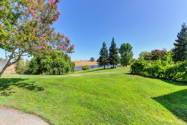
Property Record
24943 N Mcintire Rd, Clements, CA 95227


Save to a Folder
{{folder.Name}}
{{folder.ListingIds.length}} Properties
{{folder.ListingIds.length}} Property
Create a New Folder
Property Detail
24943 N Mcintire Rd
023-120-08
92-FM PT OF 023-120-02/PT OF 023-130-01 PM 18-30
Pasture
SAN JOAQUIN
AG40
California
C and X Area of minimal flood hazard, usually depicted on FIRMs as above the 500-year flood level.
40.04 AC
2025
Lodi
2025
Stockton/Modesto
004704
Stockton-Lodi, CA
3,985 SF
NEARBY LISTINGS FOR SALE OR LEASE
DEMOGRAPHICS near 24943 N Mcintire Rd
1 mile
3 mile
5 mile
2025 Total Population
46
322
1,551
2030 Population
44
309
1,510
Pop Growth 2025-2030
(4.35%)
(4.04%)
(2.64%)
Average Age
43
44
43
2025 Total Households
16
116
560
HH Growth 2025-2030
0.00%
(3.45%)
(2.68%)
Median Household Inc
$175,000
$175,000
$147,187
Avg Household Size
2.70
2.70
2.70
2025 Avg HH Vehicles
3.00
3.00
3.00
Median Home Value
$750,000
$753,731
$655,512
Median Year Built
1980
1978
1984
Nearby Places
Map Layers
Map Styles
 Street
 Aerial
Layers
 Traffic
 Biking
Places
Listings with unknown addresses are not visible on the map
- Restaurants
- Banks
- Shops
- Fitness
- Groceries
PUBLIC TRANSPORTATION
AIRPORT
Stockton Metro
Drive
Walk
Distance
Stockton Metro
50 min
31.2 mi
Freight Ports
Port of Stockton
Drive
Walk
Distance
Port of Stockton
49 min
29.7 mi
SALE & LEASE HISTORY
LISTING DATE
SALE/LEASE

Sep 11, 2019
For Sale
Nearby Properties
Address
Land Use
TOTAL SIZE
Lot Size
Zoning
Address
Land Use
TOTAL SIZE
Lot Size
Zoning
1,688.87 AC
AG80
Address
Land Use
TOTAL SIZE
Lot Size
Zoning
5,193 SF
49.16 AC
AG40
Address
Land Use
TOTAL SIZE
Lot Size
Zoning
4,362 SF
60.73 AC
AG80
Address
Land Use
TOTAL SIZE
Lot Size
Zoning
3,280 SF
4.69 AC
CX
Address
Land Use
TOTAL SIZE
Lot Size
Zoning
4,381 SF
50.59 AC
AG80
Address
Land Use
TOTAL SIZE
Lot Size
Zoning
3,658 SF
39.75 AC
AG40
Address
Land Use
TOTAL SIZE
Lot Size
Zoning
2,195 SF
54.37 AC
AG40
Address
Land Use
TOTAL SIZE
Lot Size
Zoning
78.19 AC
AG80
Address
Land Use
TOTAL SIZE
Lot Size
Zoning
3,428 SF
25.75 AC
AG80
Address
Land Use
TOTAL SIZE
Lot Size
Zoning
2,866 SF
34.80 AC
AG40
Address
Land Use
TOTAL SIZE
Lot Size
Zoning
117.68 AC
AG40
Address
Land Use
TOTAL SIZE
Lot Size
Zoning
34.86 AC
Address
Land Use
TOTAL SIZE
Lot Size
Zoning
2,469 SF
25.80 AC
AG40
Address
Land Use
TOTAL SIZE
Lot Size
Zoning
3,845 SF
19.97 AC
Address
Land Use
TOTAL SIZE
Lot Size
Zoning
5,713 SF
68.66 AC
AG80
Address
Land Use
TOTAL SIZE
Lot Size
Zoning
85.38 AC
AG80
Address
Land Use
TOTAL SIZE
Lot Size
Zoning
48.27 AC
AG40
Address
Land Use
TOTAL SIZE
Lot Size
Zoning
5,041 SF
40.06 AC
Address
Land Use
TOTAL SIZE
Lot Size
Zoning
6,192 SF
80 AC
AG80
Address
Land Use
TOTAL SIZE
Lot Size
Zoning
79.17 AC
AG80
Address
Land Use
TOTAL SIZE
Lot Size
Zoning
1,163 SF
39.59 AC
AG40
Address
Land Use
TOTAL SIZE
Lot Size
Zoning
2,983 SF
80.97 AC
AG80
Address
Land Use
TOTAL SIZE
Lot Size
Zoning
88.48 AC
AG80
Address
Land Use
TOTAL SIZE
Lot Size
Zoning
82.49 AC
AG40
Address
Land Use
TOTAL SIZE
Lot Size
Zoning
3,618 SF
58.09 AC
AG80
Address
Land Use
TOTAL SIZE
Lot Size
Zoning
3,195 SF
80.27 AC
AG80
Address
Land Use
TOTAL SIZE
Lot Size
Zoning
5,029 SF
84.93 AC
AG80
Address
Land Use
TOTAL SIZE
Lot Size
Zoning
4,186 SF
39.55 AC
AG40
Address
Land Use
TOTAL SIZE
Lot Size
Zoning
2,459 SF
62.35 AC
AG40
Address
Land Use
TOTAL SIZE
Lot Size
Zoning
4,021 SF
20.50 AC
AG40
The World's #1 Commercial Real Estate Marketplace
Connect with us
© 2026 CoStar Group
The information above has been obtained from sources believed reliable. While we do not doubt its accuracy we have not verified it and make no guarantee, warranty or representation about it. It is your responsibility to independently confirm its accuracy and completeness. Any projections, opinions, assumptions, or estimates used are for example only and do not represent the current or future performance of the property. The value of this transaction to you depends on tax and other factors which should be evaluated by your tax, financial, and legal advisors. You and your advisors should conduct a careful, independent investigation of the property to determine to your satisfaction the suitability of the property for your needs.