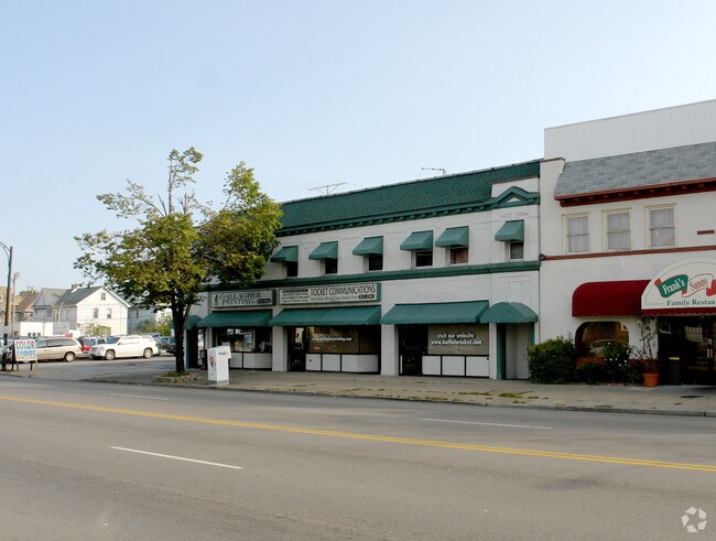
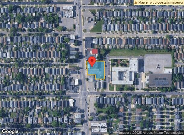
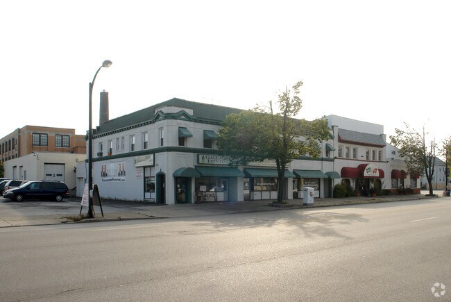
Property Record
2497 Delaware Ave, Buffalo, NY 14216
NEARBY LISTINGS FOR SALE OR LEASE
Property Detail
2497 Delaware Ave
Buffalo-Cheektowaga-Niagara Falls, NY
Holland Land Companys Survey
140200-078-550-0002-051-121
149 N TACOMA IRR S/L; 170 REAR LINE
Medicalclinic
Erie
X
New York
36029C0205H
51.121
2025
0.55 AC
2024
Greater Buffalo
005100
Buffalo/Niagara Falls
7,583 SF
DEMOGRAPHICS near 2497 Delaware Ave
1 Mile
3 Mile
5 Mile
2024 Total Population
24,806
172,406
353,685
2029 Population
24,034
168,567
347,573
Pop Growth 2024-2029
(3.11%)
(2.23%)
(1.73%)
Average Age
40
39
38
2024 Total Households
12,056
74,898
151,274
HH Growth 2024-2029
(3.14%)
(2.27%)
(1.73%)
Median Household Inc
$58,999
$54,299
$50,833
Avg Household Size
2.00
2.20
2.20
2024 Avg HH Vehicles
1.00
1.00
1.00
Median Home Value
$193,741
$174,954
$168,149
Median Year Built
1946
1947
1948
Nearby Places
- Restaurants
- Banks
- Shops
- Fitness
- Groceries
PUBLIC TRANSPORTATION
COMMUTER RAIL
DRIVE
WALK
Distance
15 min
6.8 mi
AIRPORT
Buffalo Niagara International
DRIVE
WALK
Distance
Buffalo Niagara International
20 min
8.8 mi
Niagara Falls International
DRIVE
WALK
Distance
Niagara Falls International
25 min
12.2 mi
Nearby Properties
Address
Land Use
TOTAL SIZE
Lot Size
Zoning
Address
Land Use
TOTAL SIZE
Lot Size
Zoning
6,120 SF
87.10 AC
D-IL
Address
Land Use
TOTAL SIZE
Lot Size
Zoning
135,396 SF
146.32 AC
D-E
Address
Land Use
TOTAL SIZE
Lot Size
Zoning
22,010 SF
D-M
Address
Land Use
TOTAL SIZE
Lot Size
Zoning
8,317 SF
39.03 AC
SPLIT ZONE
Address
Land Use
TOTAL SIZE
Lot Size
Zoning
646,259 SF
16.31 AC
D-M
Address
Land Use
TOTAL SIZE
Lot Size
Zoning
121,015 SF
92.60 AC
D-E
Address
Land Use
TOTAL SIZE
Lot Size
Zoning
561,196 SF
16 AC
D-M
Address
Land Use
TOTAL SIZE
Lot Size
Zoning
21,200 SF
20.94 AC
D-IL
Address
Land Use
TOTAL SIZE
Lot Size
Zoning
36,325 SF
12.50 AC
D-E
Address
Land Use
TOTAL SIZE
Lot Size
Zoning
239,735 SF
17.73 AC
TND
Address
Land Use
TOTAL SIZE
Lot Size
Zoning
12,641 SF
0.56 AC
N-2C
Address
Land Use
TOTAL SIZE
Lot Size
Zoning
19,608 SF
0.45 AC
N-3C
Address
Land Use
TOTAL SIZE
Lot Size
Zoning
94,680 SF
175.90 AC
D-OG
Address
Land Use
TOTAL SIZE
Lot Size
Zoning
540,154 SF
7.06 AC
D-E
Address
Land Use
TOTAL SIZE
Lot Size
Zoning
17,778 SF
14 AC
GB
Address
Land Use
TOTAL SIZE
Lot Size
Zoning
3,456 SF
6.90 AC
MFR-5
Address
Land Use
TOTAL SIZE
Lot Size
Zoning
7,753 SF
1 AC
N-1C
Address
Land Use
TOTAL SIZE
Lot Size
Zoning
119,851 SF
1.35 AC
N-2R
Address
Land Use
TOTAL SIZE
Lot Size
Zoning
650,000 SF
42.15 AC
G-1
Address
Land Use
TOTAL SIZE
Lot Size
Zoning
61,327 SF
175 AC
D-OG
Address
Land Use
TOTAL SIZE
Lot Size
Zoning
148,344 SF
11.14 AC
D-R
Address
Land Use
TOTAL SIZE
Lot Size
Zoning
67,666 SF
17.43 AC
G-1
Address
Land Use
TOTAL SIZE
Lot Size
Zoning
2,112 SF
15.60 AC
Address
Land Use
TOTAL SIZE
Lot Size
Zoning
3.20 AC
G-1
Address
Land Use
TOTAL SIZE
Lot Size
Zoning
679,645 SF
3.20 AC
N-1S
Address
Land Use
TOTAL SIZE
Lot Size
Zoning
73,128 SF
3.11 AC
N-2R
Address
Land Use
TOTAL SIZE
Lot Size
Zoning
11,808 SF
11.93 AC
N-3R
Address
Land Use
TOTAL SIZE
Lot Size
Zoning
192,811 SF
3.30 AC
D-E
Address
Land Use
TOTAL SIZE
Lot Size
Zoning
120,954 SF
9.74 AC
D-S
Address
Land Use
TOTAL SIZE
Lot Size
Zoning
356,891 SF
21.33 AC
B
The World's #1 Commercial Real Estate Marketplace
Connect with us
© 2025 CoStar Group
The information above has been obtained from sources believed reliable. While we do not doubt its accuracy we have not verified it and make no guarantee, warranty or representation about it. It is your responsibility to independently confirm its accuracy and completeness. Any projections, opinions, assumptions, or estimates used are for example only and do not represent the current or future performance of the property. The value of this transaction to you depends on tax and other factors which should be evaluated by your tax, financial, and legal advisors. You and your advisors should conduct a careful, independent investigation of the property to determine to your satisfaction the suitability of the property for your needs.