Property Record
24987 Ne Boones Ferry Rd, Aurora, OR 97002
NEARBY LISTINGS FOR SALE OR LEASE
Property Detail
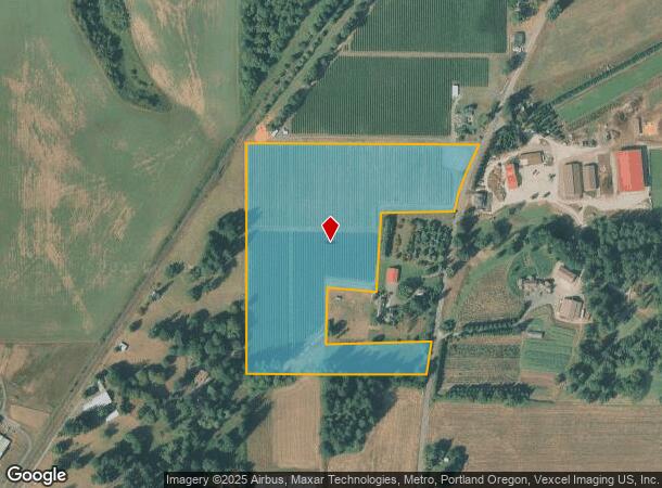
24987 Ne Boones Ferry Rd
Portland-Vancouver-Hillsboro, OR-WA
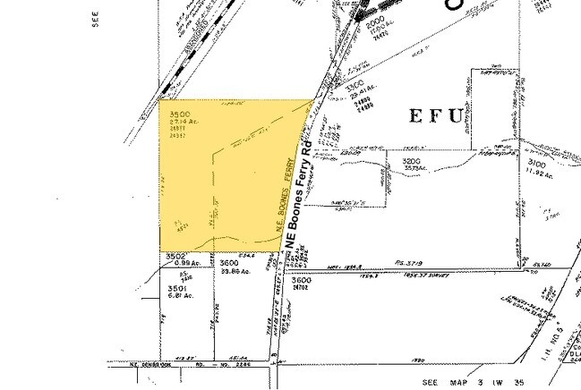
Partition 2009-076
00831844
PARTITION PLAT 2009-076 PARCEL 1
Agriculturalland
Clackamas
X
Oregon
41067C0625E
3500
2025
21.01 AC
2025
I-5 Corridor Outlying
0228003026
Portland
DEMOGRAPHICS near 24987 Ne Boones Ferry Rd
1 mile
3 mile
5 mile
2024 Total Population
1,019
25,644
49,625
2029 Population
1,040
26,236
50,619
Pop Growth 2024-2029
+ 2.06%
+ 2.31%
+ 2.00%
Average Age
59
42
42
2024 Total Households
608
10,671
19,056
HH Growth 2024-2029
+ 2.30%
+ 2.30%
+ 2.05%
Median Household Inc
$69,621
$91,247
$87,825
Avg Household Size
1.60
2.40
2.50
2024 Avg HH Vehicles
2.00
2.00
2.00
Median Home Value
$490,666
$604,633
$497,946
Median Year Built
1985
1995
1993
Nearby Places
Map Layers
Map Styles
 Street
 Aerial
Transit
 Traffic
 Biking
Places
Listings with unknown addresses are not visible on the map
- Restaurants
- Banks
- Shops
- Fitness
- Groceries
PUBLIC TRANSPORTATION
COMMUTER RAIL
Wilsonville (Westside Express Service - Tri-County Metropolitan Transportation District of Oregon Rail (TriMet Rail))
Drive
Walk
Distance
Wilsonville (Westside Express Service - Tri-County Metropolitan Transportation District of Oregon Rail (TriMet Rail))
12 min
3.9 mi
Tualatin (Westside Express Service - Tri-County Metropolitan Transportation District of Oregon Rail (TriMet Rail))
Drive
Walk
Distance
Tualatin (Westside Express Service - Tri-County Metropolitan Transportation District of Oregon Rail (TriMet Rail))
16 min
9.1 mi
AIRPORT
Portland International
Drive
Walk
Distance
Portland International
49 min
31.5 mi
Freight Ports
Port of Portland
Drive
Walk
Distance
Port of Portland
36 min
22.7 mi
Nearby Properties
Address
Land Use
TOTAL SIZE
Lot Size
Zoning
Address
Land Use
TOTAL SIZE
Lot Size
Zoning
20.21 AC
FDAHI
Address
Land Use
TOTAL SIZE
Lot Size
Zoning
54.36 AC
PDI
Address
Land Use
TOTAL SIZE
Lot Size
Zoning
60.52 AC
PF
Address
Land Use
TOTAL SIZE
Lot Size
Zoning
16.18 AC
PDR4
Address
Land Use
TOTAL SIZE
Lot Size
Zoning
21.25 AC
PDR5
Address
Land Use
TOTAL SIZE
Lot Size
Zoning
Address
Land Use
TOTAL SIZE
Lot Size
Zoning
18.49 AC
TC
Address
Land Use
TOTAL SIZE
Lot Size
Zoning
14.44 AC
PDI
Address
Land Use
TOTAL SIZE
Lot Size
Zoning
26.18 AC
PDI
Address
Land Use
TOTAL SIZE
Lot Size
Zoning
38.65 AC
PF
Address
Land Use
TOTAL SIZE
Lot Size
Zoning
14.05 AC
PDR5
Address
Land Use
TOTAL SIZE
Lot Size
Zoning
Address
Land Use
TOTAL SIZE
Lot Size
Zoning
9,918 SF
25.16 AC
PDR5
Address
Land Use
TOTAL SIZE
Lot Size
Zoning
165,375 SF
27.47 AC
P-LU
Address
Land Use
TOTAL SIZE
Lot Size
Zoning
20.89 AC
PDR5
Address
Land Use
TOTAL SIZE
Lot Size
Zoning
12.32 AC
PDR5
Address
Land Use
TOTAL SIZE
Lot Size
Zoning
3.41 AC
PDR4
Address
Land Use
TOTAL SIZE
Lot Size
Zoning
14 AC
PDR6
Address
Land Use
TOTAL SIZE
Lot Size
Zoning
Address
Land Use
TOTAL SIZE
Lot Size
Zoning
10.38 AC
V
Address
Land Use
TOTAL SIZE
Lot Size
Zoning
Address
Land Use
TOTAL SIZE
Lot Size
Zoning
Address
Land Use
TOTAL SIZE
Lot Size
Zoning
15.01 AC
TC
Address
Land Use
TOTAL SIZE
Lot Size
Zoning
19.24 AC
P
Address
Land Use
TOTAL SIZE
Lot Size
Zoning
Address
Land Use
TOTAL SIZE
Lot Size
Zoning
24.95 AC
PDI
Address
Land Use
TOTAL SIZE
Lot Size
Zoning
12 AC
PDR6
Address
Land Use
TOTAL SIZE
Lot Size
Zoning
11.77 AC
PDI
Address
Land Use
TOTAL SIZE
Lot Size
Zoning
4 AC
PDI
The World's #1 Commercial Real Estate Marketplace
Connect with us
© 2026 CoStar Group
The information above has been obtained from sources believed reliable. While we do not doubt its accuracy we have not verified it and make no guarantee, warranty or representation about it. It is your responsibility to independently confirm its accuracy and completeness. Any projections, opinions, assumptions, or estimates used are for example only and do not represent the current or future performance of the property. The value of this transaction to you depends on tax and other factors which should be evaluated by your tax, financial, and legal advisors. You and your advisors should conduct a careful, independent investigation of the property to determine to your satisfaction the suitability of the property for your needs.