Property Record
25 1St Ave, Newnan, GA 30263


NEARBY LISTINGS FOR SALE OR LEASE
Property Detail
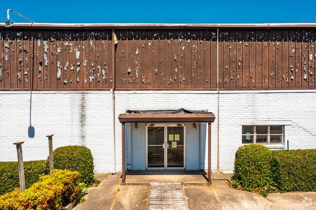
25 1St Ave
Atlanta-Sandy Springs-Roswell, GA
Magnolia Place
N03-0004-004
BLDG/FIRST AVE & LOT 10
Warehouse
Coweta
X
Georgia
13077C0231D
10
2025
5.93 AC
2025
Fayette/Coweta County
170200
Atlanta
117,960 SF
DEMOGRAPHICS near 25 1St Ave
1 Mile
3 Mile
5 Mile
2024 Total Population
7,937
36,818
63,712
2029 Population
8,887
41,171
71,059
Pop Growth 2024-2029
+ 11.97%
+ 11.82%
+ 11.53%
Average Age
38
37
38
2024 Total Households
3,006
14,305
24,558
HH Growth 2024-2029
+ 12.04%
+ 11.84%
+ 11.57%
Median Household Inc
$64,838
$65,773
$72,157
Avg Household Size
2.50
2.50
2.50
2024 Avg HH Vehicles
2.00
2.00
2.00
Median Home Value
$245,833
$242,104
$253,704
Median Year Built
1973
1992
1997
Nearby Places
Map Layers
Map Styles
 Street
 Aerial
- Restaurants
- Banks
- Shops
- Fitness
- Groceries
PUBLIC TRANSPORTATION
AIRPORT
Hartsfield - Jackson Atlanta International
DRIVE
WALK
Distance
Hartsfield - Jackson Atlanta International
45 min
33.2 mi
Freight Ports
Port of Panama City
DRIVE
WALK
Distance
Port of Panama City
312 min
254.8 mi
SALE & LEASE HISTORY
LISTING DATE
SALE/LEASE

Sep 24, 2016
For Lease
Mar 23, 2020
For Lease
Dec 08, 2016
For Sale
Nearby Properties
Address
Land Use
TOTAL SIZE
Lot Size
Zoning
Address
Land Use
TOTAL SIZE
Lot Size
Zoning
286,548 SF
26.47 AC
ND
Address
Land Use
TOTAL SIZE
Lot Size
Zoning
269,327 SF
6.57 AC
ND
Address
Land Use
TOTAL SIZE
Lot Size
Zoning
409,449 SF
93.83 AC
R1
Address
Land Use
TOTAL SIZE
Lot Size
Zoning
449,108 SF
53.36 AC
C2
Address
Land Use
TOTAL SIZE
Lot Size
Zoning
208,092 SF
9.85 AC
R2
Address
Land Use
TOTAL SIZE
Lot Size
Zoning
340,087 SF
24.91 AC
R1
Address
Land Use
TOTAL SIZE
Lot Size
Zoning
272,918 SF
24.21 AC
ND
Address
Land Use
TOTAL SIZE
Lot Size
Zoning
205,636 SF
32 AC
R1
Address
Land Use
TOTAL SIZE
Lot Size
Zoning
323,991 SF
22.48 AC
001
Address
Land Use
TOTAL SIZE
Lot Size
Zoning
208,524 SF
19.59 AC
R2
Address
Land Use
TOTAL SIZE
Lot Size
Zoning
274,787 SF
31.66 AC
001
Address
Land Use
TOTAL SIZE
Lot Size
Zoning
237,164 SF
16.85 AC
R1
Address
Land Use
TOTAL SIZE
Lot Size
Zoning
188,907 SF
25.22 AC
001
Address
Land Use
TOTAL SIZE
Lot Size
Zoning
252,746 SF
20.93 AC
M
Address
Land Use
TOTAL SIZE
Lot Size
Zoning
349,504 SF
26.40 AC
C2
Address
Land Use
TOTAL SIZE
Lot Size
Zoning
229,770 SF
30 AC
001
Address
Land Use
TOTAL SIZE
Lot Size
Zoning
136,343 SF
19.77 AC
R2
Address
Land Use
TOTAL SIZE
Lot Size
Zoning
121,224 SF
15.94 AC
R2
Address
Land Use
TOTAL SIZE
Lot Size
Zoning
137,519 SF
30.65 AC
R2
Address
Land Use
TOTAL SIZE
Lot Size
Zoning
111,730 SF
23.33 AC
001
Address
Land Use
TOTAL SIZE
Lot Size
Zoning
175,159 SF
20.20 AC
002
Address
Land Use
TOTAL SIZE
Lot Size
Zoning
71,484 SF
45.43 AC
R1
Address
Land Use
TOTAL SIZE
Lot Size
Zoning
118,282 SF
4.85 AC
C2
Address
Land Use
TOTAL SIZE
Lot Size
Zoning
128,510 SF
25.10 AC
R1
Address
Land Use
TOTAL SIZE
Lot Size
Zoning
124,120 SF
30.64 AC
001
Address
Land Use
TOTAL SIZE
Lot Size
Zoning
145,274 SF
10 AC
R1
Address
Land Use
TOTAL SIZE
Lot Size
Zoning
194,322 SF
14.25 AC
M
Address
Land Use
TOTAL SIZE
Lot Size
Zoning
89,435 SF
43.29 AC
R1
Address
Land Use
TOTAL SIZE
Lot Size
Zoning
115,754 SF
13.80 AC
C2
Address
Land Use
TOTAL SIZE
Lot Size
Zoning
131,836 SF
16.01 AC
R2
The World's #1 Commercial Real Estate Marketplace
Connect with us
© 2026 CoStar Group
The information above has been obtained from sources believed reliable. While we do not doubt its accuracy we have not verified it and make no guarantee, warranty or representation about it. It is your responsibility to independently confirm its accuracy and completeness. Any projections, opinions, assumptions, or estimates used are for example only and do not represent the current or future performance of the property. The value of this transaction to you depends on tax and other factors which should be evaluated by your tax, financial, and legal advisors. You and your advisors should conduct a careful, independent investigation of the property to determine to your satisfaction the suitability of the property for your needs.