Property Record
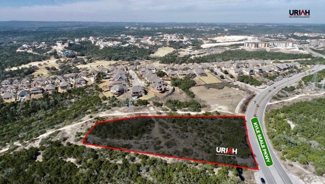
Kyle Seale Pkwy, San Antonio, TX 78255


NEARBY LISTINGS FOR SALE OR LEASE
Property Detail
Kyle Seale Pkwy
San Antonio-New Braunfels, TX
Conv A/S Code
04552-000-0026
CB 4549 P-4D (1.6 AC), CB 4552 P-2L (.922 AC) 2007 -NEW PER SPLIT PER DEED 12543/274 & 12458/272
Vacantlandnec
Bexar
X
Texas
48029C0210G
2.52 AC
2024
Far Northwest
2025
San Antonio
181902
DEMOGRAPHICS near Kyle Seale Pkwy
1 Mile
3 Mile
5 Mile
2024 Total Population
5,143
47,775
138,414
2029 Population
5,549
51,538
147,854
Pop Growth 2024-2029
+ 7.89%
+ 7.88%
+ 6.82%
Average Age
38
35
36
2024 Total Households
1,669
17,602
53,226
HH Growth 2024-2029
+ 8.09%
+ 8.33%
+ 7.12%
Median Household Inc
$153,178
$87,006
$87,193
Avg Household Size
3.10
2.50
2.50
2024 Avg HH Vehicles
2.00
2.00
2.00
Median Home Value
$395,463
$344,402
$289,614
Median Year Built
2006
2005
2003
Nearby Places
Map Layers
Map Styles
 Street
 Aerial
- Restaurants
- Banks
- Shops
- Fitness
- Groceries
PUBLIC TRANSPORTATION
AIRPORT
San Antonio International
DRIVE
WALK
Distance
San Antonio International
23 min
17.1 mi
Freight Ports
Calhoun Port
DRIVE
WALK
Distance
Calhoun Port
200 min
168.5 mi
SALE & LEASE HISTORY
LISTING DATE
SALE/LEASE

Mar 14, 2022
For Sale
Nearby Properties
Address
Land Use
TOTAL SIZE
Lot Size
Zoning
Address
Land Use
TOTAL SIZE
Lot Size
Zoning
437,060 SF
91.31 AC
Address
Land Use
TOTAL SIZE
Lot Size
Zoning
405,133 SF
16.41 AC
Address
Land Use
TOTAL SIZE
Lot Size
Zoning
538,895 SF
54.58 AC
Address
Land Use
TOTAL SIZE
Lot Size
Zoning
335,841 SF
33.70 AC
Address
Land Use
TOTAL SIZE
Lot Size
Zoning
538,895 SF
60.25 AC
Address
Land Use
TOTAL SIZE
Lot Size
Zoning
509,312 SF
43.63 AC
Address
Land Use
TOTAL SIZE
Lot Size
Zoning
13,128 SF
5.23 AC
Address
Land Use
TOTAL SIZE
Lot Size
Zoning
21,852 SF
5.25 AC
Address
Land Use
TOTAL SIZE
Lot Size
Zoning
481,373 SF
44.28 AC
Address
Land Use
TOTAL SIZE
Lot Size
Zoning
10,622 SF
8.01 AC
Address
Land Use
TOTAL SIZE
Lot Size
Zoning
329,050 SF
17.10 AC
Address
Land Use
TOTAL SIZE
Lot Size
Zoning
515,812 SF
200.45 AC
Address
Land Use
TOTAL SIZE
Lot Size
Zoning
331,741 SF
16.53 AC
Address
Land Use
TOTAL SIZE
Lot Size
Zoning
244,260 SF
5.82 AC
Address
Land Use
TOTAL SIZE
Lot Size
Zoning
312,150 SF
22.60 AC
Address
Land Use
TOTAL SIZE
Lot Size
Zoning
413,362 SF
33.77 AC
Address
Land Use
TOTAL SIZE
Lot Size
Zoning
272,094 SF
16.90 AC
Address
Land Use
TOTAL SIZE
Lot Size
Zoning
249,241 SF
28.10 AC
Address
Land Use
TOTAL SIZE
Lot Size
Zoning
307,272 SF
24.14 AC
Address
Land Use
TOTAL SIZE
Lot Size
Zoning
331,020 SF
20.13 AC
Address
Land Use
TOTAL SIZE
Lot Size
Zoning
300,670 SF
15.37 AC
Address
Land Use
TOTAL SIZE
Lot Size
Zoning
146,208 SF
12.84 AC
Address
Land Use
TOTAL SIZE
Lot Size
Zoning
263,082 SF
15.70 AC
Address
Land Use
TOTAL SIZE
Lot Size
Zoning
289,158 SF
31.78 AC
Address
Land Use
TOTAL SIZE
Lot Size
Zoning
217,267 SF
17.63 AC
Address
Land Use
TOTAL SIZE
Lot Size
Zoning
223,377 SF
7.56 AC
Address
Land Use
TOTAL SIZE
Lot Size
Zoning
255,890 SF
14.23 AC
Address
Land Use
TOTAL SIZE
Lot Size
Zoning
236,779 SF
14.31 AC
Address
Land Use
TOTAL SIZE
Lot Size
Zoning
232,610 SF
13.16 AC
Address
Land Use
TOTAL SIZE
Lot Size
Zoning
179,872 SF
12.59 AC
The World's #1 Commercial Real Estate Marketplace
Connect with us
© 2026 CoStar Group
The information above has been obtained from sources believed reliable. While we do not doubt its accuracy we have not verified it and make no guarantee, warranty or representation about it. It is your responsibility to independently confirm its accuracy and completeness. Any projections, opinions, assumptions, or estimates used are for example only and do not represent the current or future performance of the property. The value of this transaction to you depends on tax and other factors which should be evaluated by your tax, financial, and legal advisors. You and your advisors should conduct a careful, independent investigation of the property to determine to your satisfaction the suitability of the property for your needs.