Property Record
25 Edison Rd, Mahwah, NJ 07430
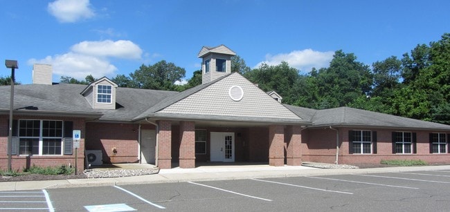

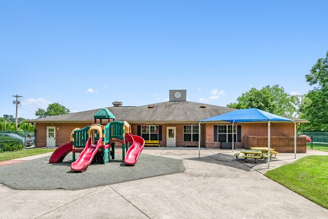

Property Detail
25 Edison Rd
New York-Jersey City-White Plains, NY-NJ
1.83 AC
33-00173-0000-00121
Bergen
Commercialnec
New Jersey
GI80
121
B and X Area of moderate flood hazard, usually the area between the limits of the 100-year and 500-year floods.
1.83 AC
2024
North 17 Corridor
2025
Northern New Jersey
032102
NEARBY LISTINGS FOR SALE OR LEASE
DEMOGRAPHICS near 25 Edison Rd
1 mile
3 mile
5 mile
2024 Total Population
6,381
67,740
174,522
2029 Population
6,653
70,248
181,042
Pop Growth 2024-2029
+ 4.26%
+ 3.70%
+ 3.74%
Average Age
45
43
43
2024 Total Households
2,279
23,989
61,295
HH Growth 2024-2029
+ 4.26%
+ 3.68%
+ 3.71%
Median Household Inc
$177,866
$162,745
$164,706
Avg Household Size
2.70
2.80
2.70
2024 Avg HH Vehicles
2.00
2.00
2.00
Median Home Value
$864,311
$794,379
$787,290
Median Year Built
1976
1965
1965
Nearby Places
Map Layers
Map Styles
 Street
 Aerial
Transit
 Traffic
 Biking
Places
Listings with unknown addresses are not visible on the map
- Restaurants
- Banks
- Shops
- Fitness
- Groceries
PUBLIC TRANSPORTATION
COMMUTER RAIL
Ramsey (Bergen County/Port Jervis Line - NJ Transit Commuter Rail (NJ Transit), Main/Port Jervis Line - NJ Transit Commuter Rail (NJ Transit))
Drive
Walk
Distance
Ramsey (Bergen County/Port Jervis Line - NJ Transit Commuter Rail (NJ Transit), Main/Port Jervis Line - NJ Transit Commuter Rail (NJ Transit))
6 min
3.3 mi
Allendale (Bergen County/Port Jervis Line - NJ Transit Commuter Rail (NJ Transit), Main/Port Jervis Line - NJ Transit Commuter Rail (NJ Transit))
Drive
Walk
Distance
Allendale (Bergen County/Port Jervis Line - NJ Transit Commuter Rail (NJ Transit), Main/Port Jervis Line - NJ Transit Commuter Rail (NJ Transit))
8 min
3.3 mi
AIRPORT
LaGuardia
Drive
Walk
Distance
LaGuardia
45 min
29.9 mi
Newark Liberty International
Drive
Walk
Distance
Newark Liberty International
39 min
30.2 mi
Westchester County
Drive
Walk
Distance
Westchester County
55 min
38.7 mi
Freight Ports
Maher Terminal
Drive
Walk
Distance
Maher Terminal
46 min
29.8 mi
SALE & LEASE HISTORY
LISTING DATE
SALE/LEASE

May 14, 2020
For Lease
May 14, 2020
For Sale
Feb 11, 2019
For Sale
Feb 07, 2019
For Sale
Aug 07, 2017
For Lease
Aug 07, 2017
For Sale
Aug 03, 2021
For Sale
Nearby Properties
Address
Land Use
TOTAL SIZE
Lot Size
Zoning
Address
Land Use
TOTAL SIZE
Lot Size
Zoning
128.12 AC
HOBR
Address
Land Use
TOTAL SIZE
Lot Size
Zoning
88.72 AC
ORL
Address
Land Use
TOTAL SIZE
Lot Size
Zoning
2,252 SF
19.04 AC
Address
Land Use
TOTAL SIZE
Lot Size
Zoning
39.50 AC
Address
Land Use
TOTAL SIZE
Lot Size
Zoning
40.40 AC
PU
Address
Land Use
TOTAL SIZE
Lot Size
Zoning
80.80 AC
Address
Land Use
TOTAL SIZE
Lot Size
Zoning
23.19 AC
R1
Address
Land Use
TOTAL SIZE
Lot Size
Zoning
16.02 AC
R3
Address
Land Use
TOTAL SIZE
Lot Size
Zoning
20.30 AC
Address
Land Use
TOTAL SIZE
Lot Size
Zoning
3,165 SF
2.07 AC
VC2
Address
Land Use
TOTAL SIZE
Lot Size
Zoning
12.69 AC
A40
Address
Land Use
TOTAL SIZE
Lot Size
Zoning
10.64 AC
AAA
Address
Land Use
TOTAL SIZE
Lot Size
Zoning
Address
Land Use
TOTAL SIZE
Lot Size
Zoning
124,528 SF
8.87 AC
EM
Address
Land Use
TOTAL SIZE
Lot Size
Zoning
3.63 AC
Address
Land Use
TOTAL SIZE
Lot Size
Zoning
99,832 SF
10.39 AC
E
Address
Land Use
TOTAL SIZE
Lot Size
Zoning
74,278 SF
6.91 AC
C2
Address
Land Use
TOTAL SIZE
Lot Size
Zoning
107,584 SF
9.19 AC
EM
Address
Land Use
TOTAL SIZE
Lot Size
Zoning
15.30 AC
R1
Address
Land Use
TOTAL SIZE
Lot Size
Zoning
12.45 AC
A225
Address
Land Use
TOTAL SIZE
Lot Size
Zoning
12.49 AC
AHO1
Address
Land Use
TOTAL SIZE
Lot Size
Zoning
98.41 AC
A130
Address
Land Use
TOTAL SIZE
Lot Size
Zoning
13.39 AC
MFAH
Address
Land Use
TOTAL SIZE
Lot Size
Zoning
Address
Land Use
TOTAL SIZE
Lot Size
Zoning
26.70 AC
Address
Land Use
TOTAL SIZE
Lot Size
Zoning
8.07 AC
SR
Address
Land Use
TOTAL SIZE
Lot Size
Zoning
6.03 AC
B2
Address
Land Use
TOTAL SIZE
Lot Size
Zoning
2,005 SF
4.62 AC
A225
Address
Land Use
TOTAL SIZE
Lot Size
Zoning
3.85 AC
Address
Land Use
TOTAL SIZE
Lot Size
Zoning
7.05 AC
The World's #1 Commercial Real Estate Marketplace
Connect with us
© 2026 CoStar Group
The information above has been obtained from sources believed reliable. While we do not doubt its accuracy we have not verified it and make no guarantee, warranty or representation about it. It is your responsibility to independently confirm its accuracy and completeness. Any projections, opinions, assumptions, or estimates used are for example only and do not represent the current or future performance of the property. The value of this transaction to you depends on tax and other factors which should be evaluated by your tax, financial, and legal advisors. You and your advisors should conduct a careful, independent investigation of the property to determine to your satisfaction the suitability of the property for your needs.