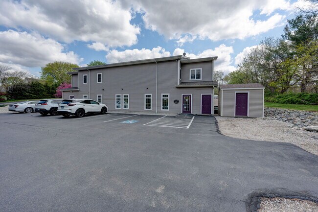
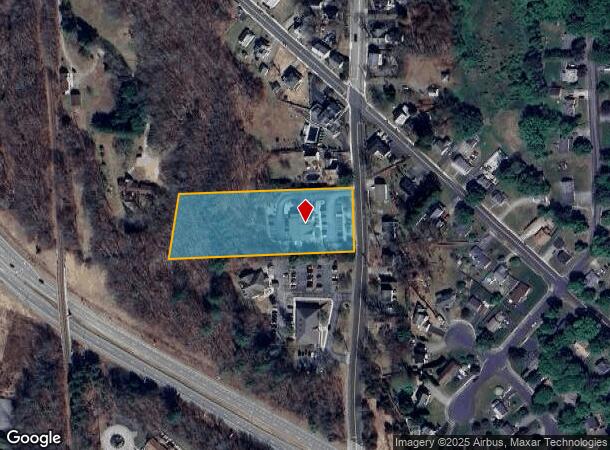
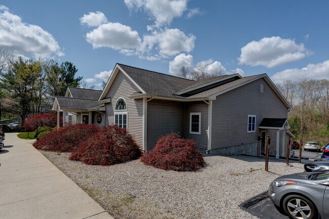
Property Record
25 Green Hollow Rd, Danielson, CT 06239
NEARBY LISTINGS FOR SALE OR LEASE
Property Detail
25 Green Hollow Rd
Medicalbuilding
Windham
X
Connecticut
09015C0242F
2.30 AC
2025
Windham County
2025
Hartford
904500
Willimantic, CT
4,550 SF
KILL-000200-000000-000139
DEMOGRAPHICS near 25 Green Hollow Rd
1 Mile
3 Mile
5 Mile
2024 Total Population
5,936
15,476
27,393
2029 Population
6,005
15,548
27,313
Pop Growth 2024-2029
+ 1.16%
+ 0.47%
(0.29%)
Average Age
40
42
42
2024 Total Households
2,442
6,374
10,898
HH Growth 2024-2029
+ 1.19%
+ 0.55%
(0.24%)
Median Household Inc
$60,617
$71,943
$76,809
Avg Household Size
2.30
2.30
2.40
2024 Avg HH Vehicles
2.00
2.00
2.00
Median Home Value
$187,499
$230,951
$245,398
Median Year Built
1949
1966
1971
Nearby Places
Map Layers
Map Styles
 Street
 Aerial
- Restaurants
- Banks
- Shops
- Fitness
- Groceries
PUBLIC TRANSPORTATION
AIRPORT
Rhode Island Tf Green International
DRIVE
WALK
Distance
Rhode Island Tf Green International
43 min
31.6 mi
Worcester Regional
DRIVE
WALK
Distance
Worcester Regional
52 min
36.9 mi
Freight Ports
Port of Davisville, RI
DRIVE
WALK
Distance
Port of Davisville, RI
55 min
40.9 mi
SALE & LEASE HISTORY
LISTING DATE
SALE/LEASE

Nov 29, 2023
For Lease
Nearby Properties
Address
Land Use
TOTAL SIZE
Lot Size
Zoning
Address
Land Use
TOTAL SIZE
Lot Size
Zoning
203,150 SF
21 AC
LD
Address
Land Use
TOTAL SIZE
Lot Size
Zoning
22 AC
I
Address
Land Use
TOTAL SIZE
Lot Size
Zoning
62 AC
LD
Address
Land Use
TOTAL SIZE
Lot Size
Zoning
53,306 SF
1.60 AC
BI
Address
Land Use
TOTAL SIZE
Lot Size
Zoning
139,010 SF
16.75 AC
MUI
Address
Land Use
TOTAL SIZE
Lot Size
Zoning
227 AC
LD
Address
Land Use
TOTAL SIZE
Lot Size
Zoning
147,139 SF
25.48 AC
PC
Address
Land Use
TOTAL SIZE
Lot Size
Zoning
148,118 SF
17 AC
BRHD
Address
Land Use
TOTAL SIZE
Lot Size
Zoning
126,601 SF
13.40 AC
MUI
Address
Land Use
TOTAL SIZE
Lot Size
Zoning
59,552 SF
4.28 AC
GC
Address
Land Use
TOTAL SIZE
Lot Size
Zoning
50,707 SF
10.50 AC
BRHD
Address
Land Use
TOTAL SIZE
Lot Size
Zoning
10.50 AC
GC
Address
Land Use
TOTAL SIZE
Lot Size
Zoning
67,994 SF
8.30 AC
GC
Address
Land Use
TOTAL SIZE
Lot Size
Zoning
15 AC
I
Address
Land Use
TOTAL SIZE
Lot Size
Zoning
9.77 AC
PC
Address
Land Use
TOTAL SIZE
Lot Size
Zoning
45,960 SF
1.40 AC
MD
Address
Land Use
TOTAL SIZE
Lot Size
Zoning
19.85 AC
R30
Address
Land Use
TOTAL SIZE
Lot Size
Zoning
7,808 SF
6.90 AC
I
Address
Land Use
TOTAL SIZE
Lot Size
Zoning
9.80 AC
GC
Address
Land Use
TOTAL SIZE
Lot Size
Zoning
12.20 AC
MD
Address
Land Use
TOTAL SIZE
Lot Size
Zoning
18,958 SF
1.52 AC
BGC
Address
Land Use
TOTAL SIZE
Lot Size
Zoning
9.12 AC
R10
Address
Land Use
TOTAL SIZE
Lot Size
Zoning
13,472 SF
1.40 AC
PC
Address
Land Use
TOTAL SIZE
Lot Size
Zoning
14,524 SF
0.92 AC
RHD
Address
Land Use
TOTAL SIZE
Lot Size
Zoning
4.60 AC
BRHD
Address
Land Use
TOTAL SIZE
Lot Size
Zoning
33,486 SF
4.10 AC
MMUDD
Address
Land Use
TOTAL SIZE
Lot Size
Zoning
28,678 SF
0.95 AC
BRHD
Address
Land Use
TOTAL SIZE
Lot Size
Zoning
4.80 AC
RHD
Address
Land Use
TOTAL SIZE
Lot Size
Zoning
Address
Land Use
TOTAL SIZE
Lot Size
Zoning
13 AC
I
The World's #1 Commercial Real Estate Marketplace
Connect with us
© 2026 CoStar Group
The information above has been obtained from sources believed reliable. While we do not doubt its accuracy we have not verified it and make no guarantee, warranty or representation about it. It is your responsibility to independently confirm its accuracy and completeness. Any projections, opinions, assumptions, or estimates used are for example only and do not represent the current or future performance of the property. The value of this transaction to you depends on tax and other factors which should be evaluated by your tax, financial, and legal advisors. You and your advisors should conduct a careful, independent investigation of the property to determine to your satisfaction the suitability of the property for your needs.