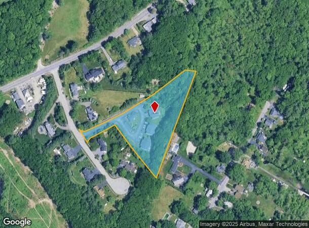
Property Record
25 Heritage Ln, Boylston, MA 01505

NEARBY LISTINGS FOR SALE OR LEASE
Property Detail
25 Heritage Ln
BOYL M:7 B:11
Worcester
Taxexempt
Massachusetts
X
2.82 AC
25027C0610F
Northeast Worcester County
0
Boston
2025
Worcester, MA-CT
718100
DEMOGRAPHICS near 25 Heritage Ln
1 Mile
3 Mile
5 Mile
2024 Total Population
1,861
45,324
137,971
2029 Population
1,838
44,991
137,092
Pop Growth 2024-2029
(1.24%)
(0.73%)
(0.64%)
Average Age
44
41
40
2024 Total Households
736
17,778
53,246
HH Growth 2024-2029
(1.22%)
(0.80%)
(0.65%)
Median Household Inc
$119,470
$82,962
$84,988
Avg Household Size
2.50
2.50
2.40
2024 Avg HH Vehicles
2.00
2.00
2.00
Median Home Value
$459,499
$373,201
$390,991
Median Year Built
1971
1959
1963
Nearby Places
Map Layers
Map Styles
 Street
 Aerial
- Restaurants
- Banks
- Shops
- Fitness
- Groceries
PUBLIC TRANSPORTATION
COMMUTER RAIL
Worcester (Framingham/Worcester Line - Massachusetts Bay Transportation Authority Commuter Rail (Purple Line))
DRIVE
WALK
Distance
Worcester (Framingham/Worcester Line - Massachusetts Bay Transportation Authority Commuter Rail (Purple Line))
11 min
5.7 mi
Worcester Union Station (Lake Shore Limited - Amtrak)
DRIVE
WALK
Distance
Worcester Union Station (Lake Shore Limited - Amtrak)
10 min
5.8 mi
AIRPORT
Worcester Regional
DRIVE
WALK
Distance
Worcester Regional
21 min
10.2 mi
Freight Ports
Port of Boston
DRIVE
WALK
Distance
Port of Boston
65 min
48.2 mi
Nearby Properties
Address
Land Use
TOTAL SIZE
Lot Size
Zoning
Address
Land Use
TOTAL SIZE
Lot Size
Zoning
155,421 SF
65.04 AC
RL-7
Address
Land Use
TOTAL SIZE
Lot Size
Zoning
524,527 SF
45.16 AC
BL-1
Address
Land Use
TOTAL SIZE
Lot Size
Zoning
362,937 SF
91.58 AC
Address
Land Use
TOTAL SIZE
Lot Size
Zoning
51.05 AC
BO-1
Address
Land Use
TOTAL SIZE
Lot Size
Zoning
295,000 SF
194.17 AC
RUR B
Address
Land Use
TOTAL SIZE
Lot Size
Zoning
50.11 AC
RS-7
Address
Land Use
TOTAL SIZE
Lot Size
Zoning
30.93 AC
RG-5
Address
Land Use
TOTAL SIZE
Lot Size
Zoning
15.37 AC
RS-7
Address
Land Use
TOTAL SIZE
Lot Size
Zoning
118,381 SF
12.61 AC
RG-5
Address
Land Use
TOTAL SIZE
Lot Size
Zoning
120,046 SF
6.90 AC
RG-5
Address
Land Use
TOTAL SIZE
Lot Size
Zoning
118,682 SF
7.33 AC
RG-5
Address
Land Use
TOTAL SIZE
Lot Size
Zoning
13.95 AC
RG-5
Address
Land Use
TOTAL SIZE
Lot Size
Zoning
217,500 SF
51.71 AC
LIM CO
Address
Land Use
TOTAL SIZE
Lot Size
Zoning
1,839.82 AC
Address
Land Use
TOTAL SIZE
Lot Size
Zoning
286,338 SF
33.45 AC
RL-7
Address
Land Use
TOTAL SIZE
Lot Size
Zoning
373,550 SF
29.05 AC
Address
Land Use
TOTAL SIZE
Lot Size
Zoning
6.70 AC
RG-5
Address
Land Use
TOTAL SIZE
Lot Size
Zoning
96,541 SF
5.24 AC
MG-5
Address
Land Use
TOTAL SIZE
Lot Size
Zoning
24,243 SF
168.59 AC
Address
Land Use
TOTAL SIZE
Lot Size
Zoning
423,883 SF
59.55 AC
Address
Land Use
TOTAL SIZE
Lot Size
Zoning
40,733 SF
4.93 AC
LIM CO
Address
Land Use
TOTAL SIZE
Lot Size
Zoning
299,228 SF
32.39 AC
Address
Land Use
TOTAL SIZE
Lot Size
Zoning
42.98 AC
LIM OF
Address
Land Use
TOTAL SIZE
Lot Size
Zoning
5.13 AC
RG-5
Address
Land Use
TOTAL SIZE
Lot Size
Zoning
5.67 AC
RG-5
Address
Land Use
TOTAL SIZE
Lot Size
Zoning
6.09 AC
RG-5
Address
Land Use
TOTAL SIZE
Lot Size
Zoning
83,148 SF
2.63 AC
ML-.5
Address
Land Use
TOTAL SIZE
Lot Size
Zoning
84.73 AC
RES A
Address
Land Use
TOTAL SIZE
Lot Size
Zoning
2,144 SF
8.14 AC
RG-5
Address
Land Use
TOTAL SIZE
Lot Size
Zoning
13 AC
RS-7
The World's #1 Commercial Real Estate Marketplace
Connect with us
© 2026 CoStar Group
The information above has been obtained from sources believed reliable. While we do not doubt its accuracy we have not verified it and make no guarantee, warranty or representation about it. It is your responsibility to independently confirm its accuracy and completeness. Any projections, opinions, assumptions, or estimates used are for example only and do not represent the current or future performance of the property. The value of this transaction to you depends on tax and other factors which should be evaluated by your tax, financial, and legal advisors. You and your advisors should conduct a careful, independent investigation of the property to determine to your satisfaction the suitability of the property for your needs.