Property Record
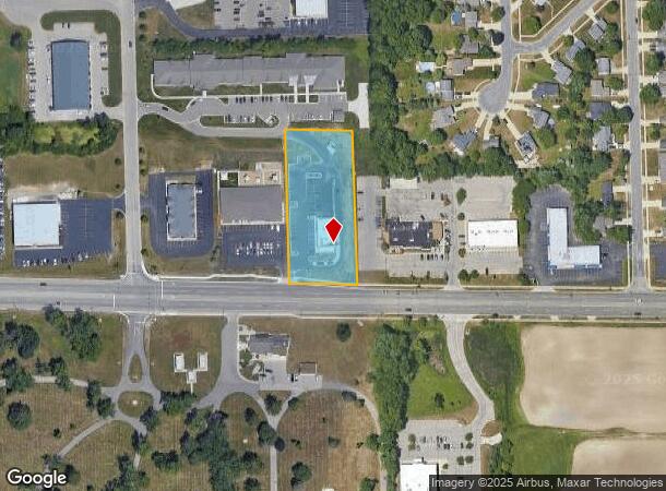
25 Lake Michigan Dr Nw, Grand Rapids, MI 49534
NEARBY LISTINGS FOR SALE OR LEASE
Property Detail
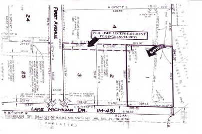
25 Lake Michigan Dr Nw
Grand Rapids-Wyoming, MI
Tallmadge Industrial Park
70-10-24-485-024
LOT 1 EXC W 10 FT, ALSO EXC E 80 FT TALLMADGE INDUSTRIAL PARK
Restaurantdrivein
Ottawa
X
Michigan
26081C0385D
1
2024
1.66 AC
2025
Northern Ottawa County
011701
West Michigan
3,634 SF
DEMOGRAPHICS near 25 Lake Michigan Dr Nw
1 Mile
3 Mile
5 Mile
2024 Total Population
4,702
28,574
85,541
2029 Population
4,894
29,344
87,060
Pop Growth 2024-2029
+ 4.08%
+ 2.69%
+ 1.78%
Average Age
38
40
39
2024 Total Households
1,759
11,661
33,663
HH Growth 2024-2029
+ 3.92%
+ 2.52%
+ 1.76%
Median Household Inc
$74,271
$74,964
$71,054
Avg Household Size
2.60
2.40
2.50
2024 Avg HH Vehicles
2.00
2.00
2.00
Median Home Value
$229,950
$254,148
$228,993
Median Year Built
1992
1984
1971
Nearby Places
Map Layers
Map Styles
 Street
 Aerial
- Restaurants
- Banks
- Shops
- Fitness
- Groceries
PUBLIC TRANSPORTATION
COMMUTER RAIL
Grand Rapids Vernon J. Ehlers Station (Pere Marquette - Amtrak)
DRIVE
WALK
Distance
Grand Rapids Vernon J. Ehlers Station (Pere Marquette - Amtrak)
13 min
6.5 mi
AIRPORT
Gerald R Ford International
DRIVE
WALK
Distance
Gerald R Ford International
32 min
20.8 mi
Freight Ports
Port Milwaukee
DRIVE
WALK
Distance
Port Milwaukee
303 min
260.5 mi
SALE & LEASE HISTORY
LISTING DATE
SALE/LEASE

Sep 24, 2016
For Sale
Nearby Properties
Address
Land Use
TOTAL SIZE
Lot Size
Zoning
Address
Land Use
TOTAL SIZE
Lot Size
Zoning
390,682 SF
47.73 AC
ARM - MULT
Address
Land Use
TOTAL SIZE
Lot Size
Zoning
389,181 SF
51.01 AC
RPUD - 2
Address
Land Use
TOTAL SIZE
Lot Size
Zoning
32.89 AC
TN-LDR
Address
Land Use
TOTAL SIZE
Lot Size
Zoning
343,973 SF
29.15 AC
MON-LDR
Address
Land Use
TOTAL SIZE
Lot Size
Zoning
245,620 SF
20.13 AC
RPUD - 2
Address
Land Use
TOTAL SIZE
Lot Size
Zoning
209,522 SF
27.89 AC
CPUD
Address
Land Use
TOTAL SIZE
Lot Size
Zoning
147,232 SF
18.42 AC
ARM - MULT
Address
Land Use
TOTAL SIZE
Lot Size
Zoning
107,800 SF
13.29 AC
CPUD
Address
Land Use
TOTAL SIZE
Lot Size
Zoning
140,841 SF
8.96 AC
Address
Land Use
TOTAL SIZE
Lot Size
Zoning
85,472 SF
12.17 AC
ARM - MULT
Address
Land Use
TOTAL SIZE
Lot Size
Zoning
Address
Land Use
TOTAL SIZE
Lot Size
Zoning
78,872 SF
3.09 AC
MON-LDR
Address
Land Use
TOTAL SIZE
Lot Size
Zoning
88,113 SF
12.50 AC
Address
Land Use
TOTAL SIZE
Lot Size
Zoning
4.80 AC
Address
Land Use
TOTAL SIZE
Lot Size
Zoning
53,653 SF
1.81 AC
MON-MDR
Address
Land Use
TOTAL SIZE
Lot Size
Zoning
37,268 SF
3.32 AC
Address
Land Use
TOTAL SIZE
Lot Size
Zoning
51,232 SF
5.04 AC
MCN-C
Address
Land Use
TOTAL SIZE
Lot Size
Zoning
1,992 SF
48.64 AC
RMT
Address
Land Use
TOTAL SIZE
Lot Size
Zoning
53,600 SF
Address
Land Use
TOTAL SIZE
Lot Size
Zoning
67,821 SF
4.95 AC
Address
Land Use
TOTAL SIZE
Lot Size
Zoning
65,562 SF
8.18 AC
Address
Land Use
TOTAL SIZE
Lot Size
Zoning
2,173 SF
40.87 AC
RMT
Address
Land Use
TOTAL SIZE
Lot Size
Zoning
78,451 SF
4.57 AC
Address
Land Use
TOTAL SIZE
Lot Size
Zoning
47,178 SF
2.64 AC
Address
Land Use
TOTAL SIZE
Lot Size
Zoning
45,000 SF
2.31 AC
Address
Land Use
TOTAL SIZE
Lot Size
Zoning
13,255 SF
1.36 AC
CPUD
Address
Land Use
TOTAL SIZE
Lot Size
Zoning
62,978 SF
7.58 AC
Address
Land Use
TOTAL SIZE
Lot Size
Zoning
19,078 SF
3.46 AC
CPUD
Address
Land Use
TOTAL SIZE
Lot Size
Zoning
77,750 SF
5.46 AC
IPUD
Address
Land Use
TOTAL SIZE
Lot Size
Zoning
36,975 SF
The World's #1 Commercial Real Estate Marketplace
Connect with us
© 2025 CoStar Group
The information above has been obtained from sources believed reliable. While we do not doubt its accuracy we have not verified it and make no guarantee, warranty or representation about it. It is your responsibility to independently confirm its accuracy and completeness. Any projections, opinions, assumptions, or estimates used are for example only and do not represent the current or future performance of the property. The value of this transaction to you depends on tax and other factors which should be evaluated by your tax, financial, and legal advisors. You and your advisors should conduct a careful, independent investigation of the property to determine to your satisfaction the suitability of the property for your needs.