Property Record
25 N 4Th St, Beaumont, TX 77701


NEARBY LISTINGS FOR SALE OR LEASE
Property Detail
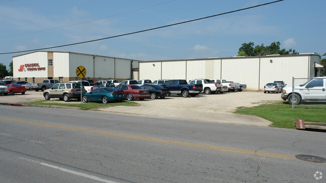
25 N 4Th St
Beaumont/Port Arthur
Parkdale
Beaumont-Port Arthur, TX
PARKDALE LT 1 TO 4 & & S 40 LTS 5 & 6 & LT A & B BLK 22 AND LTS 1 TO 6 BLK 24
050750-000-017500-00000
Jefferson
Commercialnec
Texas
2024
1
2025
2.14 AC
001200
Downtown Beaumont
44,048 SF
DEMOGRAPHICS near 25 N 4Th St
1 Mile
3 Mile
5 Mile
2024 Total Population
6,231
54,424
96,551
2029 Population
6,102
53,607
94,546
Pop Growth 2024-2029
(2.07%)
(1.50%)
(2.08%)
Average Age
37
38
38
2024 Total Households
2,378
21,020
38,273
HH Growth 2024-2029
(2.23%)
(1.57%)
(2.13%)
Median Household Inc
$52,130
$46,055
$50,538
Avg Household Size
2.40
2.40
2.40
2024 Avg HH Vehicles
1.00
2.00
2.00
Median Home Value
$99,367
$111,248
$144,786
Median Year Built
1963
1968
1975
Nearby Places
Map Layers
Map Styles
 Street
 Aerial
- Restaurants
- Banks
- Shops
- Fitness
- Groceries
PUBLIC TRANSPORTATION
COMMUTER RAIL
Beaumont Amtrak (Sunset Limited - Amtrak)
DRIVE
WALK
Distance
Beaumont Amtrak (Sunset Limited - Amtrak)
3 min
1.5 mi
Freight Ports
Port Beaumont
DRIVE
WALK
Distance
Port Beaumont
2 min
1.1 mi
Nearby Properties
Address
Land Use
TOTAL SIZE
Lot Size
Zoning
Address
Land Use
TOTAL SIZE
Lot Size
Zoning
373,397 SF
21.07 AC
Address
Land Use
TOTAL SIZE
Lot Size
Zoning
425,204 SF
6.99 AC
Address
Land Use
TOTAL SIZE
Lot Size
Zoning
163,287 SF
5.46 AC
Address
Land Use
TOTAL SIZE
Lot Size
Zoning
130,658 SF
8.03 AC
Address
Land Use
TOTAL SIZE
Lot Size
Zoning
2.07 AC
Address
Land Use
TOTAL SIZE
Lot Size
Zoning
241,242 SF
24.31 AC
Address
Land Use
TOTAL SIZE
Lot Size
Zoning
185,378 SF
2.76 AC
Address
Land Use
TOTAL SIZE
Lot Size
Zoning
56,223 SF
1.93 AC
Address
Land Use
TOTAL SIZE
Lot Size
Zoning
110,109 SF
6 AC
Address
Land Use
TOTAL SIZE
Lot Size
Zoning
35,901 SF
2.71 AC
Address
Land Use
TOTAL SIZE
Lot Size
Zoning
250,157 SF
17.65 AC
Address
Land Use
TOTAL SIZE
Lot Size
Zoning
56,916 SF
13.76 AC
Address
Land Use
TOTAL SIZE
Lot Size
Zoning
79,125 SF
8.09 AC
Address
Land Use
TOTAL SIZE
Lot Size
Zoning
65,335 SF
11.51 AC
Address
Land Use
TOTAL SIZE
Lot Size
Zoning
61,010 SF
5.28 AC
Address
Land Use
TOTAL SIZE
Lot Size
Zoning
132,319 SF
13.24 AC
Address
Land Use
TOTAL SIZE
Lot Size
Zoning
124,838 SF
11.80 AC
Address
Land Use
TOTAL SIZE
Lot Size
Zoning
83,490 SF
10.93 AC
Address
Land Use
TOTAL SIZE
Lot Size
Zoning
72,224 SF
1.46 AC
Address
Land Use
TOTAL SIZE
Lot Size
Zoning
101,083 SF
3.16 AC
Address
Land Use
TOTAL SIZE
Lot Size
Zoning
68,958 SF
1.78 AC
Address
Land Use
TOTAL SIZE
Lot Size
Zoning
75,288 SF
Address
Land Use
TOTAL SIZE
Lot Size
Zoning
62,600 SF
20 AC
Address
Land Use
TOTAL SIZE
Lot Size
Zoning
70.66 AC
Address
Land Use
TOTAL SIZE
Lot Size
Zoning
76,000 SF
0.94 AC
Address
Land Use
TOTAL SIZE
Lot Size
Zoning
53,990 SF
2.34 AC
Address
Land Use
TOTAL SIZE
Lot Size
Zoning
117,870 SF
4.04 AC
Address
Land Use
TOTAL SIZE
Lot Size
Zoning
43,095 SF
4.46 AC
Address
Land Use
TOTAL SIZE
Lot Size
Zoning
95,273 SF
9.43 AC
Address
Land Use
TOTAL SIZE
Lot Size
Zoning
191,420 SF
7.85 AC
The World's #1 Commercial Real Estate Marketplace
Connect with us
© 2026 CoStar Group
The information above has been obtained from sources believed reliable. While we do not doubt its accuracy we have not verified it and make no guarantee, warranty or representation about it. It is your responsibility to independently confirm its accuracy and completeness. Any projections, opinions, assumptions, or estimates used are for example only and do not represent the current or future performance of the property. The value of this transaction to you depends on tax and other factors which should be evaluated by your tax, financial, and legal advisors. You and your advisors should conduct a careful, independent investigation of the property to determine to your satisfaction the suitability of the property for your needs.