Property Record
25 N Highway 25 Byp, Greenville, SC 29617
NEARBY LISTINGS FOR SALE OR LEASE
-
-
View all Greenville listings for sale on LoopNet.com
Property Detail
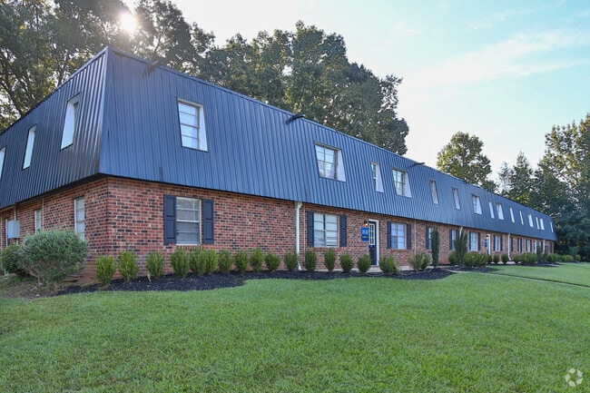
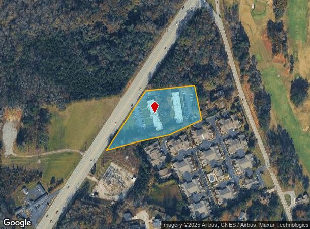
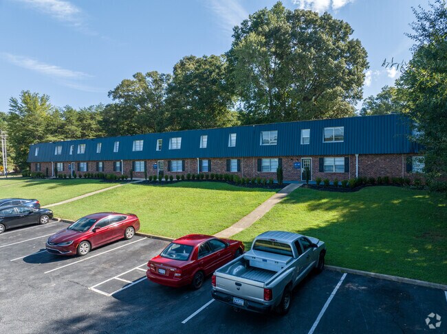
25 N Highway 25 Byp
Greenville-Anderson-Mauldin, SC
Survey For Harry B Luthi Jr
0472.00-01-011.00
MAP 0472.00
Apartment
Greenville
X
South Carolina
45045C0312E
011.00
2024
3.30 AC
2024
North Greenville
003701
Greenville/Spartanburg
DEMOGRAPHICS near 25 N Highway 25 Byp
1 Mile
3 Mile
5 Mile
2024 Total Population
5,064
29,727
73,836
2029 Population
5,453
32,681
81,475
Pop Growth 2024-2029
+ 7.68%
+ 9.94%
+ 10.35%
Average Age
36
40
39
2024 Total Households
1,452
11,528
28,538
HH Growth 2024-2029
+ 9.57%
+ 10.40%
+ 10.56%
Median Household Inc
$65,511
$54,728
$48,151
Avg Household Size
2.20
2.30
2.40
2024 Avg HH Vehicles
2.00
2.00
2.00
Median Home Value
$277,132
$221,366
$212,090
Median Year Built
1999
1990
1984
Nearby Places
Map Layers
Map Styles
 Street
 Aerial
- Restaurants
- Banks
- Shops
- Fitness
- Groceries
PUBLIC TRANSPORTATION
COMMUTER RAIL
Greenville Amtrak Station (Crescent - Amtrak)
DRIVE
WALK
Distance
Greenville Amtrak Station (Crescent - Amtrak)
14 min
7.0 mi
AIRPORT
Greenville Spartanburg International
DRIVE
WALK
Distance
Greenville Spartanburg International
36 min
20.0 mi
Freight Ports
North Charleston Terminal
DRIVE
WALK
Distance
North Charleston Terminal
243 min
210.6 mi
Nearby Properties
Address
Land Use
TOTAL SIZE
Lot Size
Zoning
Address
Land Use
TOTAL SIZE
Lot Size
Zoning
22.58 AC
RRROW
Address
Land Use
TOTAL SIZE
Lot Size
Zoning
14.41 AC
R15
Address
Land Use
TOTAL SIZE
Lot Size
Zoning
703.30 AC
RS
Address
Land Use
TOTAL SIZE
Lot Size
Zoning
10.17 AC
RM
Address
Land Use
TOTAL SIZE
Lot Size
Zoning
3.93 AC
R10
Address
Land Use
TOTAL SIZE
Lot Size
Zoning
19.25 AC
R15
Address
Land Use
TOTAL SIZE
Lot Size
Zoning
14.40 AC
I1
Address
Land Use
TOTAL SIZE
Lot Size
Zoning
7.56 AC
C2
Address
Land Use
TOTAL SIZE
Lot Size
Zoning
2.21 AC
RMA
Address
Land Use
TOTAL SIZE
Lot Size
Zoning
Address
Land Use
TOTAL SIZE
Lot Size
Zoning
Address
Land Use
TOTAL SIZE
Lot Size
Zoning
37 AC
S1
Address
Land Use
TOTAL SIZE
Lot Size
Zoning
22.92 AC
R10
Address
Land Use
TOTAL SIZE
Lot Size
Zoning
165.20 AC
RS
Address
Land Use
TOTAL SIZE
Lot Size
Zoning
14.46 AC
RM
Address
Land Use
TOTAL SIZE
Lot Size
Zoning
22.88 AC
C2
Address
Land Use
TOTAL SIZE
Lot Size
Zoning
5.05 AC
C2
Address
Land Use
TOTAL SIZE
Lot Size
Zoning
15.82 AC
Address
Land Use
TOTAL SIZE
Lot Size
Zoning
100 AC
RS
Address
Land Use
TOTAL SIZE
Lot Size
Zoning
5.10 AC
C2
Address
Land Use
TOTAL SIZE
Lot Size
Zoning
4.97 AC
C2
Address
Land Use
TOTAL SIZE
Lot Size
Zoning
1,491 SF
27.82 AC
R15
Address
Land Use
TOTAL SIZE
Lot Size
Zoning
11.56 AC
I1
Address
Land Use
TOTAL SIZE
Lot Size
Zoning
34.67 AC
I1
Address
Land Use
TOTAL SIZE
Lot Size
Zoning
0.14 AC
C3
Address
Land Use
TOTAL SIZE
Lot Size
Zoning
2,471 SF
16.10 AC
RM
Address
Land Use
TOTAL SIZE
Lot Size
Zoning
24.45 AC
I1
Address
Land Use
TOTAL SIZE
Lot Size
Zoning
63.70 AC
RS
Address
Land Use
TOTAL SIZE
Lot Size
Zoning
38.88 AC
C1
Address
Land Use
TOTAL SIZE
Lot Size
Zoning
58.29 AC
PD
The World's #1 Commercial Real Estate Marketplace
Connect with us
© 2025 CoStar Group
The information above has been obtained from sources believed reliable. While we do not doubt its accuracy we have not verified it and make no guarantee, warranty or representation about it. It is your responsibility to independently confirm its accuracy and completeness. Any projections, opinions, assumptions, or estimates used are for example only and do not represent the current or future performance of the property. The value of this transaction to you depends on tax and other factors which should be evaluated by your tax, financial, and legal advisors. You and your advisors should conduct a careful, independent investigation of the property to determine to your satisfaction the suitability of the property for your needs.