Property Record
25 River Rd, Wilton, CT 06897

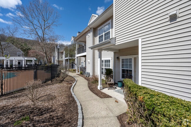

Property Detail
25 River Rd
WILT-000073-000025-000003
Western Ct
Apartment
Connecticut
CRA-1
3
B and X Area of moderate flood hazard, usually the area between the limits of the 100-year and 500-year floods.
12.32 AC
2025
Outer Middle Fairfield County
2025
Westchester/So Connecticut
045200
Bridgeport-Stamford-Danbury, CT
NEARBY LISTINGS FOR SALE OR LEASE
-
-
View all Wilton listings for sale on LoopNet.com
DEMOGRAPHICS near 25 River Rd
1 mile
3 mile
5 mile
2025 Total Population
3,498
24,683
92,615
2030 Population
3,639
25,432
95,019
Pop Growth 2025-2030
+ 4.03%
+ 3.03%
+ 2.60%
Average Age
43
42
42
2025 Total Households
1,316
8,841
33,861
HH Growth 2025-2030
+ 4.10%
+ 3.12%
+ 2.59%
Median Household Inc
$171,335
$197,567
$173,593
Avg Household Size
2.60
2.70
2.70
2025 Avg HH Vehicles
2.00
2.00
2.00
Median Home Value
$863,914
$895,322
$866,310
Median Year Built
1982
1974
1968
Nearby Places
Map Layers
Map Styles
 Street
 Aerial
Transit
 Traffic
 Biking
Places
Listings with unknown addresses are not visible on the map
- Restaurants
- Banks
- Shops
- Fitness
- Groceries
PUBLIC TRANSPORTATION
COMMUTER RAIL
Wilton Station (New Haven Line - Metro-North Commuter Railroad Company (Metro-North))
Drive
Walk
Distance
Wilton Station (New Haven Line - Metro-North Commuter Railroad Company (Metro-North))
4 min
18 min
0.9 mi
Cannondale Station (New Haven Line - Metro-North Commuter Railroad Company (Metro-North))
Drive
Walk
Distance
Cannondale Station (New Haven Line - Metro-North Commuter Railroad Company (Metro-North))
6 min
2.6 mi
AIRPORT
Westchester County
Drive
Walk
Distance
Westchester County
39 min
25.4 mi
Tweed/New Haven
Drive
Walk
Distance
Tweed/New Haven
59 min
37.0 mi
Freight Ports
Port of New Haven
Drive
Walk
Distance
Port of New Haven
54 min
34.1 mi
Nearby Properties
Address
Land Use
TOTAL SIZE
Lot Size
Zoning
Address
Land Use
TOTAL SIZE
Lot Size
Zoning
339,272 SF
4.07 AC
EO
Address
Land Use
TOTAL SIZE
Lot Size
Zoning
28.64 AC
DE-10
Address
Land Use
TOTAL SIZE
Lot Size
Zoning
82.14 AC
R-2
Address
Land Use
TOTAL SIZE
Lot Size
Zoning
292,852 SF
3.38 AC
EO
Address
Land Use
TOTAL SIZE
Lot Size
Zoning
254,126 SF
3.33 AC
EO
Address
Land Use
TOTAL SIZE
Lot Size
Zoning
109.27 AC
R-2
Address
Land Use
TOTAL SIZE
Lot Size
Zoning
254,126 SF
3.06 AC
EO
Address
Land Use
TOTAL SIZE
Lot Size
Zoning
271,344 SF
2.36 AC
EO
Address
Land Use
TOTAL SIZE
Lot Size
Zoning
196,084 SF
4.34 AC
DE-5
Address
Land Use
TOTAL SIZE
Lot Size
Zoning
21.34 AC
B2
Address
Land Use
TOTAL SIZE
Lot Size
Zoning
24.67 AC
DE-10
Address
Land Use
TOTAL SIZE
Lot Size
Zoning
34.16 AC
R-2
Address
Land Use
TOTAL SIZE
Lot Size
Zoning
248,782 SF
3.52 AC
EO
Address
Land Use
TOTAL SIZE
Lot Size
Zoning
10.64 AC
HODD
Address
Land Use
TOTAL SIZE
Lot Size
Zoning
249,779 SF
3.09 AC
EO
Address
Land Use
TOTAL SIZE
Lot Size
Zoning
214,890 SF
2.91 AC
EO
Address
Land Use
TOTAL SIZE
Lot Size
Zoning
199,630 SF
1.94 AC
EO
Address
Land Use
TOTAL SIZE
Lot Size
Zoning
32.55 AC
DE-10
Address
Land Use
TOTAL SIZE
Lot Size
Zoning
33.70 AC
R-2
Address
Land Use
TOTAL SIZE
Lot Size
Zoning
219,944 SF
2 AC
EO
Address
Land Use
TOTAL SIZE
Lot Size
Zoning
206,490 SF
1 AC
DE-5
Address
Land Use
TOTAL SIZE
Lot Size
Zoning
11.14 AC
B2
Address
Land Use
TOTAL SIZE
Lot Size
Zoning
11 AC
DE-5
Address
Land Use
TOTAL SIZE
Lot Size
Zoning
206,774 SF
3.57 AC
EO
Address
Land Use
TOTAL SIZE
Lot Size
Zoning
134.24 AC
A3
Address
Land Use
TOTAL SIZE
Lot Size
Zoning
7.61 AC
WC
Address
Land Use
TOTAL SIZE
Lot Size
Zoning
8.92 AC
R-2
Address
Land Use
TOTAL SIZE
Lot Size
Zoning
77,212 SF
DE-5
Address
Land Use
TOTAL SIZE
Lot Size
Zoning
7.10 AC
DRB
The World's #1 Commercial Real Estate Marketplace
Connect with us
© 2026 CoStar Group
The information above has been obtained from sources believed reliable. While we do not doubt its accuracy we have not verified it and make no guarantee, warranty or representation about it. It is your responsibility to independently confirm its accuracy and completeness. Any projections, opinions, assumptions, or estimates used are for example only and do not represent the current or future performance of the property. The value of this transaction to you depends on tax and other factors which should be evaluated by your tax, financial, and legal advisors. You and your advisors should conduct a careful, independent investigation of the property to determine to your satisfaction the suitability of the property for your needs.