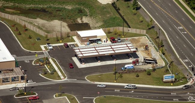
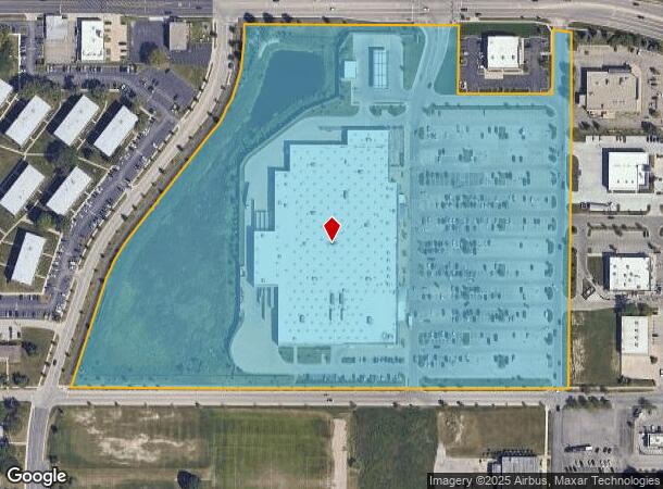
Property Record
25 Route 25, Carpentersville, IL 60110
NEARBY LISTINGS FOR SALE OR LEASE
Property Detail
25 Route 25
Chicago-Naperville-Elgin, IL-IN-WI
Walmart Meadowdale
03-14-276-025
WALMART MEADOWDALE LT 1
Commercialnec
Kane
X
Illinois
17089C0157H
1
2024
23.38 AC
2024
Far Northwest
850302
Chicago
DEMOGRAPHICS near 25 Route 25
1 Mile
3 Mile
5 Mile
2024 Total Population
16,651
49,308
113,817
2029 Population
16,643
49,144
113,152
Pop Growth 2024-2029
(0.05%)
(0.33%)
(0.58%)
Average Age
34
37
39
2024 Total Households
4,772
16,248
39,262
HH Growth 2024-2029
(0.06%)
(0.41%)
(0.66%)
Median Household Inc
$66,605
$79,555
$91,550
Avg Household Size
3.40
3.00
2.80
2024 Avg HH Vehicles
2.00
2.00
2.00
Median Home Value
$183,782
$230,095
$259,523
Median Year Built
1967
1976
1985
Nearby Places
Map Layers
Map Styles
 Street
 Aerial
- Restaurants
- Banks
- Shops
- Fitness
- Groceries
PUBLIC TRANSPORTATION
COMMUTER RAIL
Fox River Grove Station (Union Pacific Northwest Line - Northeast Illinois Regional Commuter Railroad (Metra))
DRIVE
WALK
Distance
Fox River Grove Station (Union Pacific Northwest Line - Northeast Illinois Regional Commuter Railroad (Metra))
19 min
7.5 mi
Big Timber Road Station (Milwaukee District West Line - Northeast Illinois Regional Commuter Railroad (Metra))
DRIVE
WALK
Distance
Big Timber Road Station (Milwaukee District West Line - Northeast Illinois Regional Commuter Railroad (Metra))
16 min
7.6 mi
AIRPORT
Chicago O'Hare International
DRIVE
WALK
Distance
Chicago O'Hare International
37 min
26.9 mi
Freight Ports
Port Milwaukee
DRIVE
WALK
Distance
Port Milwaukee
107 min
78.8 mi
Nearby Properties
Address
Land Use
TOTAL SIZE
Lot Size
Zoning
Address
Land Use
TOTAL SIZE
Lot Size
Zoning
Address
Land Use
TOTAL SIZE
Lot Size
Zoning
183,924 SF
0.80 AC
Address
Land Use
TOTAL SIZE
Lot Size
Zoning
211,680 SF
11.60 AC
Address
Land Use
TOTAL SIZE
Lot Size
Zoning
211,680 SF
11.34 AC
Address
Land Use
TOTAL SIZE
Lot Size
Zoning
Address
Land Use
TOTAL SIZE
Lot Size
Zoning
126,314 SF
11.58 AC
Address
Land Use
TOTAL SIZE
Lot Size
Zoning
Address
Land Use
TOTAL SIZE
Lot Size
Zoning
1.30 AC
Address
Land Use
TOTAL SIZE
Lot Size
Zoning
23.97 AC
Address
Land Use
TOTAL SIZE
Lot Size
Zoning
7,200 SF
16.86 AC
Address
Land Use
TOTAL SIZE
Lot Size
Zoning
56,900 SF
5.93 AC
Address
Land Use
TOTAL SIZE
Lot Size
Zoning
32,540 SF
8.08 AC
Address
Land Use
TOTAL SIZE
Lot Size
Zoning
106,488 SF
5.60 AC
Address
Land Use
TOTAL SIZE
Lot Size
Zoning
35.28 AC
Address
Land Use
TOTAL SIZE
Lot Size
Zoning
Address
Land Use
TOTAL SIZE
Lot Size
Zoning
64,870 SF
11.66 AC
Address
Land Use
TOTAL SIZE
Lot Size
Zoning
44.10 AC
Address
Land Use
TOTAL SIZE
Lot Size
Zoning
109,180 SF
11.91 AC
Address
Land Use
TOTAL SIZE
Lot Size
Zoning
Address
Land Use
TOTAL SIZE
Lot Size
Zoning
Address
Land Use
TOTAL SIZE
Lot Size
Zoning
60,138 SF
5.08 AC
Address
Land Use
TOTAL SIZE
Lot Size
Zoning
106,488 SF
6.64 AC
Address
Land Use
TOTAL SIZE
Lot Size
Zoning
31,400 SF
40.36 AC
Address
Land Use
TOTAL SIZE
Lot Size
Zoning
12.47 AC
Address
Land Use
TOTAL SIZE
Lot Size
Zoning
11,200 SF
50.39 AC
Address
Land Use
TOTAL SIZE
Lot Size
Zoning
75,970 SF
5 AC
Address
Land Use
TOTAL SIZE
Lot Size
Zoning
85,364 SF
5.57 AC
Address
Land Use
TOTAL SIZE
Lot Size
Zoning
140,516 SF
2.71 AC
The World's #1 Commercial Real Estate Marketplace
Connect with us
© 2026 CoStar Group
The information above has been obtained from sources believed reliable. While we do not doubt its accuracy we have not verified it and make no guarantee, warranty or representation about it. It is your responsibility to independently confirm its accuracy and completeness. Any projections, opinions, assumptions, or estimates used are for example only and do not represent the current or future performance of the property. The value of this transaction to you depends on tax and other factors which should be evaluated by your tax, financial, and legal advisors. You and your advisors should conduct a careful, independent investigation of the property to determine to your satisfaction the suitability of the property for your needs.