Property Record
25 Tom Eason Dr, Hampton, GA 30228
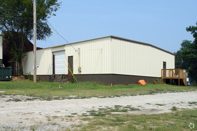

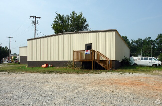
Property Detail
25 Tom Eason Dr
0H06-03-003-000
TRACT 1 AND TRACT 3 /LAND LOT: 249 /LAND DISTRICT: 6
Warehouse
Henry
C2
Georgia
B and X Area of moderate flood hazard, usually the area between the limits of the 100-year and 500-year floods.
249
2025
0.22 AC
2025
S Clayton/Henry Cnty
070505
Atlanta
3,500 SF
Atlanta-Sandy Springs-Roswell, GA
NEARBY LISTINGS FOR SALE OR LEASE
DEMOGRAPHICS near 25 Tom Eason Dr
1 mile
3 mile
5 mile
2024 Total Population
6,040
19,159
49,169
2029 Population
6,492
20,507
51,906
Pop Growth 2024-2029
+ 7.48%
+ 7.04%
+ 5.57%
Average Age
37
37
38
2024 Total Households
2,065
6,368
16,220
HH Growth 2024-2029
+ 7.65%
+ 7.15%
+ 5.60%
Median Household Inc
$74,544
$74,973
$76,165
Avg Household Size
2.90
3.00
2.90
2024 Avg HH Vehicles
2.00
2.00
2.00
Median Home Value
$301,083
$301,027
$304,885
Median Year Built
2002
2002
2003
Nearby Places
Map Layers
Map Styles
 Street
 Aerial
Transit
 Traffic
 Biking
Places
Listings with unknown addresses are not visible on the map
- Restaurants
- Banks
- Shops
- Fitness
- Groceries
PUBLIC TRANSPORTATION
AIRPORT
Hartsfield - Jackson Atlanta International
Drive
Walk
Distance
Hartsfield - Jackson Atlanta International
37 min
22.9 mi
Nearby Properties
Address
Land Use
TOTAL SIZE
Lot Size
Zoning
Address
Land Use
TOTAL SIZE
Lot Size
Zoning
1,424,654 SF
172.86 AC
Address
Land Use
TOTAL SIZE
Lot Size
Zoning
1,389,488 SF
166.64 AC
Address
Land Use
TOTAL SIZE
Lot Size
Zoning
640,693 SF
691.83 AC
PD
Address
Land Use
TOTAL SIZE
Lot Size
Zoning
147,861 SF
36.79 AC
M1
Address
Land Use
TOTAL SIZE
Lot Size
Zoning
402.93 AC
Address
Land Use
TOTAL SIZE
Lot Size
Zoning
41,568 SF
29.31 AC
M2
Address
Land Use
TOTAL SIZE
Lot Size
Zoning
1,404 SF
62.12 AC
RMH
Address
Land Use
TOTAL SIZE
Lot Size
Zoning
24,540 SF
26 AC
C1
Address
Land Use
TOTAL SIZE
Lot Size
Zoning
4,824 SF
15.10 AC
RM
Address
Land Use
TOTAL SIZE
Lot Size
Zoning
371,928 SF
10.16 AC
M1
Address
Land Use
TOTAL SIZE
Lot Size
Zoning
87,276 SF
5 AC
M1
Address
Land Use
TOTAL SIZE
Lot Size
Zoning
39,681 SF
6.19 AC
C2
Address
Land Use
TOTAL SIZE
Lot Size
Zoning
5,518 SF
11.39 AC
C-1
Address
Land Use
TOTAL SIZE
Lot Size
Zoning
183,000 SF
6.40 AC
M2
Address
Land Use
TOTAL SIZE
Lot Size
Zoning
68,010 SF
8 AC
M1
Address
Land Use
TOTAL SIZE
Lot Size
Zoning
19,500 SF
3.09 AC
C
Address
Land Use
TOTAL SIZE
Lot Size
Zoning
15,968 SF
2.96 AC
C2
Address
Land Use
TOTAL SIZE
Lot Size
Zoning
9,020 SF
3.30 AC
C1
Address
Land Use
TOTAL SIZE
Lot Size
Zoning
6,880 SF
7.89 AC
M2
Address
Land Use
TOTAL SIZE
Lot Size
Zoning
20,609 SF
2.34 AC
C2
Address
Land Use
TOTAL SIZE
Lot Size
Zoning
40,411 SF
47.18 AC
C1
Address
Land Use
TOTAL SIZE
Lot Size
Zoning
7,191 SF
41.14 AC
RA
Address
Land Use
TOTAL SIZE
Lot Size
Zoning
3,840 SF
29.94 AC
RA
Address
Land Use
TOTAL SIZE
Lot Size
Zoning
30.24 AC
M1
Address
Land Use
TOTAL SIZE
Lot Size
Zoning
8,800 SF
4.19 AC
M1
The World's #1 Commercial Real Estate Marketplace
Connect with us
© 2026 CoStar Group
The information above has been obtained from sources believed reliable. While we do not doubt its accuracy we have not verified it and make no guarantee, warranty or representation about it. It is your responsibility to independently confirm its accuracy and completeness. Any projections, opinions, assumptions, or estimates used are for example only and do not represent the current or future performance of the property. The value of this transaction to you depends on tax and other factors which should be evaluated by your tax, financial, and legal advisors. You and your advisors should conduct a careful, independent investigation of the property to determine to your satisfaction the suitability of the property for your needs.