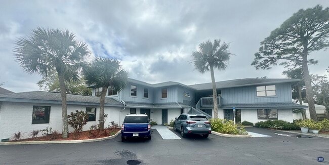
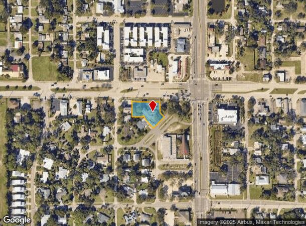
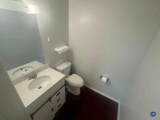
Property Record
25 W New Haven Ave, Melbourne, FL 32901
NEARBY LISTINGS FOR SALE OR LEASE
Property Detail
25 W New Haven Ave
Palm Bay-Melbourne-Titusville, FL
Country Club Colony
28-37-04-75-00000.0-0008.00
COUNTRY CLUB COLONY LOTS 4 THRU 11 & 1/2 OF ADJ VAC R/WS EXC HWY RW
Officebuilding
Brevard
X
Florida
12009C0603H
8
2025
0.57 AC
2025
Brevard County
064901
Orlando
8,460 SF
DEMOGRAPHICS near 25 W New Haven Ave
1 Mile
3 Mile
5 Mile
2024 Total Population
9,961
60,333
157,318
2029 Population
11,926
72,368
188,169
Pop Growth 2024-2029
+ 19.73%
+ 19.95%
+ 19.61%
Average Age
46
43
44
2024 Total Households
4,415
26,319
67,169
HH Growth 2024-2029
+ 19.68%
+ 19.50%
+ 19.03%
Median Household Inc
$36,438
$46,806
$60,479
Avg Household Size
1.80
2.10
2.20
2024 Avg HH Vehicles
1.00
1.00
2.00
Median Home Value
$207,070
$231,455
$257,905
Median Year Built
1974
1986
1984
Nearby Places
Map Layers
Map Styles
 Street
 Aerial
- Restaurants
- Banks
- Shops
- Fitness
- Groceries
PUBLIC TRANSPORTATION
AIRPORT
Melbourne Orlando International
DRIVE
WALK
Distance
Melbourne Orlando International
10 min
3.0 mi
Freight Ports
Port Canaveral
DRIVE
WALK
Distance
Port Canaveral
50 min
27.3 mi
SALE & LEASE HISTORY
LISTING DATE
SALE/LEASE

Apr 17, 2025
For Lease
Nearby Properties
Address
Land Use
TOTAL SIZE
Lot Size
Zoning
Address
Land Use
TOTAL SIZE
Lot Size
Zoning
1,105,462 SF
18.74 AC
CC1
Address
Land Use
TOTAL SIZE
Lot Size
Zoning
1,245,196 SF
110.73 AC
I1
Address
Land Use
TOTAL SIZE
Lot Size
Zoning
506,643 SF
80 AC
RA
Address
Land Use
TOTAL SIZE
Lot Size
Zoning
458,852 SF
23.05 AC
GU
Address
Land Use
TOTAL SIZE
Lot Size
Zoning
408,025 SF
15.72 AC
Address
Land Use
TOTAL SIZE
Lot Size
Zoning
475,791 SF
229.02 AC
M1
Address
Land Use
TOTAL SIZE
Lot Size
Zoning
265,062 SF
14.75 AC
M1
Address
Land Use
TOTAL SIZE
Lot Size
Zoning
332,802 SF
37.02 AC
I1
Address
Land Use
TOTAL SIZE
Lot Size
Zoning
368,326 SF
14.77 AC
C1
Address
Land Use
TOTAL SIZE
Lot Size
Zoning
672 SF
57.80 AC
I1
Address
Land Use
TOTAL SIZE
Lot Size
Zoning
387,843 SF
27.19 AC
R3
Address
Land Use
TOTAL SIZE
Lot Size
Zoning
342,276 SF
12.53 AC
LI
Address
Land Use
TOTAL SIZE
Lot Size
Zoning
197,734 SF
27.99 AC
M1
Address
Land Use
TOTAL SIZE
Lot Size
Zoning
349,772 SF
16.27 AC
R2
Address
Land Use
TOTAL SIZE
Lot Size
Zoning
213,482 SF
1.27 AC
Address
Land Use
TOTAL SIZE
Lot Size
Zoning
280,518 SF
13.88 AC
Address
Land Use
TOTAL SIZE
Lot Size
Zoning
24.95 AC
I1
Address
Land Use
TOTAL SIZE
Lot Size
Zoning
295,347 SF
14.61 AC
R2
Address
Land Use
TOTAL SIZE
Lot Size
Zoning
213,704 SF
0.57 AC
CC3
Address
Land Use
TOTAL SIZE
Lot Size
Zoning
542,262 SF
51.88 AC
CP
Address
Land Use
TOTAL SIZE
Lot Size
Zoning
201,017 SF
13.77 AC
RM20
Address
Land Use
TOTAL SIZE
Lot Size
Zoning
330,705 SF
25 AC
I1
Address
Land Use
TOTAL SIZE
Lot Size
Zoning
270,428 SF
19.69 AC
R2
Address
Land Use
TOTAL SIZE
Lot Size
Zoning
309,725 SF
14.70 AC
R2 (6)
Address
Land Use
TOTAL SIZE
Lot Size
Zoning
184,447 SF
14.06 AC
R2
Address
Land Use
TOTAL SIZE
Lot Size
Zoning
219,628 SF
29.84 AC
R2(6)
Address
Land Use
TOTAL SIZE
Lot Size
Zoning
201,325 SF
11.41 AC
Address
Land Use
TOTAL SIZE
Lot Size
Zoning
226,121 SF
17.73 AC
Address
Land Use
TOTAL SIZE
Lot Size
Zoning
225,020 SF
24.25 AC
Address
Land Use
TOTAL SIZE
Lot Size
Zoning
74,716 SF
366.45 AC
M1
The World's #1 Commercial Real Estate Marketplace
Connect with us
© 2025 CoStar Group
The information above has been obtained from sources believed reliable. While we do not doubt its accuracy we have not verified it and make no guarantee, warranty or representation about it. It is your responsibility to independently confirm its accuracy and completeness. Any projections, opinions, assumptions, or estimates used are for example only and do not represent the current or future performance of the property. The value of this transaction to you depends on tax and other factors which should be evaluated by your tax, financial, and legal advisors. You and your advisors should conduct a careful, independent investigation of the property to determine to your satisfaction the suitability of the property for your needs.