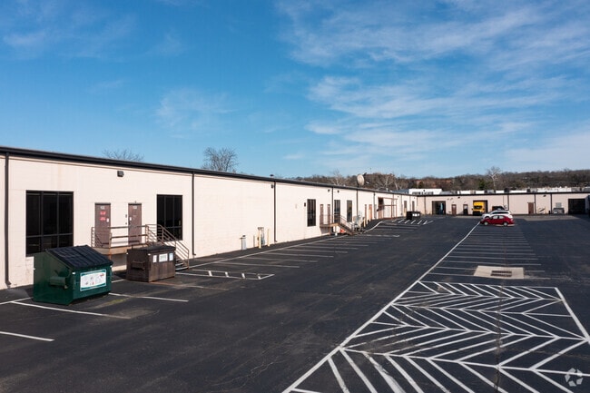
Property Record
25 Whitney Dr, Milford, OH 45150


NEARBY LISTINGS FOR SALE OR LEASE
Property Detail
25 Whitney Dr
Cincinnati, OH-KY-IN
Park 50
19-24-10F-119
PARK 50 SECTION I LOT 3
Storesoffices
Clermont
AE
Ohio
39025C0119G
3
2024
8.62 AC
2024
East
040600
Cincinnati/Dayton
78,393 SF
DEMOGRAPHICS near 25 Whitney Dr
1 Mile
3 Mile
5 Mile
2024 Total Population
566
31,191
78,769
2029 Population
575
31,871
80,497
Pop Growth 2024-2029
+ 1.59%
+ 2.18%
+ 2.19%
Average Age
41
42
41
2024 Total Households
193
12,432
31,428
HH Growth 2024-2029
+ 1.55%
+ 2.28%
+ 2.33%
Median Household Inc
$147,999
$80,044
$74,829
Avg Household Size
2.90
2.40
2.40
2024 Avg HH Vehicles
3.00
2.00
2.00
Median Home Value
$312,820
$245,564
$239,609
Median Year Built
1992
1977
1982
Nearby Places
Map Layers
Map Styles
 Street
 Aerial
- Restaurants
- Banks
- Shops
- Fitness
- Groceries
PUBLIC TRANSPORTATION
AIRPORT
Cincinnati/Northern Kentucky International
DRIVE
WALK
Distance
Cincinnati/Northern Kentucky International
46 min
31.3 mi
Freight Ports
Port of Toledo
DRIVE
WALK
Distance
Port of Toledo
240 min
206.2 mi
SALE & LEASE HISTORY
LISTING DATE
SALE/LEASE

Sep 25, 2016
For Lease
May 04, 2020
For Lease
May 01, 2020
For Lease
Mar 28, 2017
For Lease
Aug 13, 2024
For Lease
Nearby Properties
Address
Land Use
TOTAL SIZE
Lot Size
Zoning
Address
Land Use
TOTAL SIZE
Lot Size
Zoning
315,096 SF
9.48 AC
Address
Land Use
TOTAL SIZE
Lot Size
Zoning
2,555 SF
23.68 AC
Address
Land Use
TOTAL SIZE
Lot Size
Zoning
43,511 SF
12.36 AC
Address
Land Use
TOTAL SIZE
Lot Size
Zoning
6,432 SF
16.37 AC
Address
Land Use
TOTAL SIZE
Lot Size
Zoning
10.89 AC
Address
Land Use
TOTAL SIZE
Lot Size
Zoning
Address
Land Use
TOTAL SIZE
Lot Size
Zoning
220,050 SF
33 AC
Address
Land Use
TOTAL SIZE
Lot Size
Zoning
221,360 SF
34.62 AC
Address
Land Use
TOTAL SIZE
Lot Size
Zoning
20,432 SF
20.32 AC
Address
Land Use
TOTAL SIZE
Lot Size
Zoning
53,033 SF
17.48 AC
Address
Land Use
TOTAL SIZE
Lot Size
Zoning
75,944 SF
4.09 AC
Address
Land Use
TOTAL SIZE
Lot Size
Zoning
13.89 AC
Address
Land Use
TOTAL SIZE
Lot Size
Zoning
31,200 SF
3.92 AC
Address
Land Use
TOTAL SIZE
Lot Size
Zoning
4,800 SF
3.41 AC
Address
Land Use
TOTAL SIZE
Lot Size
Zoning
32,024 SF
3.24 AC
Address
Land Use
TOTAL SIZE
Lot Size
Zoning
Address
Land Use
TOTAL SIZE
Lot Size
Zoning
26,878 SF
14.94 AC
Address
Land Use
TOTAL SIZE
Lot Size
Zoning
74,252 SF
20.47 AC
Address
Land Use
TOTAL SIZE
Lot Size
Zoning
36,380 SF
5.45 AC
Address
Land Use
TOTAL SIZE
Lot Size
Zoning
7,000 SF
0.18 AC
M1
Address
Land Use
TOTAL SIZE
Lot Size
Zoning
50,720 SF
6.29 AC
Address
Land Use
TOTAL SIZE
Lot Size
Zoning
86,550 SF
7.13 AC
Address
Land Use
TOTAL SIZE
Lot Size
Zoning
1,748 SF
9.23 AC
Address
Land Use
TOTAL SIZE
Lot Size
Zoning
7,192 SF
19.87 AC
Address
Land Use
TOTAL SIZE
Lot Size
Zoning
110,569 SF
7.88 AC
Address
Land Use
TOTAL SIZE
Lot Size
Zoning
11,706 SF
1.96 AC
Address
Land Use
TOTAL SIZE
Lot Size
Zoning
39,257 SF
11.54 AC
Address
Land Use
TOTAL SIZE
Lot Size
Zoning
62.89 AC
Address
Land Use
TOTAL SIZE
Lot Size
Zoning
21,732 SF
9.41 AC
Address
Land Use
TOTAL SIZE
Lot Size
Zoning
126,837 SF
11.70 AC
The World's #1 Commercial Real Estate Marketplace
Connect with us
© 2025 CoStar Group
The information above has been obtained from sources believed reliable. While we do not doubt its accuracy we have not verified it and make no guarantee, warranty or representation about it. It is your responsibility to independently confirm its accuracy and completeness. Any projections, opinions, assumptions, or estimates used are for example only and do not represent the current or future performance of the property. The value of this transaction to you depends on tax and other factors which should be evaluated by your tax, financial, and legal advisors. You and your advisors should conduct a careful, independent investigation of the property to determine to your satisfaction the suitability of the property for your needs.