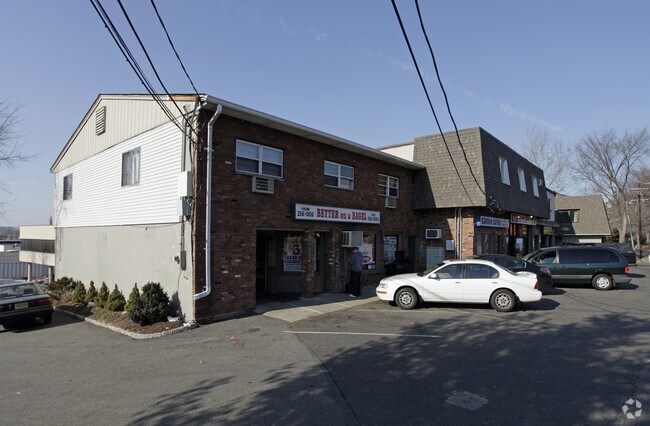
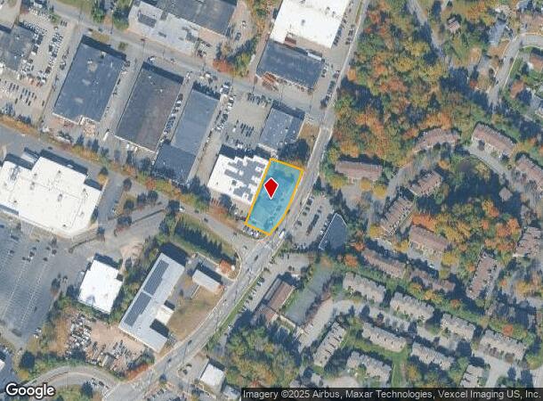
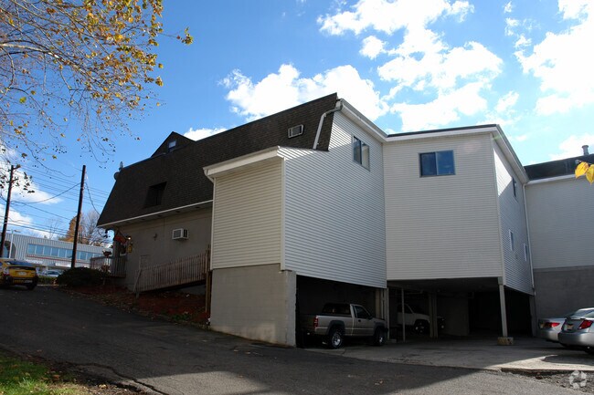
Property Record
250 Browertown Rd, Woodland Park, NJ 07424
NEARBY LISTINGS FOR SALE OR LEASE
Property Detail
250 Browertown Rd
16-00122-0000-00004
Passaic
Storemultistory
New Jersey
X
4
34031C0214G
0.39 AC
2024
Passaic Rt 46/23
2025
Northern New Jersey
264102
New York-Jersey City-White Plains, NY-NJ
20,068 SF
DEMOGRAPHICS near 250 Browertown Rd
1 Mile
3 Mile
5 Mile
2024 Total Population
14,830
153,656
514,707
2029 Population
14,626
150,307
501,318
Pop Growth 2024-2029
(1.38%)
(2.18%)
(2.60%)
Average Age
41
40
39
2024 Total Households
5,377
52,535
173,882
HH Growth 2024-2029
(1.38%)
(2.16%)
(2.66%)
Median Household Inc
$96,949
$85,095
$78,784
Avg Household Size
2.50
2.80
2.80
2024 Avg HH Vehicles
2.00
2.00
2.00
Median Home Value
$451,442
$450,015
$453,987
Median Year Built
1966
1957
1954
Nearby Places
Map Layers
Map Styles
 Street
 Aerial
- Restaurants
- Banks
- Shops
- Fitness
- Groceries
PUBLIC TRANSPORTATION
COMMUTER RAIL
Montclair State University (Montclair-Boonton Line - NJ Transit Commuter Rail (NJ Transit))
DRIVE
WALK
Distance
Montclair State University (Montclair-Boonton Line - NJ Transit Commuter Rail (NJ Transit))
4 min
1.8 mi
Little Falls (Montclair-Boonton Line - NJ Transit Commuter Rail (NJ Transit))
DRIVE
WALK
Distance
Little Falls (Montclair-Boonton Line - NJ Transit Commuter Rail (NJ Transit))
5 min
2.2 mi
AIRPORT
Newark Liberty International
DRIVE
WALK
Distance
Newark Liberty International
24 min
19.3 mi
LaGuardia
DRIVE
WALK
Distance
LaGuardia
43 min
29.2 mi
John F Kennedy International
DRIVE
WALK
Distance
John F Kennedy International
54 min
33.9 mi
Freight Ports
Maher Terminal
DRIVE
WALK
Distance
Maher Terminal
32 min
19.6 mi
Nearby Properties
Address
Land Use
TOTAL SIZE
Lot Size
Zoning
Address
Land Use
TOTAL SIZE
Lot Size
Zoning
8.75 AC
Address
Land Use
TOTAL SIZE
Lot Size
Zoning
667,698 SF
38.15 AC
Address
Land Use
TOTAL SIZE
Lot Size
Zoning
12,506 SF
130 AC
B-2
Address
Land Use
TOTAL SIZE
Lot Size
Zoning
56.67 AC
Address
Land Use
TOTAL SIZE
Lot Size
Zoning
28.33 AC
Address
Land Use
TOTAL SIZE
Lot Size
Zoning
49.48 AC
Address
Land Use
TOTAL SIZE
Lot Size
Zoning
260,609 SF
35.39 AC
Address
Land Use
TOTAL SIZE
Lot Size
Zoning
20.43 AC
Address
Land Use
TOTAL SIZE
Lot Size
Zoning
2.87 AC
Address
Land Use
TOTAL SIZE
Lot Size
Zoning
79,310 SF
2 AC
B-2
Address
Land Use
TOTAL SIZE
Lot Size
Zoning
24,200 SF
19.33 AC
Address
Land Use
TOTAL SIZE
Lot Size
Zoning
152,050 SF
1.96 AC
B-1
Address
Land Use
TOTAL SIZE
Lot Size
Zoning
315,332 SF
19.60 AC
Address
Land Use
TOTAL SIZE
Lot Size
Zoning
3.55 AC
Address
Land Use
TOTAL SIZE
Lot Size
Zoning
12.86 AC
Address
Land Use
TOTAL SIZE
Lot Size
Zoning
960 SF
22.84 AC
GWS
Address
Land Use
TOTAL SIZE
Lot Size
Zoning
0.69 AC
I-1
Address
Land Use
TOTAL SIZE
Lot Size
Zoning
25.80 AC
P
Address
Land Use
TOTAL SIZE
Lot Size
Zoning
271,679 SF
20.79 AC
Address
Land Use
TOTAL SIZE
Lot Size
Zoning
1,512 SF
90 AC
Address
Land Use
TOTAL SIZE
Lot Size
Zoning
21.80 AC
R-A3
Address
Land Use
TOTAL SIZE
Lot Size
Zoning
243,660 SF
20.53 AC
Address
Land Use
TOTAL SIZE
Lot Size
Zoning
49.03 AC
Address
Land Use
TOTAL SIZE
Lot Size
Zoning
207,519 SF
32.39 AC
Address
Land Use
TOTAL SIZE
Lot Size
Zoning
342,518 SF
31.80 AC
IP
Address
Land Use
TOTAL SIZE
Lot Size
Zoning
648 SF
108.80 AC
Address
Land Use
TOTAL SIZE
Lot Size
Zoning
14,152 SF
23.87 AC
Address
Land Use
TOTAL SIZE
Lot Size
Zoning
15.80 AC
IND
Address
Land Use
TOTAL SIZE
Lot Size
Zoning
764,364 SF
16.60 AC
I-2
Address
Land Use
TOTAL SIZE
Lot Size
Zoning
0.12 AC
The World's #1 Commercial Real Estate Marketplace
Connect with us
© 2025 CoStar Group
The information above has been obtained from sources believed reliable. While we do not doubt its accuracy we have not verified it and make no guarantee, warranty or representation about it. It is your responsibility to independently confirm its accuracy and completeness. Any projections, opinions, assumptions, or estimates used are for example only and do not represent the current or future performance of the property. The value of this transaction to you depends on tax and other factors which should be evaluated by your tax, financial, and legal advisors. You and your advisors should conduct a careful, independent investigation of the property to determine to your satisfaction the suitability of the property for your needs.