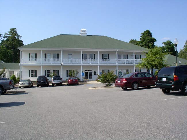
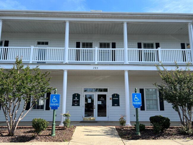
Property Record
250 Central Park Ave, West End, NC 27376
NEARBY LISTINGS FOR SALE OR LEASE
-
-
View all West End listings for lease on LoopNet.com
Property Detail
250 Central Park Ave
8553-19-60-1464
MCCORMICK OFFICE UNIT 104
Hotelormotel
Moore
X
North Carolina
3710854200J
4.34 AC
2024
North Carolina Southeast Area
2024
Other Market Areas
950603
Pinehurst-Southern Pines, NC
25,651 SF
DEMOGRAPHICS near 250 Central Park Ave
1 Mile
3 Mile
5 Mile
2024 Total Population
2,523
21,984
37,028
2029 Population
2,926
25,439
42,932
Pop Growth 2024-2029
+ 15.97%
+ 15.72%
+ 15.94%
Average Age
48
49
47
2024 Total Households
1,116
9,843
16,495
HH Growth 2024-2029
+ 16.22%
+ 16.05%
+ 16.28%
Median Household Inc
$69,687
$91,259
$78,978
Avg Household Size
2.20
2.20
2.20
2024 Avg HH Vehicles
2.00
2.00
2.00
Median Home Value
$408,381
$396,984
$383,698
Median Year Built
1994
1994
1995
Nearby Places
Map Layers
Map Styles
 Street
 Aerial
- Restaurants
- Banks
- Shops
- Fitness
- Groceries
PUBLIC TRANSPORTATION
COMMUTER RAIL
Southern Pines Amtrak Station (Silver Star - Amtrak)
DRIVE
WALK
Distance
Southern Pines Amtrak Station (Silver Star - Amtrak)
13 min
6.9 mi
Freight Ports
Port of Wilmington
DRIVE
WALK
Distance
Port of Wilmington
176 min
138.5 mi
SALE & LEASE HISTORY
LISTING DATE
SALE/LEASE

Nov 16, 2023
For Lease
Nov 15, 2017
For Sale
Mar 07, 2017
For Lease
Jun 26, 2019
For Lease
Jan 26, 2017
For Sale
Jan 26, 2017
For Sale
Feb 02, 2017
For Sale
Dec 05, 2017
For Lease
Apr 28, 2021
For Lease
Apr 04, 2018
For Lease
Nearby Properties
Address
Land Use
TOTAL SIZE
Lot Size
Zoning
Address
Land Use
TOTAL SIZE
Lot Size
Zoning
3,953 SF
86.18 AC
MULTI
Address
Land Use
TOTAL SIZE
Lot Size
Zoning
29,476 SF
22.76 AC
H
Address
Land Use
TOTAL SIZE
Lot Size
Zoning
7,161 SF
0.87 AC
RD
Address
Land Use
TOTAL SIZE
Lot Size
Zoning
132,600 SF
86.18 AC
Address
Land Use
TOTAL SIZE
Lot Size
Zoning
17,091 SF
12.65 AC
R10
Address
Land Use
TOTAL SIZE
Lot Size
Zoning
96,496 SF
35 AC
MULTI
Address
Land Use
TOTAL SIZE
Lot Size
Zoning
11.80 AC
Address
Land Use
TOTAL SIZE
Lot Size
Zoning
190.53 AC
Address
Land Use
TOTAL SIZE
Lot Size
Zoning
70,747 SF
12 AC
RA20
Address
Land Use
TOTAL SIZE
Lot Size
Zoning
155.66 AC
RD
Address
Land Use
TOTAL SIZE
Lot Size
Zoning
7.45 AC
Address
Land Use
TOTAL SIZE
Lot Size
Zoning
26,856 SF
1.52 AC
R10
Address
Land Use
TOTAL SIZE
Lot Size
Zoning
9,417 SF
4.19 AC
OP
Address
Land Use
TOTAL SIZE
Lot Size
Zoning
4,000 SF
238.22 AC
PDD
Address
Land Use
TOTAL SIZE
Lot Size
Zoning
15,100 SF
11.47 AC
NC
Address
Land Use
TOTAL SIZE
Lot Size
Zoning
20,709 SF
3.60 AC
H
Address
Land Use
TOTAL SIZE
Lot Size
Zoning
33,886 SF
9.68 AC
R10
Address
Land Use
TOTAL SIZE
Lot Size
Zoning
0.87 AC
Address
Land Use
TOTAL SIZE
Lot Size
Zoning
0.87 AC
Address
Land Use
TOTAL SIZE
Lot Size
Zoning
47,273 SF
11.25 AC
NC
Address
Land Use
TOTAL SIZE
Lot Size
Zoning
7.43 AC
Address
Land Use
TOTAL SIZE
Lot Size
Zoning
10,435 SF
11.26 AC
R20
Address
Land Use
TOTAL SIZE
Lot Size
Zoning
5,090 SF
99.55 AC
RD
Address
Land Use
TOTAL SIZE
Lot Size
Zoning
36 SF
181.27 AC
RD
Address
Land Use
TOTAL SIZE
Lot Size
Zoning
5,700 SF
205.35 AC
RS2CD
Address
Land Use
TOTAL SIZE
Lot Size
Zoning
480 SF
73.70 AC
PC
Address
Land Use
TOTAL SIZE
Lot Size
Zoning
18,895 SF
86.18 AC
Address
Land Use
TOTAL SIZE
Lot Size
Zoning
10.94 AC
Address
Land Use
TOTAL SIZE
Lot Size
Zoning
15,550 SF
11.60 AC
B2
The World's #1 Commercial Real Estate Marketplace
Connect with us
© 2025 CoStar Group
The information above has been obtained from sources believed reliable. While we do not doubt its accuracy we have not verified it and make no guarantee, warranty or representation about it. It is your responsibility to independently confirm its accuracy and completeness. Any projections, opinions, assumptions, or estimates used are for example only and do not represent the current or future performance of the property. The value of this transaction to you depends on tax and other factors which should be evaluated by your tax, financial, and legal advisors. You and your advisors should conduct a careful, independent investigation of the property to determine to your satisfaction the suitability of the property for your needs.