Property Record
250 College Dr Nw, Salem, OR 97304

NEARBY LISTINGS FOR SALE OR LEASE
Property Detail
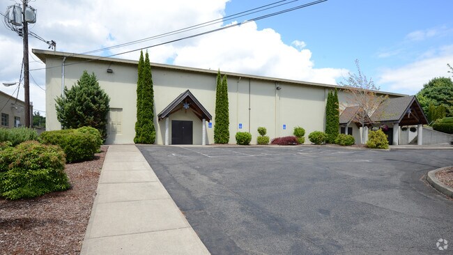
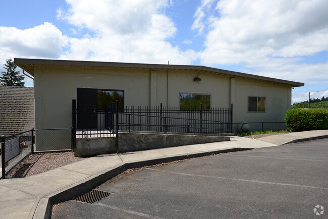
250 College Dr Nw
327743
College Sub 2
Religious
SCHOOLS
ARE
Polk
41053C0287F
Oregon
0
4.99 AC
2025
Polk County
0052013004
Portland
38,080 SF
Salem, OR
DEMOGRAPHICS near 250 College Dr Nw
1 Mile
3 Mile
5 Mile
2024 Total Population
7,379
64,273
158,832
2029 Population
8,016
67,382
163,395
Pop Growth 2024-2029
+ 8.63%
+ 4.84%
+ 2.87%
Average Age
41
40
39
2024 Total Households
2,868
25,209
59,402
HH Growth 2024-2029
+ 9.10%
+ 4.90%
+ 3.00%
Median Household Inc
$86,184
$76,484
$67,241
Avg Household Size
2.50
2.40
2.50
2024 Avg HH Vehicles
2.00
2.00
2.00
Median Home Value
$384,848
$395,185
$365,023
Median Year Built
1978
1974
1975
Nearby Places
Map Layers
Map Styles
 Street
 Aerial
- Restaurants
- Banks
- Shops
- Fitness
- Groceries
PUBLIC TRANSPORTATION
COMMUTER RAIL
Salem (Amtrak Cascades - Amtrak, Coast Starlight - Amtrak)
DRIVE
WALK
Distance
Salem (Amtrak Cascades - Amtrak, Coast Starlight - Amtrak)
8 min
4.0 mi
Freight Ports
Port of Portland
DRIVE
WALK
Distance
Port of Portland
70 min
51.5 mi
Nearby Properties
Address
Land Use
TOTAL SIZE
Lot Size
Zoning
Address
Land Use
TOTAL SIZE
Lot Size
Zoning
978,999 SF
25.74 AC
PE
Address
Land Use
TOTAL SIZE
Lot Size
Zoning
324,567 SF
49.27 AC
PE
Address
Land Use
TOTAL SIZE
Lot Size
Zoning
236,837 SF
20.76 AC
PE
Address
Land Use
TOTAL SIZE
Lot Size
Zoning
118,829 SF
3.49 AC
CB
Address
Land Use
TOTAL SIZE
Lot Size
Zoning
145,520 SF
1.70 AC
PM
Address
Land Use
TOTAL SIZE
Lot Size
Zoning
120,642 SF
4 AC
CB
Address
Land Use
TOTAL SIZE
Lot Size
Zoning
305,230 SF
9.76 AC
PS
Address
Land Use
TOTAL SIZE
Lot Size
Zoning
325,042 SF
16.86 AC
RM2
Address
Land Use
TOTAL SIZE
Lot Size
Zoning
166,344 SF
1.70 AC
PM
Address
Land Use
TOTAL SIZE
Lot Size
Zoning
183,400 SF
7.17 AC
PE; CB
Address
Land Use
TOTAL SIZE
Lot Size
Zoning
137,002 SF
6.27 AC
PE
Address
Land Use
TOTAL SIZE
Lot Size
Zoning
136,813 SF
27.08 AC
RA
Address
Land Use
TOTAL SIZE
Lot Size
Zoning
72,096 SF
13.36 AC
RA
Address
Land Use
TOTAL SIZE
Lot Size
Zoning
122,260 SF
2.32 AC
PE
Address
Land Use
TOTAL SIZE
Lot Size
Zoning
122,333 SF
0.48 AC
CB
Address
Land Use
TOTAL SIZE
Lot Size
Zoning
98,733 SF
1.13 AC
CB
Address
Land Use
TOTAL SIZE
Lot Size
Zoning
77,198 SF
1.71 AC
PM
Address
Land Use
TOTAL SIZE
Lot Size
Zoning
170,756 SF
2.65 AC
PS
Address
Land Use
TOTAL SIZE
Lot Size
Zoning
105,152 SF
2.39 AC
CR
Address
Land Use
TOTAL SIZE
Lot Size
Zoning
173,887 SF
7.65 AC
RM2
Address
Land Use
TOTAL SIZE
Lot Size
Zoning
514,875 SF
28.02 AC
IG
Address
Land Use
TOTAL SIZE
Lot Size
Zoning
144,782 SF
1.24 AC
CB
Address
Land Use
TOTAL SIZE
Lot Size
Zoning
322,533 SF
12.91 AC
RH
Address
Land Use
TOTAL SIZE
Lot Size
Zoning
140,505 SF
5.84 AC
RM2; RS
Address
Land Use
TOTAL SIZE
Lot Size
Zoning
112,052 SF
CB
Address
Land Use
TOTAL SIZE
Lot Size
Zoning
56,304 SF
11.87 AC
RA
Address
Land Use
TOTAL SIZE
Lot Size
Zoning
92,268 SF
1.41 AC
CB
Address
Land Use
TOTAL SIZE
Lot Size
Zoning
105,457 SF
8.29 AC
WSCB
Address
Land Use
TOTAL SIZE
Lot Size
Zoning
49,882 SF
5.64 AC
PE
Address
Land Use
TOTAL SIZE
Lot Size
Zoning
143,684 SF
9.43 AC
CR; RS
The World's #1 Commercial Real Estate Marketplace
Connect with us
© 2026 CoStar Group
The information above has been obtained from sources believed reliable. While we do not doubt its accuracy we have not verified it and make no guarantee, warranty or representation about it. It is your responsibility to independently confirm its accuracy and completeness. Any projections, opinions, assumptions, or estimates used are for example only and do not represent the current or future performance of the property. The value of this transaction to you depends on tax and other factors which should be evaluated by your tax, financial, and legal advisors. You and your advisors should conduct a careful, independent investigation of the property to determine to your satisfaction the suitability of the property for your needs.