Property Record
250 Crocker Dr, Vacaville, CA 95688


NEARBY LISTINGS FOR SALE OR LEASE
Property Detail
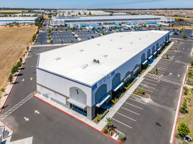
250 Crocker Dr
0133-030-400
BK-BG 00-00
Warehouse
Solano
X
California
06113C0700G
2.85 AC
2024
Vacaville
2025
North Bay/Santa Rosa
252904
Vallejo-Fairfield, CA
DEMOGRAPHICS near 250 Crocker Dr
1 Mile
3 Mile
5 Mile
2024 Total Population
3,918
32,990
100,890
2029 Population
3,830
32,488
99,736
Pop Growth 2024-2029
(2.25%)
(1.52%)
(1.14%)
Average Age
36
42
40
2024 Total Households
1,351
12,531
34,969
HH Growth 2024-2029
(2.29%)
(1.49%)
(1.24%)
Median Household Inc
$117,072
$98,723
$95,652
Avg Household Size
2.90
2.60
2.70
2024 Avg HH Vehicles
2.00
2.00
2.00
Median Home Value
$726,470
$667,658
$609,646
Median Year Built
2010
1990
1983
Nearby Places
Map Layers
Map Styles
 Street
 Aerial
- Restaurants
- Banks
- Shops
- Fitness
- Groceries
PUBLIC TRANSPORTATION
COMMUTER RAIL
Fairfield-Vacaville (Capitol Corridor - Amtrak)
DRIVE
WALK
Distance
Fairfield-Vacaville (Capitol Corridor - Amtrak)
15 min
9.1 mi
AIRPORT
Sacramento International
DRIVE
WALK
Distance
Sacramento International
47 min
36.0 mi
Freight Ports
Port of Richmond
DRIVE
WALK
Distance
Port of Richmond
61 min
47.4 mi
SALE & LEASE HISTORY
LISTING DATE
SALE/LEASE

Apr 06, 2018
For Lease
Nearby Properties
Address
Land Use
TOTAL SIZE
Lot Size
Zoning
Address
Land Use
TOTAL SIZE
Lot Size
Zoning
Address
Land Use
TOTAL SIZE
Lot Size
Zoning
47.87 AC
Address
Land Use
TOTAL SIZE
Lot Size
Zoning
35.69 AC
Address
Land Use
TOTAL SIZE
Lot Size
Zoning
831,193 SF
68.78 AC
Address
Land Use
TOTAL SIZE
Lot Size
Zoning
12.64 AC
Address
Land Use
TOTAL SIZE
Lot Size
Zoning
332,833 SF
18.53 AC
Address
Land Use
TOTAL SIZE
Lot Size
Zoning
210,900 SF
26.31 AC
Address
Land Use
TOTAL SIZE
Lot Size
Zoning
241,629 SF
9.99 AC
Address
Land Use
TOTAL SIZE
Lot Size
Zoning
332,571 SF
8.35 AC
Address
Land Use
TOTAL SIZE
Lot Size
Zoning
332,571 SF
9.55 AC
Address
Land Use
TOTAL SIZE
Lot Size
Zoning
7.69 AC
Address
Land Use
TOTAL SIZE
Lot Size
Zoning
224,536 SF
11.77 AC
CG W/RES O
Address
Land Use
TOTAL SIZE
Lot Size
Zoning
597,816 SF
32.25 AC
Address
Land Use
TOTAL SIZE
Lot Size
Zoning
11.52 AC
Address
Land Use
TOTAL SIZE
Lot Size
Zoning
173,016 SF
13.79 AC
Address
Land Use
TOTAL SIZE
Lot Size
Zoning
Address
Land Use
TOTAL SIZE
Lot Size
Zoning
164,256 SF
6.74 AC
Address
Land Use
TOTAL SIZE
Lot Size
Zoning
321,651 SF
21.29 AC
Address
Land Use
TOTAL SIZE
Lot Size
Zoning
7,302 SF
17.10 AC
Address
Land Use
TOTAL SIZE
Lot Size
Zoning
242,472 SF
12.13 AC
Address
Land Use
TOTAL SIZE
Lot Size
Zoning
242,472 SF
12.39 AC
Address
Land Use
TOTAL SIZE
Lot Size
Zoning
234,916 SF
11.25 AC
Address
Land Use
TOTAL SIZE
Lot Size
Zoning
252,423 SF
14.03 AC
Address
Land Use
TOTAL SIZE
Lot Size
Zoning
224,654 SF
6.06 AC
Address
Land Use
TOTAL SIZE
Lot Size
Zoning
42.62 AC
Address
Land Use
TOTAL SIZE
Lot Size
Zoning
131,348 SF
14.77 AC
Address
Land Use
TOTAL SIZE
Lot Size
Zoning
224,654 SF
4.24 AC
Address
Land Use
TOTAL SIZE
Lot Size
Zoning
15.39 AC
Address
Land Use
TOTAL SIZE
Lot Size
Zoning
66,041 SF
22.01 AC
OFFICE/COM
Address
Land Use
TOTAL SIZE
Lot Size
Zoning
159,297 SF
7.40 AC
The World's #1 Commercial Real Estate Marketplace
Connect with us
© 2025 CoStar Group
The information above has been obtained from sources believed reliable. While we do not doubt its accuracy we have not verified it and make no guarantee, warranty or representation about it. It is your responsibility to independently confirm its accuracy and completeness. Any projections, opinions, assumptions, or estimates used are for example only and do not represent the current or future performance of the property. The value of this transaction to you depends on tax and other factors which should be evaluated by your tax, financial, and legal advisors. You and your advisors should conduct a careful, independent investigation of the property to determine to your satisfaction the suitability of the property for your needs.