Property Record
250 N 1950 W, Salt Lake City, UT 84116


NEARBY LISTINGS FOR SALE OR LEASE
Property Detail
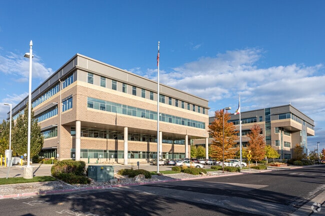
250 N 1950 W
Salt Lake City, UT
Radius Curve
08-34-301-022-0000
BEG S 89^5150 E 16.5 FT FR W 1/4 COR SEC 34, T 1N, R 1W, SLM; S 89^5150 E 0.67 FT; N 0^1316 E 494 FT M OR L; S 89^5150 E 218.37 FT; S 0^0428 W 292 FT; S 89^5606 E 458.8 FT; N 0^0428 E 86.4 FT; S 89^5150 E 120.2 FT; S 0^0428 W 552 FT; N 89^5150 W 444.
Officebuilding
Salt Lake
X
Utah
49011C0525E
213
0
18.71 AC
2025
Airport/International Ctr
100306
Salt Lake City
243,202 SF
DEMOGRAPHICS near 250 N 1950 W
1 Mile
3 Mile
5 Mile
2024 Total Population
11,948
73,467
162,336
2029 Population
12,293
75,131
165,912
Pop Growth 2024-2029
+ 2.89%
+ 2.26%
+ 2.20%
Average Age
35
36
36
2024 Total Households
4,358
28,647
69,649
HH Growth 2024-2029
+ 2.96%
+ 3.03%
+ 2.70%
Median Household Inc
$54,347
$58,283
$58,063
Avg Household Size
2.60
2.40
2.20
2024 Avg HH Vehicles
2.00
2.00
2.00
Median Home Value
$229,558
$336,397
$398,700
Median Year Built
1992
1980
1973
Nearby Places
Map Layers
Map Styles
 Street
 Aerial
- Restaurants
- Banks
- Shops
- Fitness
- Groceries
PUBLIC TRANSPORTATION
TRANSIT/SUBWAY
1940 W. North Temple Station (Green Line - Utah Transit Authority (UTA))
DRIVE
WALK
Distance
1940 W. North Temple Station (Green Line - Utah Transit Authority (UTA))
1 min
6 min
0.3 mi
Power Station (Green Line - Utah Transit Authority (UTA))
DRIVE
WALK
Distance
Power Station (Green Line - Utah Transit Authority (UTA))
3 min
18 min
1.0 mi
COMMUTER RAIL
North Temple Station (FrontRunner - Utah Transit Authority (UTA))
DRIVE
WALK
Distance
North Temple Station (FrontRunner - Utah Transit Authority (UTA))
9 min
3.0 mi
Warm Springs Relief Point (FrontRunner - Utah Transit Authority (UTA))
DRIVE
WALK
Distance
Warm Springs Relief Point (FrontRunner - Utah Transit Authority (UTA))
10 min
3.8 mi
AIRPORT
Salt Lake City International
DRIVE
WALK
Distance
Salt Lake City International
9 min
3.8 mi
Freight Ports
Port of Stockton
DRIVE
WALK
Distance
Port of Stockton
710 min
694.2 mi
Nearby Properties
Address
Land Use
TOTAL SIZE
Lot Size
Zoning
Address
Land Use
TOTAL SIZE
Lot Size
Zoning
1,115,174 SF
9.72 AC
D-4
Address
Land Use
TOTAL SIZE
Lot Size
Zoning
427,316 SF
12.31 AC
AIRPRT
Address
Land Use
TOTAL SIZE
Lot Size
Zoning
350,000 SF
10 AC
U1
Address
Land Use
TOTAL SIZE
Lot Size
Zoning
1,523,947 SF
37.63 AC
AIR
Address
Land Use
TOTAL SIZE
Lot Size
Zoning
186,429 SF
101 AC
AIRPRT
Address
Land Use
TOTAL SIZE
Lot Size
Zoning
56,741 SF
1.70 AC
D-1
Address
Land Use
TOTAL SIZE
Lot Size
Zoning
1,330,058 SF
5.02 AC
D2
Address
Land Use
TOTAL SIZE
Lot Size
Zoning
836,183 SF
5.89 AC
TSA-UC
Address
Land Use
TOTAL SIZE
Lot Size
Zoning
691,465 SF
18.57 AC
3000
Address
Land Use
TOTAL SIZE
Lot Size
Zoning
157,938 SF
12 AC
1205
Address
Land Use
TOTAL SIZE
Lot Size
Zoning
146,422 SF
2.62 AC
UI
Address
Land Use
TOTAL SIZE
Lot Size
Zoning
449,528 SF
1.64 AC
2000
Address
Land Use
TOTAL SIZE
Lot Size
Zoning
0.01 AC
D-4
Address
Land Use
TOTAL SIZE
Lot Size
Zoning
22,022 SF
308 AC
AIRPRT
Address
Land Use
TOTAL SIZE
Lot Size
Zoning
366,584 SF
1.95 AC
TSAUC
Address
Land Use
TOTAL SIZE
Lot Size
Zoning
617,901 SF
2.73 AC
TSA-UC
Address
Land Use
TOTAL SIZE
Lot Size
Zoning
695,737 SF
1.70 AC
D-1
Address
Land Use
TOTAL SIZE
Lot Size
Zoning
248,345 SF
50 AC
PL
Address
Land Use
TOTAL SIZE
Lot Size
Zoning
252,420 SF
15.26 AC
TSA-MU
Address
Land Use
TOTAL SIZE
Lot Size
Zoning
136,387 SF
6.77 AC
D-4
Address
Land Use
TOTAL SIZE
Lot Size
Zoning
398,351 SF
1.57 AC
D-1
Address
Land Use
TOTAL SIZE
Lot Size
Zoning
472.94 AC
AIRPRT
Address
Land Use
TOTAL SIZE
Lot Size
Zoning
210,623 SF
1.35 AC
TSAUCC
Address
Land Use
TOTAL SIZE
Lot Size
Zoning
472,757 SF
3.20 AC
GMU
Address
Land Use
TOTAL SIZE
Lot Size
Zoning
86,072 SF
240 AC
AIRPOR
Address
Land Use
TOTAL SIZE
Lot Size
Zoning
146,652 SF
16.63 AC
RMF-45
Address
Land Use
TOTAL SIZE
Lot Size
Zoning
170,322 SF
20.46 AC
M-2
Address
Land Use
TOTAL SIZE
Lot Size
Zoning
878,018 SF
2.08 AC
R-MU
Address
Land Use
TOTAL SIZE
Lot Size
Zoning
434,985 SF
74.85 AC
AIRPOR
The World's #1 Commercial Real Estate Marketplace
Connect with us
© 2025 CoStar Group
The information above has been obtained from sources believed reliable. While we do not doubt its accuracy we have not verified it and make no guarantee, warranty or representation about it. It is your responsibility to independently confirm its accuracy and completeness. Any projections, opinions, assumptions, or estimates used are for example only and do not represent the current or future performance of the property. The value of this transaction to you depends on tax and other factors which should be evaluated by your tax, financial, and legal advisors. You and your advisors should conduct a careful, independent investigation of the property to determine to your satisfaction the suitability of the property for your needs.