Property Record
250 Randol Mill Ave, Southlake, TX 76092

NEARBY LISTINGS FOR SALE OR LEASE
Property Detail
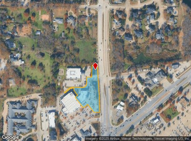
250 Randol Mill Ave
Dallas-Fort Worth-Arlington, TX
Jellico Square
41504046
JELLICO SQUARE BLOCK 1 LOT 4R
Commercialnec
Tarrant
X
Texas
48121C0660G
4r
2024
1.69 AC
2025
Southlake
113912
Dallas/Ft Worth
10,142 SF
DEMOGRAPHICS near 250 Randol Mill Ave
1 Mile
3 Mile
5 Mile
2024 Total Population
6,345
54,181
168,275
2029 Population
6,661
57,108
179,072
Pop Growth 2024-2029
+ 4.98%
+ 5.40%
+ 6.42%
Average Age
41
41
40
2024 Total Households
2,012
17,801
57,174
HH Growth 2024-2029
+ 5.07%
+ 5.49%
+ 6.59%
Median Household Inc
$218,812
$195,033
$144,425
Avg Household Size
3.10
3.00
2.90
2024 Avg HH Vehicles
2.00
2.00
2.00
Median Home Value
$686,656
$684,822
$483,496
Median Year Built
1996
1998
1996
Nearby Places
Map Layers
Map Styles
 Street
 Aerial
- Restaurants
- Banks
- Shops
- Fitness
- Groceries
PUBLIC TRANSPORTATION
AIRPORT
Dallas-Fort Worth International
DRIVE
WALK
Distance
Dallas-Fort Worth International
19 min
12.3 mi
Dallas Love Field
DRIVE
WALK
Distance
Dallas Love Field
37 min
26.0 mi
Freight Ports
Port of Shreveport
DRIVE
WALK
Distance
Port of Shreveport
247 min
225.8 mi
SALE & LEASE HISTORY
LISTING DATE
SALE/LEASE

May 22, 2025
For Lease
May 12, 2025
For Lease
Nearby Properties
Address
Land Use
TOTAL SIZE
Lot Size
Zoning
Address
Land Use
TOTAL SIZE
Lot Size
Zoning
255,937 SF
55.03 AC
Address
Land Use
TOTAL SIZE
Lot Size
Zoning
1,603,686 SF
81.43 AC
Address
Land Use
TOTAL SIZE
Lot Size
Zoning
203,458 SF
16.58 AC
Address
Land Use
TOTAL SIZE
Lot Size
Zoning
298,773 SF
17.40 AC
Address
Land Use
TOTAL SIZE
Lot Size
Zoning
270,044 SF
30.51 AC
Address
Land Use
TOTAL SIZE
Lot Size
Zoning
645,587 SF
12.57 AC
Address
Land Use
TOTAL SIZE
Lot Size
Zoning
367,008 SF
29.55 AC
Address
Land Use
TOTAL SIZE
Lot Size
Zoning
258,155 SF
5.55 AC
Address
Land Use
TOTAL SIZE
Lot Size
Zoning
342,090 SF
12.83 AC
Address
Land Use
TOTAL SIZE
Lot Size
Zoning
219,109 SF
24.78 AC
Address
Land Use
TOTAL SIZE
Lot Size
Zoning
214,425 SF
6.24 AC
Address
Land Use
TOTAL SIZE
Lot Size
Zoning
121,348 SF
13.78 AC
Address
Land Use
TOTAL SIZE
Lot Size
Zoning
188,500 SF
6.28 AC
Address
Land Use
TOTAL SIZE
Lot Size
Zoning
133,430 SF
19.75 AC
Address
Land Use
TOTAL SIZE
Lot Size
Zoning
59,556 SF
13.40 AC
Address
Land Use
TOTAL SIZE
Lot Size
Zoning
25,965 SF
79.42 AC
Address
Land Use
TOTAL SIZE
Lot Size
Zoning
244,297 SF
6.29 AC
Address
Land Use
TOTAL SIZE
Lot Size
Zoning
105,813 SF
12.68 AC
Address
Land Use
TOTAL SIZE
Lot Size
Zoning
98,778 SF
11.96 AC
Address
Land Use
TOTAL SIZE
Lot Size
Zoning
153,206 SF
3 AC
Address
Land Use
TOTAL SIZE
Lot Size
Zoning
34,633 SF
6.58 AC
Address
Land Use
TOTAL SIZE
Lot Size
Zoning
101,941 SF
8.54 AC
Address
Land Use
TOTAL SIZE
Lot Size
Zoning
73,376 SF
28.72 AC
Address
Land Use
TOTAL SIZE
Lot Size
Zoning
47.96 AC
Address
Land Use
TOTAL SIZE
Lot Size
Zoning
47.94 AC
Address
Land Use
TOTAL SIZE
Lot Size
Zoning
95,590 SF
2.62 AC
Address
Land Use
TOTAL SIZE
Lot Size
Zoning
60,000 SF
44.26 AC
Address
Land Use
TOTAL SIZE
Lot Size
Zoning
51,850 SF
5.24 AC
Address
Land Use
TOTAL SIZE
Lot Size
Zoning
38,635 SF
5.33 AC
Address
Land Use
TOTAL SIZE
Lot Size
Zoning
46,129 SF
3.68 AC
The World's #1 Commercial Real Estate Marketplace
Connect with us
© 2025 CoStar Group
The information above has been obtained from sources believed reliable. While we do not doubt its accuracy we have not verified it and make no guarantee, warranty or representation about it. It is your responsibility to independently confirm its accuracy and completeness. Any projections, opinions, assumptions, or estimates used are for example only and do not represent the current or future performance of the property. The value of this transaction to you depends on tax and other factors which should be evaluated by your tax, financial, and legal advisors. You and your advisors should conduct a careful, independent investigation of the property to determine to your satisfaction the suitability of the property for your needs.