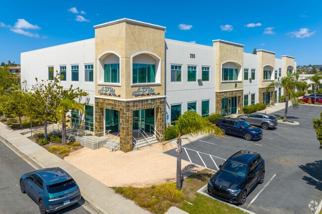
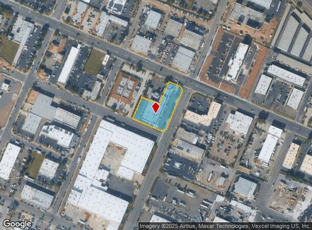
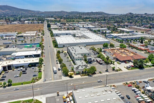
Property Record
250 S Pacific St, San Marcos, CA 92078

This Property Is For Sale
NEARBY LISTINGS FOR SALE OR LEASE
Property Detail
250 S Pacific St
219-083-10-02
Pacific Street Retail
Industrialcondominium
PAR 1 US 101PER DOC07-0087485&UND INT IN TR PM20164
X
San Diego
06073C0789H
California
2024
1.13 AC
2025
San Marcos
020029
San Diego
948 SF
San Diego-Carlsbad, CA
DEMOGRAPHICS near 250 S Pacific St
1 Mile
3 Mile
5 Mile
2024 Total Population
13,993
97,621
207,005
2029 Population
13,894
96,822
205,549
Pop Growth 2024-2029
(0.71%)
(0.82%)
(0.70%)
Average Age
39
38
40
2024 Total Households
4,581
32,605
71,036
HH Growth 2024-2029
(0.61%)
(0.91%)
(0.86%)
Median Household Inc
$65,096
$94,159
$104,713
Avg Household Size
2.80
2.90
2.80
2024 Avg HH Vehicles
2.00
2.00
2.00
Median Home Value
$524,496
$741,757
$777,456
Median Year Built
1982
1991
1988
Nearby Places
- Restaurants
- Banks
- Shops
- Fitness
- Groceries
PUBLIC TRANSPORTATION
TRANSIT/SUBWAY
Palomar College (Sprinter - San Diego North County Transit District (Coaster/Sprinter/Breeze))
DRIVE
WALK
Distance
Palomar College (Sprinter - San Diego North County Transit District (Coaster/Sprinter/Breeze))
2 min
18 min
1.0 mi
COMMUTER RAIL
Carlsbad Poinsettia (Coaster - San Diego North County Transit District (Coaster/Sprinter/Breeze))
DRIVE
WALK
Distance
Carlsbad Poinsettia (Coaster - San Diego North County Transit District (Coaster/Sprinter/Breeze))
17 min
9.6 mi
AIRPORT
San Diego International
DRIVE
WALK
Distance
San Diego International
47 min
36.4 mi
Freight Ports
Port of San Diego
DRIVE
WALK
Distance
Port of San Diego
49 min
38.6 mi
Nearby Properties
Address
Land Use
TOTAL SIZE
Lot Size
Zoning
Address
Land Use
TOTAL SIZE
Lot Size
Zoning
27.98 AC
SPA
Address
Land Use
TOTAL SIZE
Lot Size
Zoning
18.90 AC
R-M
Address
Land Use
TOTAL SIZE
Lot Size
Zoning
15.37 AC
SPA
Address
Land Use
TOTAL SIZE
Lot Size
Zoning
5.25 AC
SPA
Address
Land Use
TOTAL SIZE
Lot Size
Zoning
5.37 AC
SPA
Address
Land Use
TOTAL SIZE
Lot Size
Zoning
10.82 AC
SPA
Address
Land Use
TOTAL SIZE
Lot Size
Zoning
11.87 AC
R-M
Address
Land Use
TOTAL SIZE
Lot Size
Zoning
9.41 AC
SPI
Address
Land Use
TOTAL SIZE
Lot Size
Zoning
16.91 AC
C
Address
Land Use
TOTAL SIZE
Lot Size
Zoning
11.08 AC
SPI
Address
Land Use
TOTAL SIZE
Lot Size
Zoning
9.88 AC
R-3-10
Address
Land Use
TOTAL SIZE
Lot Size
Zoning
SPECIFIC P
Address
Land Use
TOTAL SIZE
Lot Size
Zoning
11.49 AC
P-M
Address
Land Use
TOTAL SIZE
Lot Size
Zoning
14.91 AC
SPI
Address
Land Use
TOTAL SIZE
Lot Size
Zoning
4.76 AC
C34
Address
Land Use
TOTAL SIZE
Lot Size
Zoning
13.20 AC
P-M
Address
Land Use
TOTAL SIZE
Lot Size
Zoning
9.80 AC
I
Address
Land Use
TOTAL SIZE
Lot Size
Zoning
7.91 AC
SPI
Address
Land Use
TOTAL SIZE
Lot Size
Zoning
19.35 AC
P-M
Address
Land Use
TOTAL SIZE
Lot Size
Zoning
27.30 AC
SPI
Address
Land Use
TOTAL SIZE
Lot Size
Zoning
19.68 AC
SPI
Address
Land Use
TOTAL SIZE
Lot Size
Zoning
10.80 AC
SPA
Address
Land Use
TOTAL SIZE
Lot Size
Zoning
1.94 AC
C
Address
Land Use
TOTAL SIZE
Lot Size
Zoning
9.99 AC
MU-1
Address
Land Use
TOTAL SIZE
Lot Size
Zoning
4.65 AC
SPI
Address
Land Use
TOTAL SIZE
Lot Size
Zoning
7.33 AC
R-M
Address
Land Use
TOTAL SIZE
Lot Size
Zoning
8.07 AC
SPI
Address
Land Use
TOTAL SIZE
Lot Size
Zoning
1.49 AC
SPA
Address
Land Use
TOTAL SIZE
Lot Size
Zoning
Address
Land Use
TOTAL SIZE
Lot Size
Zoning
5.85 AC
SPA
The World's #1 Commercial Real Estate Marketplace
Connect with us
© 2025 CoStar Group
The information above has been obtained from sources believed reliable. While we do not doubt its accuracy we have not verified it and make no guarantee, warranty or representation about it. It is your responsibility to independently confirm its accuracy and completeness. Any projections, opinions, assumptions, or estimates used are for example only and do not represent the current or future performance of the property. The value of this transaction to you depends on tax and other factors which should be evaluated by your tax, financial, and legal advisors. You and your advisors should conduct a careful, independent investigation of the property to determine to your satisfaction the suitability of the property for your needs.