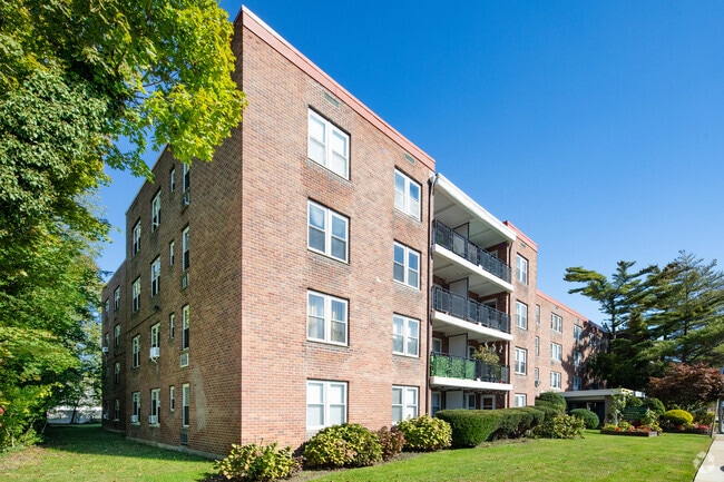
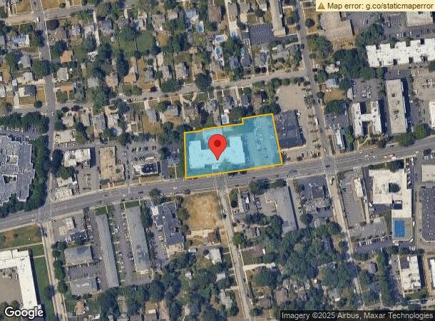
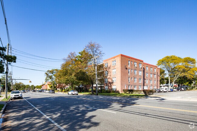
Property Record
250 W Merrick Rd, Valley Stream, NY 11580
NEARBY LISTINGS FOR SALE OR LEASE
-
-
View all Valley Stream listings for sale on LoopNet.com
Property Detail
250 W Merrick Rd
2009-54-092-00-0512-0
512-514
Apartment
Nassau
X
New York
36059C0239G
512-5
2025
1.70 AC
2025
Freeport
414301
Long Island (New York)
19,424 SF
Nassau County-Suffolk County, NY
DEMOGRAPHICS near 250 W Merrick Rd
1 Mile
3 Mile
5 Mile
2024 Total Population
33,245
179,271
435,757
2029 Population
32,727
176,083
427,590
Pop Growth 2024-2029
(1.56%)
(1.78%)
(1.87%)
Average Age
39
41
41
2024 Total Households
10,036
55,394
137,476
HH Growth 2024-2029
(1.63%)
(1.83%)
(1.97%)
Median Household Inc
$100,993
$123,854
$119,076
Avg Household Size
3.10
3.10
3.00
2024 Avg HH Vehicles
2.00
2.00
2.00
Median Home Value
$440,793
$569,934
$601,817
Median Year Built
1949
1951
1953
Nearby Places
- Restaurants
- Banks
- Shops
- Fitness
- Groceries
PUBLIC TRANSPORTATION
COMMUTER RAIL
Freeport Station (Babylon Branch - Long Island Rail Road)
DRIVE
WALK
Distance
Freeport Station (Babylon Branch - Long Island Rail Road)
1 min
14 min
0.7 mi
Baldwin Station (Babylon Branch - Long Island Rail Road)
DRIVE
WALK
Distance
Baldwin Station (Babylon Branch - Long Island Rail Road)
2 min
1.4 mi
AIRPORT
John F Kennedy International
DRIVE
WALK
Distance
John F Kennedy International
20 min
13.2 mi
LaGuardia
DRIVE
WALK
Distance
LaGuardia
31 min
20.2 mi
Long Island MacArthur
DRIVE
WALK
Distance
Long Island MacArthur
41 min
30.5 mi
Freight Ports
NY - Red Hook Container Terminal
DRIVE
WALK
Distance
NY - Red Hook Container Terminal
41 min
24.6 mi
Nearby Properties
Address
Land Use
TOTAL SIZE
Lot Size
Zoning
Address
Land Use
TOTAL SIZE
Lot Size
Zoning
Address
Land Use
TOTAL SIZE
Lot Size
Zoning
5,800 SF
10.48 AC
Address
Land Use
TOTAL SIZE
Lot Size
Zoning
986.74 AC
Address
Land Use
TOTAL SIZE
Lot Size
Zoning
169.25 AC
Address
Land Use
TOTAL SIZE
Lot Size
Zoning
336,450 SF
139.91 AC
Address
Land Use
TOTAL SIZE
Lot Size
Zoning
341,098 SF
31.88 AC
Address
Land Use
TOTAL SIZE
Lot Size
Zoning
19.88 AC
Address
Land Use
TOTAL SIZE
Lot Size
Zoning
57,970 SF
1.69 AC
Address
Land Use
TOTAL SIZE
Lot Size
Zoning
57,874 SF
21 AC
Address
Land Use
TOTAL SIZE
Lot Size
Zoning
65,235 SF
15.48 AC
Address
Land Use
TOTAL SIZE
Lot Size
Zoning
94,204 SF
35.42 AC
Address
Land Use
TOTAL SIZE
Lot Size
Zoning
145,209 SF
20.01 AC
Address
Land Use
TOTAL SIZE
Lot Size
Zoning
140,000 SF
50.78 AC
Address
Land Use
TOTAL SIZE
Lot Size
Zoning
29,998 SF
22.49 AC
Address
Land Use
TOTAL SIZE
Lot Size
Zoning
115.42 AC
Address
Land Use
TOTAL SIZE
Lot Size
Zoning
151,757 SF
34.38 AC
Address
Land Use
TOTAL SIZE
Lot Size
Zoning
67,408 SF
66.13 AC
Address
Land Use
TOTAL SIZE
Lot Size
Zoning
80,895 SF
26.22 AC
Address
Land Use
TOTAL SIZE
Lot Size
Zoning
225,460 SF
14.70 AC
Address
Land Use
TOTAL SIZE
Lot Size
Zoning
99,904 SF
20.17 AC
Address
Land Use
TOTAL SIZE
Lot Size
Zoning
20,670 SF
6.62 AC
Address
Land Use
TOTAL SIZE
Lot Size
Zoning
86.38 AC
Address
Land Use
TOTAL SIZE
Lot Size
Zoning
357,868 SF
24.92 AC
Address
Land Use
TOTAL SIZE
Lot Size
Zoning
377,041 SF
14.43 AC
Address
Land Use
TOTAL SIZE
Lot Size
Zoning
140,992 SF
12.07 AC
Address
Land Use
TOTAL SIZE
Lot Size
Zoning
253,201 SF
16.01 AC
Address
Land Use
TOTAL SIZE
Lot Size
Zoning
59,715 SF
12.81 AC
Address
Land Use
TOTAL SIZE
Lot Size
Zoning
168,070 SF
11.29 AC
Address
Land Use
TOTAL SIZE
Lot Size
Zoning
82,698 SF
12.03 AC
Address
Land Use
TOTAL SIZE
Lot Size
Zoning
41,612 SF
3.89 AC
The World's #1 Commercial Real Estate Marketplace
Connect with us
© 2025 CoStar Group
The information above has been obtained from sources believed reliable. While we do not doubt its accuracy we have not verified it and make no guarantee, warranty or representation about it. It is your responsibility to independently confirm its accuracy and completeness. Any projections, opinions, assumptions, or estimates used are for example only and do not represent the current or future performance of the property. The value of this transaction to you depends on tax and other factors which should be evaluated by your tax, financial, and legal advisors. You and your advisors should conduct a careful, independent investigation of the property to determine to your satisfaction the suitability of the property for your needs.