Property Record
250 Wolcott Rd, Wolcott, CT 06716
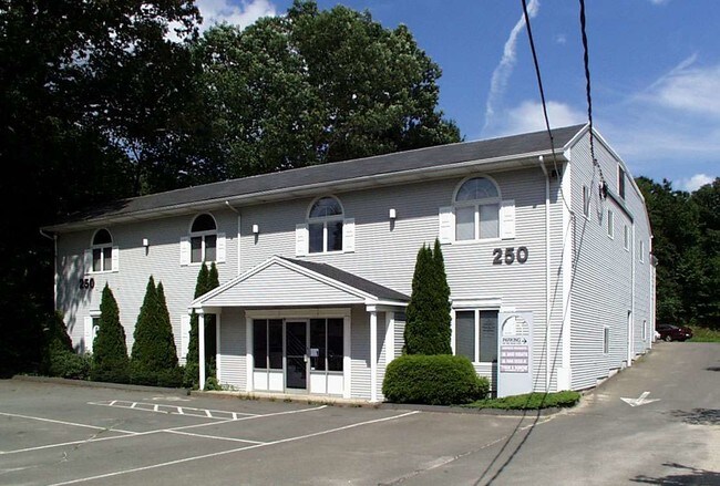

Property Detail
250 Wolcott Rd
WOLC-000115-000004-000006A
NEW HAVEN
Commercialbuilding
Connecticut
GC
6a
B and X Area of moderate flood hazard, usually the area between the limits of the 100-year and 500-year floods.
0.69 AC
2025
Waterbury
2025
Westchester/So Connecticut
361100
New Haven, CT
8,769 SF
NEARBY LISTINGS FOR SALE OR LEASE
DEMOGRAPHICS near 250 Wolcott Rd
1 mile
3 mile
5 mile
2025 Total Population
3,882
71,816
151,463
2030 Population
3,976
73,280
155,001
Pop Growth 2025-2030
+ 2.42%
+ 2.04%
+ 2.34%
Average Age
43
39
39
2025 Total Households
1,652
27,628
58,549
HH Growth 2025-2030
+ 2.42%
+ 2.10%
+ 2.38%
Median Household Inc
$91,911
$56,162
$62,500
Avg Household Size
2.30
2.50
2.50
2025 Avg HH Vehicles
2.00
1.00
2.00
Median Home Value
$305,405
$242,592
$259,559
Median Year Built
1977
1960
1961
Nearby Places
Map Layers
Map Styles
 Street
 Aerial
Layers
 Traffic
 Biking
Places
Listings with unknown addresses are not visible on the map
- Restaurants
- Banks
- Shops
- Fitness
- Groceries
PUBLIC TRANSPORTATION
COMMUTER RAIL
Waterbury Station (New Haven Line - Metro-North Commuter Railroad Company (Metro-North))
Drive
Walk
Distance
Waterbury Station (New Haven Line - Metro-North Commuter Railroad Company (Metro-North))
8 min
4.4 mi
Naugatuck Station (New Haven Line - Metro-North Commuter Railroad Company (Metro-North))
Drive
Walk
Distance
Naugatuck Station (New Haven Line - Metro-North Commuter Railroad Company (Metro-North))
13 min
8.6 mi
AIRPORT
Tweed/New Haven
Drive
Walk
Distance
Tweed/New Haven
46 min
29.4 mi
Bradley International
Drive
Walk
Distance
Bradley International
67 min
38.5 mi
Freight Ports
Port of New Haven
Drive
Walk
Distance
Port of New Haven
42 min
27.1 mi
Nearby Properties
Address
Land Use
TOTAL SIZE
Lot Size
Zoning
Address
Land Use
TOTAL SIZE
Lot Size
Zoning
77.50 AC
RS
Address
Land Use
TOTAL SIZE
Lot Size
Zoning
306,366 SF
84 AC
RS-12
Address
Land Use
TOTAL SIZE
Lot Size
Zoning
118,884 SF
13.40 AC
RL
Address
Land Use
TOTAL SIZE
Lot Size
Zoning
97,386 SF
53.20 AC
RS
Address
Land Use
TOTAL SIZE
Lot Size
Zoning
44.31 AC
CA
Address
Land Use
TOTAL SIZE
Lot Size
Zoning
95,000 SF
9.30 AC
RM
Address
Land Use
TOTAL SIZE
Lot Size
Zoning
5.13 AC
RM
Address
Land Use
TOTAL SIZE
Lot Size
Zoning
39 AC
RM
Address
Land Use
TOTAL SIZE
Lot Size
Zoning
19.24 AC
CA
Address
Land Use
TOTAL SIZE
Lot Size
Zoning
50 AC
R-40
Address
Land Use
TOTAL SIZE
Lot Size
Zoning
24.49 AC
CA
Address
Land Use
TOTAL SIZE
Lot Size
Zoning
31.75 AC
CA
Address
Land Use
TOTAL SIZE
Lot Size
Zoning
18.01 AC
CA
Address
Land Use
TOTAL SIZE
Lot Size
Zoning
10.51 AC
RL
Address
Land Use
TOTAL SIZE
Lot Size
Zoning
25,474 SF
20.35 AC
RM
Address
Land Use
TOTAL SIZE
Lot Size
Zoning
15.39 AC
RM
Address
Land Use
TOTAL SIZE
Lot Size
Zoning
1.02 AC
CBD
Address
Land Use
TOTAL SIZE
Lot Size
Zoning
81,501 SF
19 AC
R-30
Address
Land Use
TOTAL SIZE
Lot Size
Zoning
5.10 AC
RM
Address
Land Use
TOTAL SIZE
Lot Size
Zoning
5 AC
RO
Address
Land Use
TOTAL SIZE
Lot Size
Zoning
10 AC
RS-12
Address
Land Use
TOTAL SIZE
Lot Size
Zoning
125,520 SF
9 AC
CA
Address
Land Use
TOTAL SIZE
Lot Size
Zoning
54,820 SF
1.03 AC
CA
Address
Land Use
TOTAL SIZE
Lot Size
Zoning
154,629 SF
18.76 AC
CA
Address
Land Use
TOTAL SIZE
Lot Size
Zoning
1.24 AC
RM
Address
Land Use
TOTAL SIZE
Lot Size
Zoning
59,531 SF
2.70 AC
CA
Address
Land Use
TOTAL SIZE
Lot Size
Zoning
6.39 AC
RM
Address
Land Use
TOTAL SIZE
Lot Size
Zoning
61,173 SF
3.60 AC
RL
Address
Land Use
TOTAL SIZE
Lot Size
Zoning
117,743 SF
2.95 AC
CA
Address
Land Use
TOTAL SIZE
Lot Size
Zoning
93,086 SF
1.95 AC
CBD
The World's #1 Commercial Real Estate Marketplace
Connect with us
© 2026 CoStar Group
The information above has been obtained from sources believed reliable. While we do not doubt its accuracy we have not verified it and make no guarantee, warranty or representation about it. It is your responsibility to independently confirm its accuracy and completeness. Any projections, opinions, assumptions, or estimates used are for example only and do not represent the current or future performance of the property. The value of this transaction to you depends on tax and other factors which should be evaluated by your tax, financial, and legal advisors. You and your advisors should conduct a careful, independent investigation of the property to determine to your satisfaction the suitability of the property for your needs.