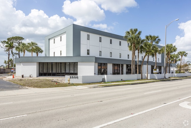
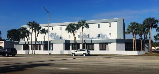
Property Record
2500 Airport Rd S, Naples, FL 34112

Current Lease Availabilities
NEARBY LISTINGS FOR SALE OR LEASE
Property Detail
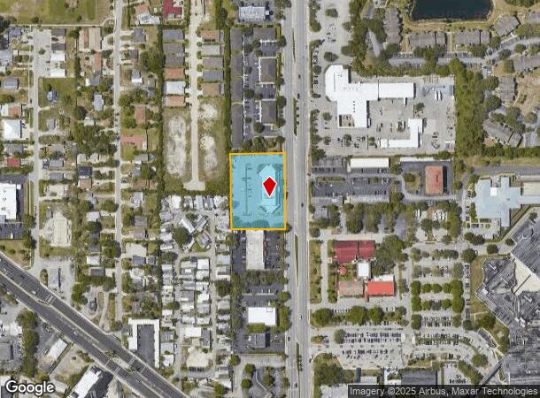
2500 Airport Rd S
Naples-Immokalee-Marco Island, FL
N G & T C L F Unit 2
61842200007
N G + T C L F NO 2 S 300FT OF N 800FT OF LOT 124, LESS R/W
Officebuilding
Collier
AE
Florida
12021C0394J
124
2024
1.48 AC
2025
East Naples
010601
Southwest Florida
6,168 SF
DEMOGRAPHICS near 2500 Airport Rd S
1 Mile
3 Mile
5 Mile
2024 Total Population
12,425
59,497
116,502
2029 Population
14,261
68,757
133,733
Pop Growth 2024-2029
+ 14.78%
+ 15.56%
+ 14.79%
Average Age
45
52
51
2024 Total Households
5,220
27,408
52,531
HH Growth 2024-2029
+ 14.56%
+ 15.48%
+ 14.82%
Median Household Inc
$50,919
$65,094
$69,430
Avg Household Size
2.10
2.00
2.10
2024 Avg HH Vehicles
1.00
2.00
2.00
Median Home Value
$218,265
$350,104
$374,587
Median Year Built
1981
1988
1991
Nearby Places
- Restaurants
- Banks
- Shops
- Fitness
- Groceries
PUBLIC TRANSPORTATION
AIRPORT
Southwest Florida International
DRIVE
WALK
Distance
Southwest Florida International
47 min
35.2 mi
Freight Ports
Port of Miami
DRIVE
WALK
Distance
Port of Miami
149 min
123.6 mi
Nearby Properties
Address
Land Use
TOTAL SIZE
Lot Size
Zoning
Address
Land Use
TOTAL SIZE
Lot Size
Zoning
1,429,641 SF
45.28 AC
P
Address
Land Use
TOTAL SIZE
Lot Size
Zoning
556,070 SF
13.72 AC
NAPLES
Address
Land Use
TOTAL SIZE
Lot Size
Zoning
560,854 SF
592.62 AC
NAPLES
Address
Land Use
TOTAL SIZE
Lot Size
Zoning
77,529 SF
1.15 AC
NAPLES
Address
Land Use
TOTAL SIZE
Lot Size
Zoning
368,003 SF
34.19 AC
PUD
Address
Land Use
TOTAL SIZE
Lot Size
Zoning
362,032 SF
15.97 AC
PUD
Address
Land Use
TOTAL SIZE
Lot Size
Zoning
140,512 SF
12.10 AC
PUD
Address
Land Use
TOTAL SIZE
Lot Size
Zoning
344,520 SF
21.91 AC
PUD
Address
Land Use
TOTAL SIZE
Lot Size
Zoning
291,699 SF
18.17 AC
PUD
Address
Land Use
TOTAL SIZE
Lot Size
Zoning
159,901 SF
10.08 AC
RMF-16
Address
Land Use
TOTAL SIZE
Lot Size
Zoning
93,542 SF
4.09 AC
NAPLES
Address
Land Use
TOTAL SIZE
Lot Size
Zoning
39,546 SF
1.62 AC
Address
Land Use
TOTAL SIZE
Lot Size
Zoning
217,119 SF
4.20 AC
NAPLES
Address
Land Use
TOTAL SIZE
Lot Size
Zoning
69,767 SF
1.89 AC
NAPLES
Address
Land Use
TOTAL SIZE
Lot Size
Zoning
70,944 SF
9.51 AC
P
Address
Land Use
TOTAL SIZE
Lot Size
Zoning
168,247 SF
25.60 AC
RMF-6
Address
Land Use
TOTAL SIZE
Lot Size
Zoning
19,641 SF
2.93 AC
NAPLES
Address
Land Use
TOTAL SIZE
Lot Size
Zoning
240,746 SF
30.45 AC
PUD
Address
Land Use
TOTAL SIZE
Lot Size
Zoning
49,687 SF
3.16 AC
NAPLES
Address
Land Use
TOTAL SIZE
Lot Size
Zoning
166,921 SF
31.98 AC
PUD
Address
Land Use
TOTAL SIZE
Lot Size
Zoning
16,556 SF
2.07 AC
NAPLES
Address
Land Use
TOTAL SIZE
Lot Size
Zoning
5,995 SF
2.28 AC
NAPLES
Address
Land Use
TOTAL SIZE
Lot Size
Zoning
4,736 SF
1.15 AC
NAPLES
Address
Land Use
TOTAL SIZE
Lot Size
Zoning
2,000 SF
2.79 AC
NAPLES
Address
Land Use
TOTAL SIZE
Lot Size
Zoning
28,509 SF
1.63 AC
NAPLES
Address
Land Use
TOTAL SIZE
Lot Size
Zoning
4,127 SF
2.35 AC
Address
Land Use
TOTAL SIZE
Lot Size
Zoning
2.31 AC
Address
Land Use
TOTAL SIZE
Lot Size
Zoning
3,429 SF
1.38 AC
NAPLES
Address
Land Use
TOTAL SIZE
Lot Size
Zoning
197,846 SF
10.07 AC
Address
Land Use
TOTAL SIZE
Lot Size
Zoning
29,944 SF
1.14 AC
NAPLES
The World's #1 Commercial Real Estate Marketplace
Connect with us
© 2025 CoStar Group
The information above has been obtained from sources believed reliable. While we do not doubt its accuracy we have not verified it and make no guarantee, warranty or representation about it. It is your responsibility to independently confirm its accuracy and completeness. Any projections, opinions, assumptions, or estimates used are for example only and do not represent the current or future performance of the property. The value of this transaction to you depends on tax and other factors which should be evaluated by your tax, financial, and legal advisors. You and your advisors should conduct a careful, independent investigation of the property to determine to your satisfaction the suitability of the property for your needs.