Property Record
2500 Decker Blvd, Columbia, SC 29206
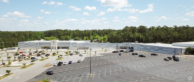

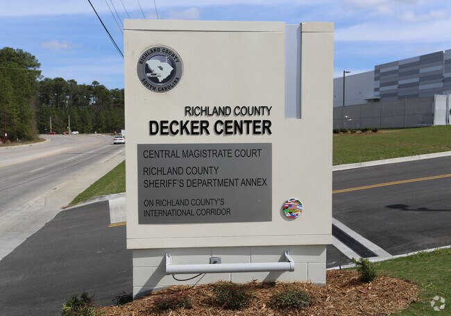
Property Detail
2500 Decker Blvd
16911-03-09
UNNUMBERED PARCEL & B #SU #PR RB1691-0254
Commercialnec
RICHLAND
GC
South Carolina
B and X Area of moderate flood hazard, usually the area between the limits of the 100-year and 500-year floods.
11.60 AC
2024
Northeast Columbia
2023
Columbia
011304
Columbia, SC
113,510 SF
NEARBY LISTINGS FOR SALE OR LEASE
DEMOGRAPHICS near 2500 Decker Blvd
1 mile
3 mile
5 mile
2025 Total Population
7,391
48,752
122,170
2030 Population
7,613
50,320
126,428
Pop Growth 2025-2030
+ 3.00%
+ 3.22%
+ 3.49%
Average Age
39
39
39
2025 Total Households
3,207
20,670
48,704
HH Growth 2025-2030
+ 3.06%
+ 3.35%
+ 3.75%
Median Household Inc
$51,211
$53,331
$57,095
Avg Household Size
2.20
2.20
2.20
2025 Avg HH Vehicles
2.00
2.00
2.00
Median Home Value
$221,306
$211,178
$241,118
Median Year Built
1976
1976
1977
Nearby Places
Map Layers
Map Styles
 Street
 Aerial
Layers
 Traffic
 Biking
Places
Listings with unknown addresses are not visible on the map
- Restaurants
- Banks
- Shops
- Fitness
- Groceries
PUBLIC TRANSPORTATION
COMMUTER RAIL
Columbia Amtrak Station (Silver Star - Amtrak)
Drive
Walk
Distance
Columbia Amtrak Station (Silver Star - Amtrak)
16 min
8.6 mi
AIRPORT
Columbia Metro
Drive
Walk
Distance
Columbia Metro
34 min
18.0 mi
Freight Ports
North Charleston Terminal
Drive
Walk
Distance
North Charleston Terminal
129 min
113.2 mi
Nearby Properties
Address
Land Use
TOTAL SIZE
Lot Size
Zoning
Address
Land Use
TOTAL SIZE
Lot Size
Zoning
456,536 SF
42.16 AC
M-1
Address
Land Use
TOTAL SIZE
Lot Size
Zoning
1,704.85 AC
RU
Address
Land Use
TOTAL SIZE
Lot Size
Zoning
354,813 SF
20.66 AC
RM-HD
Address
Land Use
TOTAL SIZE
Lot Size
Zoning
338,744 SF
21.28 AC
RM-HD
Address
Land Use
TOTAL SIZE
Lot Size
Zoning
333,825 SF
17.75 AC
GC
Address
Land Use
TOTAL SIZE
Lot Size
Zoning
313,244 SF
12.75 AC
RM-HD
Address
Land Use
TOTAL SIZE
Lot Size
Zoning
278,001 SF
28.82 AC
GC
Address
Land Use
TOTAL SIZE
Lot Size
Zoning
260,572 SF
15 AC
GC
Address
Land Use
TOTAL SIZE
Lot Size
Zoning
288,000 SF
17.34 AC
OI
Address
Land Use
TOTAL SIZE
Lot Size
Zoning
231,426 SF
10 AC
C-3
Address
Land Use
TOTAL SIZE
Lot Size
Zoning
96,192 SF
26.36 AC
GC
Address
Land Use
TOTAL SIZE
Lot Size
Zoning
155,314 SF
26.04 AC
OI
Address
Land Use
TOTAL SIZE
Lot Size
Zoning
299,909 SF
14.49 AC
RM-HD
Address
Land Use
TOTAL SIZE
Lot Size
Zoning
129,018 SF
19.99 AC
RM-HD
Address
Land Use
TOTAL SIZE
Lot Size
Zoning
169,291 SF
18.97 AC
C-3
Address
Land Use
TOTAL SIZE
Lot Size
Zoning
200,609 SF
17.97 AC
GC
Address
Land Use
TOTAL SIZE
Lot Size
Zoning
179,652 SF
14.98 AC
RM-HD
Address
Land Use
TOTAL SIZE
Lot Size
Zoning
341,550 SF
20.66 AC
RM-HD
Address
Land Use
TOTAL SIZE
Lot Size
Zoning
239,450 SF
16.85 AC
GC
Address
Land Use
TOTAL SIZE
Lot Size
Zoning
129,721 SF
3.72 AC
C-3
Address
Land Use
TOTAL SIZE
Lot Size
Zoning
183,237 SF
13.65 AC
GC
Address
Land Use
TOTAL SIZE
Lot Size
Zoning
147,062 SF
13.20 AC
GC
Address
Land Use
TOTAL SIZE
Lot Size
Zoning
259,948 SF
14.40 AC
RM-HD
Address
Land Use
TOTAL SIZE
Lot Size
Zoning
202,048 SF
20.98 AC
C-3
Address
Land Use
TOTAL SIZE
Lot Size
Zoning
414,262 SF
34.45 AC
RM-HD
Address
Land Use
TOTAL SIZE
Lot Size
Zoning
23,379 SF
3.76 AC
M-1
Address
Land Use
TOTAL SIZE
Lot Size
Zoning
138,552 SF
12.02 AC
RM-HD
Address
Land Use
TOTAL SIZE
Lot Size
Zoning
223,692 SF
12 AC
GC
Address
Land Use
TOTAL SIZE
Lot Size
Zoning
20 AC
C-3
The World's #1 Commercial Real Estate Marketplace
Connect with us
© 2026 CoStar Group
The information above has been obtained from sources believed reliable. While we do not doubt its accuracy we have not verified it and make no guarantee, warranty or representation about it. It is your responsibility to independently confirm its accuracy and completeness. Any projections, opinions, assumptions, or estimates used are for example only and do not represent the current or future performance of the property. The value of this transaction to you depends on tax and other factors which should be evaluated by your tax, financial, and legal advisors. You and your advisors should conduct a careful, independent investigation of the property to determine to your satisfaction the suitability of the property for your needs.