Property Record
2500 E 9 Mile Rd, Warren, MI 48091
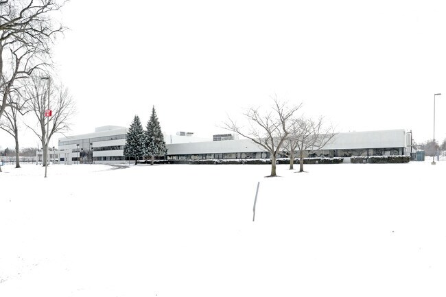


Property Detail
2500 E 9 Mile Rd
12-13-31-126-013
SEC 31; COM AT N 1/4 POST SEC 31; TH N89*50'W 219.47 FT TH S 650.00 FT; TH N89*80'00" W 140.00 FT TO POB; TH S 588.90 FT; TH
Industrialgeneral
MACOMB
MZ
Michigan
2025
27.39 AC
2025
W of Van Dyke/Macomb
263600
Detroit
259,959 SF
Detroit-Warren-Dearborn, MI
NEARBY LISTINGS FOR SALE OR LEASE
DEMOGRAPHICS near 2500 E 9 Mile Rd
1 mile
3 mile
5 mile
2025 Total Population
16,589
130,080
365,326
2030 Population
17,018
132,556
370,444
Pop Growth 2025-2030
+ 2.59%
+ 1.90%
+ 1.40%
Average Age
39
39
39
2025 Total Households
6,758
54,506
149,442
HH Growth 2025-2030
+ 2.69%
+ 1.93%
+ 1.59%
Median Household Inc
$57,491
$56,848
$58,298
Avg Household Size
2.40
2.30
2.40
2025 Avg HH Vehicles
2.00
2.00
1.00
Median Home Value
$129,729
$141,375
$171,336
Median Year Built
1961
1955
1954
Nearby Places
Map Layers
Map Styles
 Street
 Aerial
Layers
 Traffic
 Biking
Places
Listings with unknown addresses are not visible on the map
- Restaurants
- Banks
- Shops
- Fitness
- Groceries
PUBLIC TRANSPORTATION
COMMUTER RAIL
Drive
Walk
Distance
12 min
5.4 mi
Drive
Walk
Distance
15 min
8.4 mi
AIRPORT
Windsor International
Drive
Walk
Distance
Windsor International
39 min
20.3 mi
Detroit Metro Wayne County
Drive
Walk
Distance
Detroit Metro Wayne County
44 min
29.8 mi
SALE & LEASE HISTORY
LISTING DATE
SALE/LEASE

Mar 04, 2020
For Sale
Nearby Properties
Address
Land Use
TOTAL SIZE
Lot Size
Zoning
Address
Land Use
TOTAL SIZE
Lot Size
Zoning
3,529,575 SF
84.46 AC
B4
Address
Land Use
TOTAL SIZE
Lot Size
Zoning
910,140 SF
47.78 AC
Address
Land Use
TOTAL SIZE
Lot Size
Zoning
419,600 SF
Address
Land Use
TOTAL SIZE
Lot Size
Zoning
649,140 SF
43.98 AC
Address
Land Use
TOTAL SIZE
Lot Size
Zoning
3,327,621 SF
130.89 AC
M-4
Address
Land Use
TOTAL SIZE
Lot Size
Zoning
576,924 SF
31.35 AC
Address
Land Use
TOTAL SIZE
Lot Size
Zoning
1,784,888 SF
58.32 AC
M-4
Address
Land Use
TOTAL SIZE
Lot Size
Zoning
306,345 SF
Address
Land Use
TOTAL SIZE
Lot Size
Zoning
455,425 SF
Address
Land Use
TOTAL SIZE
Lot Size
Zoning
348,256 SF
46.10 AC
MZ
Address
Land Use
TOTAL SIZE
Lot Size
Zoning
576,924 SF
36.24 AC
Address
Land Use
TOTAL SIZE
Lot Size
Zoning
198,064 SF
11.11 AC
MZ
Address
Land Use
TOTAL SIZE
Lot Size
Zoning
150,703 SF
Address
Land Use
TOTAL SIZE
Lot Size
Zoning
1,261,658 SF
71.94 AC
M-2
Address
Land Use
TOTAL SIZE
Lot Size
Zoning
233,900 SF
15.56 AC
M-2
Address
Land Use
TOTAL SIZE
Lot Size
Zoning
Address
Land Use
TOTAL SIZE
Lot Size
Zoning
272,046 SF
17.63 AC
M-2
Address
Land Use
TOTAL SIZE
Lot Size
Zoning
362,895 SF
14.85 AC
M-2
Address
Land Use
TOTAL SIZE
Lot Size
Zoning
199,592 SF
17.02 AC
B3
Address
Land Use
TOTAL SIZE
Lot Size
Zoning
103,320 SF
Address
Land Use
TOTAL SIZE
Lot Size
Zoning
220,561 SF
10.62 AC
M-2
Address
Land Use
TOTAL SIZE
Lot Size
Zoning
1,094,075 SF
58.76 AC
M-4
Address
Land Use
TOTAL SIZE
Lot Size
Zoning
128,309 SF
1.74 AC
Address
Land Use
TOTAL SIZE
Lot Size
Zoning
303,615 SF
22.07 AC
MZ
Address
Land Use
TOTAL SIZE
Lot Size
Zoning
201,790 SF
13.25 AC
R-3
Address
Land Use
TOTAL SIZE
Lot Size
Zoning
184,571 SF
5.84 AC
R-5
Address
Land Use
TOTAL SIZE
Lot Size
Zoning
123,844 SF
1.81 AC
R2
Address
Land Use
TOTAL SIZE
Lot Size
Zoning
137,583 SF
2.96 AC
BI
Address
Land Use
TOTAL SIZE
Lot Size
Zoning
156,250 SF
8.79 AC
B4
The World's #1 Commercial Real Estate Marketplace
Connect with us
© 2026 CoStar Group
The information above has been obtained from sources believed reliable. While we do not doubt its accuracy we have not verified it and make no guarantee, warranty or representation about it. It is your responsibility to independently confirm its accuracy and completeness. Any projections, opinions, assumptions, or estimates used are for example only and do not represent the current or future performance of the property. The value of this transaction to you depends on tax and other factors which should be evaluated by your tax, financial, and legal advisors. You and your advisors should conduct a careful, independent investigation of the property to determine to your satisfaction the suitability of the property for your needs.