Property Record
2500 Forest Hills Rd W, Wilson, NC 27893
NEARBY LISTINGS FOR SALE OR LEASE
Property Detail
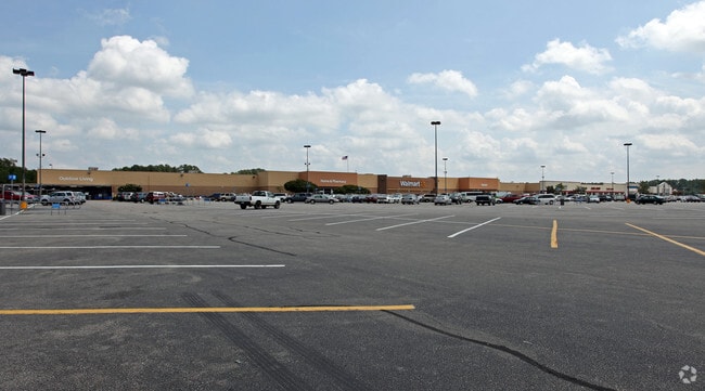
2500 Forest Hills Rd W
3712-13-6752.000
2348 FOREST HILLS RD W 11.89AC
Departmentstore
Wilson
X
North Carolina
3720371200J
19.58 AC
2024
Westwood Village
2025
Other Market Areas
000200
Wilson, NC
185,515 SF
DEMOGRAPHICS near 2500 Forest Hills Rd W
1 Mile
3 Mile
5 Mile
2024 Total Population
4,343
40,018
55,270
2029 Population
4,268
40,367
55,650
Pop Growth 2024-2029
(1.73%)
+ 0.87%
+ 0.69%
Average Age
46
41
41
2024 Total Households
1,859
16,890
22,983
HH Growth 2024-2029
(1.83%)
+ 0.81%
+ 0.66%
Median Household Inc
$59,033
$47,868
$48,172
Avg Household Size
2.20
2.30
2.30
2024 Avg HH Vehicles
2.00
2.00
2.00
Median Home Value
$172,804
$153,380
$154,318
Median Year Built
1979
1982
1984
Nearby Places
Map Layers
Map Styles
 Street
 Aerial
- Restaurants
- Banks
- Shops
- Fitness
- Groceries
PUBLIC TRANSPORTATION
COMMUTER RAIL
Wilson (Carolinian - Amtrak, Palmetto - Amtrak)
DRIVE
WALK
Distance
Wilson (Carolinian - Amtrak, Palmetto - Amtrak)
7 min
3.2 mi
Freight Ports
Port of Morehead City
DRIVE
WALK
Distance
Port of Morehead City
170 min
128.4 mi
SALE & LEASE HISTORY
LISTING DATE
SALE/LEASE

Sep 25, 2016
For Lease
Mar 15, 2023
For Lease
Nearby Properties
Address
Land Use
TOTAL SIZE
Lot Size
Zoning
Address
Land Use
TOTAL SIZE
Lot Size
Zoning
25,554 SF
18.75 AC
RMX
Address
Land Use
TOTAL SIZE
Lot Size
Zoning
11,771 SF
31.78 AC
ICD
Address
Land Use
TOTAL SIZE
Lot Size
Zoning
21,655 SF
34.44 AC
ICD
Address
Land Use
TOTAL SIZE
Lot Size
Zoning
220,639 SF
1.94 AC
CCMX
Address
Land Use
TOTAL SIZE
Lot Size
Zoning
232,805 SF
49.53 AC
HI
Address
Land Use
TOTAL SIZE
Lot Size
Zoning
14,520 SF
642.25 AC
HI
Address
Land Use
TOTAL SIZE
Lot Size
Zoning
159,765 SF
74.19 AC
AR
Address
Land Use
TOTAL SIZE
Lot Size
Zoning
11,375 SF
29.21 AC
HI
Address
Land Use
TOTAL SIZE
Lot Size
Zoning
4,803 SF
10.23 AC
RMX
Address
Land Use
TOTAL SIZE
Lot Size
Zoning
98,777 SF
50 AC
ICD
Address
Land Use
TOTAL SIZE
Lot Size
Zoning
59,319 SF
1.01 AC
CCMX
Address
Land Use
TOTAL SIZE
Lot Size
Zoning
150,316 SF
10.97 AC
RMX
Address
Land Use
TOTAL SIZE
Lot Size
Zoning
338,739 SF
29.79 AC
HI
Address
Land Use
TOTAL SIZE
Lot Size
Zoning
30,488 SF
49.06 AC
GR6
Address
Land Use
TOTAL SIZE
Lot Size
Zoning
11,664 SF
10.13 AC
HC
Address
Land Use
TOTAL SIZE
Lot Size
Zoning
11,760 SF
56.76 AC
ICD
Address
Land Use
TOTAL SIZE
Lot Size
Zoning
135,620 SF
31.85 AC
HI
Address
Land Use
TOTAL SIZE
Lot Size
Zoning
91,637 SF
1.95 AC
CCMX
Address
Land Use
TOTAL SIZE
Lot Size
Zoning
78,875 SF
34.82 AC
ICD
Address
Land Use
TOTAL SIZE
Lot Size
Zoning
111,191 SF
10.64 AC
B4
Address
Land Use
TOTAL SIZE
Lot Size
Zoning
33,650 SF
35.52 AC
ICD
Address
Land Use
TOTAL SIZE
Lot Size
Zoning
133,549 SF
21.49 AC
HC
Address
Land Use
TOTAL SIZE
Lot Size
Zoning
1,944 SF
13.64 AC
GR6
Address
Land Use
TOTAL SIZE
Lot Size
Zoning
13,672 SF
7.68 AC
NC
Address
Land Use
TOTAL SIZE
Lot Size
Zoning
8,616 SF
40 AC
ICD
Address
Land Use
TOTAL SIZE
Lot Size
Zoning
27,488 SF
17.21 AC
GR6
Address
Land Use
TOTAL SIZE
Lot Size
Zoning
35,406 SF
2.91 AC
GR6
Address
Land Use
TOTAL SIZE
Lot Size
Zoning
12,560 SF
11.89 AC
HC
Address
Land Use
TOTAL SIZE
Lot Size
Zoning
1,942 SF
28.23 AC
HI
The World's #1 Commercial Real Estate Marketplace
Connect with us
© 2025 CoStar Group
The information above has been obtained from sources believed reliable. While we do not doubt its accuracy we have not verified it and make no guarantee, warranty or representation about it. It is your responsibility to independently confirm its accuracy and completeness. Any projections, opinions, assumptions, or estimates used are for example only and do not represent the current or future performance of the property. The value of this transaction to you depends on tax and other factors which should be evaluated by your tax, financial, and legal advisors. You and your advisors should conduct a careful, independent investigation of the property to determine to your satisfaction the suitability of the property for your needs.