Property Record
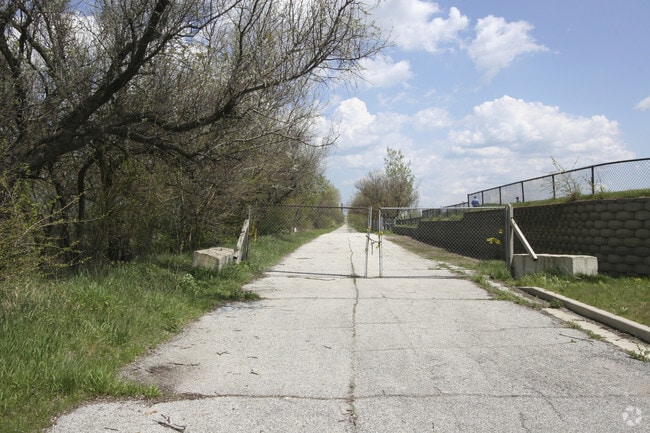
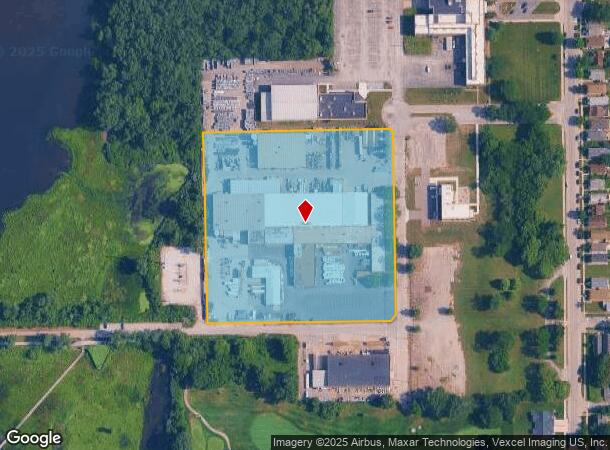
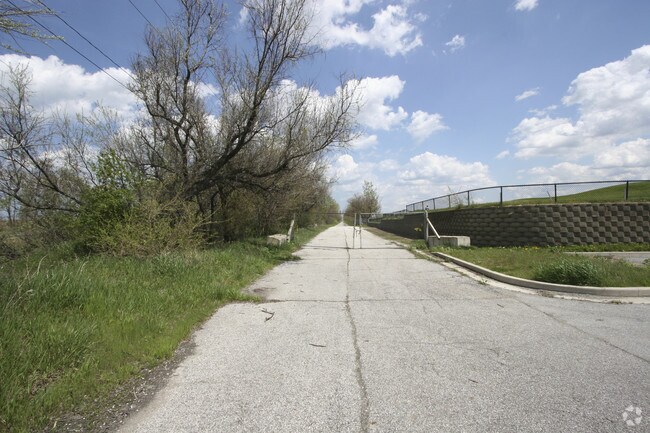
2500 Gaspar Ave, Hammond, IN 46323
NEARBY LISTINGS FOR SALE OR LEASE
Property Detail
2500 Gaspar Ave
Chicago-Naperville-Elgin, IL-IN-WI
Robertsdale Industrial Park
45-03-07-451-006.000-023
ROBERTSDALE INDUSTRIAL PARK BL.7 EX. S.200FT OF W.150FT 7.13AC
Industrialgeneral
Lake
X
Indiana
18089C0036F
1
2024
7.13 AC
2025
Indiana
021100
Chicago
101,815 SF
DEMOGRAPHICS near 2500 Gaspar Ave
1 Mile
3 Mile
5 Mile
2024 Total Population
6,349
46,904
129,538
2029 Population
6,233
46,118
126,850
Pop Growth 2024-2029
(1.83%)
(1.68%)
(2.08%)
Average Age
40
38
38
2024 Total Households
2,608
17,284
47,122
HH Growth 2024-2029
(1.84%)
(1.79%)
(2.19%)
Median Household Inc
$54,335
$52,646
$46,605
Avg Household Size
2.30
2.60
2.60
2024 Avg HH Vehicles
2.00
2.00
2.00
Median Home Value
$160,312
$142,292
$130,818
Median Year Built
1946
1947
1948
Nearby Places
Map Layers
Map Styles
 Street
 Aerial
- Restaurants
- Banks
- Shops
- Fitness
- Groceries
PUBLIC TRANSPORTATION
COMMUTER RAIL
Hammond-Whiting Amtrak Station (Wolverine - Amtrak)
DRIVE
WALK
Distance
Hammond-Whiting Amtrak Station (Wolverine - Amtrak)
5 min
2.2 mi
Hammond Station (South Shore Line - Northern Indiana Commuter Transportation District (South Shore Line))
DRIVE
WALK
Distance
Hammond Station (South Shore Line - Northern Indiana Commuter Transportation District (South Shore Line))
8 min
4.1 mi
AIRPORT
Chicago Midway International
DRIVE
WALK
Distance
Chicago Midway International
33 min
18.2 mi
Freight Ports
Port Milwaukee
DRIVE
WALK
Distance
Port Milwaukee
133 min
103.5 mi
Nearby Properties
Address
Land Use
TOTAL SIZE
Lot Size
Zoning
Address
Land Use
TOTAL SIZE
Lot Size
Zoning
27,934 SF
37.50 AC
Address
Land Use
TOTAL SIZE
Lot Size
Zoning
282,089 SF
3.82 AC
R33
Address
Land Use
TOTAL SIZE
Lot Size
Zoning
4,527,578 SF
716.50 AC
Address
Land Use
TOTAL SIZE
Lot Size
Zoning
112,300 SF
2.34 AC
Address
Land Use
TOTAL SIZE
Lot Size
Zoning
241,800 SF
14.30 AC
Address
Land Use
TOTAL SIZE
Lot Size
Zoning
221,190 SF
109.74 AC
Address
Land Use
TOTAL SIZE
Lot Size
Zoning
443,065 SF
36.69 AC
Address
Land Use
TOTAL SIZE
Lot Size
Zoning
99,042 SF
255 AC
Address
Land Use
TOTAL SIZE
Lot Size
Zoning
244,773 SF
65.01 AC
Address
Land Use
TOTAL SIZE
Lot Size
Zoning
298,373 SF
21.23 AC
Address
Land Use
TOTAL SIZE
Lot Size
Zoning
2,618,087 SF
221.28 AC
Address
Land Use
TOTAL SIZE
Lot Size
Zoning
6,139 SF
78.90 AC
Address
Land Use
TOTAL SIZE
Lot Size
Zoning
196,210 SF
21.55 AC
Address
Land Use
TOTAL SIZE
Lot Size
Zoning
790,642 SF
37.20 AC
Address
Land Use
TOTAL SIZE
Lot Size
Zoning
16,644 SF
52.10 AC
Address
Land Use
TOTAL SIZE
Lot Size
Zoning
484,604 SF
70.49 AC
Address
Land Use
TOTAL SIZE
Lot Size
Zoning
126,900 SF
75.99 AC
Address
Land Use
TOTAL SIZE
Lot Size
Zoning
292,953 SF
8.93 AC
Address
Land Use
TOTAL SIZE
Lot Size
Zoning
55,800 SF
7.25 AC
Address
Land Use
TOTAL SIZE
Lot Size
Zoning
68,885 SF
5.93 AC
Address
Land Use
TOTAL SIZE
Lot Size
Zoning
678,912 SF
29.68 AC
Address
Land Use
TOTAL SIZE
Lot Size
Zoning
91,644 SF
29.28 AC
Address
Land Use
TOTAL SIZE
Lot Size
Zoning
55,357 SF
5.23 AC
Address
Land Use
TOTAL SIZE
Lot Size
Zoning
261,928 SF
12.74 AC
Address
Land Use
TOTAL SIZE
Lot Size
Zoning
129,650 SF
12.16 AC
Address
Land Use
TOTAL SIZE
Lot Size
Zoning
219,409 SF
89.21 AC
Address
Land Use
TOTAL SIZE
Lot Size
Zoning
209,753 SF
8.94 AC
Address
Land Use
TOTAL SIZE
Lot Size
Zoning
2,408,021 SF
2.67 AC
Address
Land Use
TOTAL SIZE
Lot Size
Zoning
600,448 SF
36.42 AC
Address
Land Use
TOTAL SIZE
Lot Size
Zoning
108,999 SF
109.32 AC
The World's #1 Commercial Real Estate Marketplace
Connect with us
© 2026 CoStar Group
The information above has been obtained from sources believed reliable. While we do not doubt its accuracy we have not verified it and make no guarantee, warranty or representation about it. It is your responsibility to independently confirm its accuracy and completeness. Any projections, opinions, assumptions, or estimates used are for example only and do not represent the current or future performance of the property. The value of this transaction to you depends on tax and other factors which should be evaluated by your tax, financial, and legal advisors. You and your advisors should conduct a careful, independent investigation of the property to determine to your satisfaction the suitability of the property for your needs.