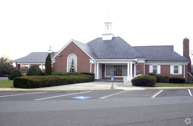
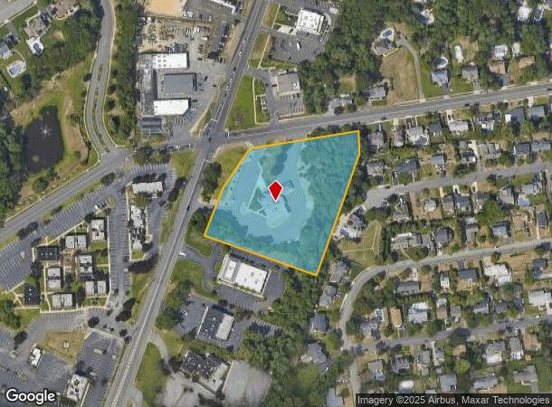
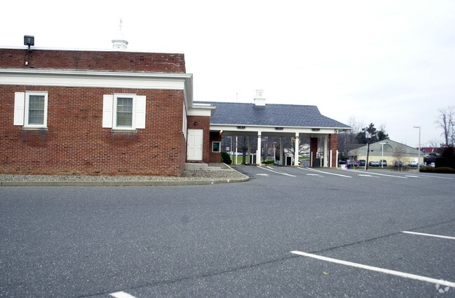
Property Record
2500 Highway 35, Manasquan, NJ 08736

NEARBY LISTINGS FOR SALE OR LEASE
Property Detail
2500 Highway 35
52-00337-0000-00025
Monmouth
Financialbuilding
New Jersey
X
25
34025C0455F
3.63 AC
2024
Southern Monmouth
2025
Northern New Jersey
808800
New York-Jersey City-White Plains, NY-NJ
6,953 SF
DEMOGRAPHICS near 2500 Highway 35
1 Mile
3 Mile
5 Mile
2024 Total Population
8,329
58,675
136,788
2029 Population
8,252
60,958
142,420
Pop Growth 2024-2029
(0.92%)
+ 3.89%
+ 4.12%
Average Age
44
45
44
2024 Total Households
3,178
23,794
55,082
HH Growth 2024-2029
(1.16%)
+ 3.72%
+ 3.95%
Median Household Inc
$159,507
$118,093
$105,804
Avg Household Size
2.60
2.40
2.40
2024 Avg HH Vehicles
2.00
2.00
2.00
Median Home Value
$707,906
$631,300
$481,441
Median Year Built
1970
1969
1972
Nearby Places
Map Layers
Map Styles
 Street
 Aerial
- Restaurants
- Banks
- Shops
- Fitness
- Groceries
PUBLIC TRANSPORTATION
COMMUTER RAIL
Manasquan (North Jersey Coast Line - NJ Transit Commuter Rail (NJ Transit))
DRIVE
WALK
Distance
Manasquan (North Jersey Coast Line - NJ Transit Commuter Rail (NJ Transit))
4 min
1.4 mi
Point Pleasant Beach (North Jersey Coast Line - NJ Transit Commuter Rail (NJ Transit))
DRIVE
WALK
Distance
Point Pleasant Beach (North Jersey Coast Line - NJ Transit Commuter Rail (NJ Transit))
6 min
3.3 mi
Freight Ports
New York Container Terminal
DRIVE
WALK
Distance
New York Container Terminal
64 min
48.0 mi
Nearby Properties
Address
Land Use
TOTAL SIZE
Lot Size
Zoning
Address
Land Use
TOTAL SIZE
Lot Size
Zoning
22,660 SF
164.35 AC
4
Address
Land Use
TOTAL SIZE
Lot Size
Zoning
23,868 SF
137.35 AC
R-1
Address
Land Use
TOTAL SIZE
Lot Size
Zoning
4,078 SF
0.01 AC
3
Address
Land Use
TOTAL SIZE
Lot Size
Zoning
3.46 AC
3
Address
Land Use
TOTAL SIZE
Lot Size
Zoning
5,000 SF
22.50 AC
R-4
Address
Land Use
TOTAL SIZE
Lot Size
Zoning
17.66 AC
1E
Address
Land Use
TOTAL SIZE
Lot Size
Zoning
34,337 SF
99.30 AC
R-1
Address
Land Use
TOTAL SIZE
Lot Size
Zoning
64,757 SF
11.81 AC
MLHB
Address
Land Use
TOTAL SIZE
Lot Size
Zoning
49,657 SF
11.22 AC
HB80
Address
Land Use
TOTAL SIZE
Lot Size
Zoning
3.44 AC
R-2
Address
Land Use
TOTAL SIZE
Lot Size
Zoning
7.79 AC
MLCC
Address
Land Use
TOTAL SIZE
Lot Size
Zoning
84,297 SF
42.37 AC
CR40
Address
Land Use
TOTAL SIZE
Lot Size
Zoning
145,918 SF
20.31 AC
OR-5
Address
Land Use
TOTAL SIZE
Lot Size
Zoning
49,170 SF
8.38 AC
HB80
Address
Land Use
TOTAL SIZE
Lot Size
Zoning
45,236 SF
48.30 AC
POS
Address
Land Use
TOTAL SIZE
Lot Size
Zoning
26.05 AC
SF10
Address
Land Use
TOTAL SIZE
Lot Size
Zoning
3,792 SF
7.64 AC
R-1A
Address
Land Use
TOTAL SIZE
Lot Size
Zoning
115,960 SF
17.93 AC
OR-5
Address
Land Use
TOTAL SIZE
Lot Size
Zoning
111,580 SF
25 AC
POS
Address
Land Use
TOTAL SIZE
Lot Size
Zoning
8.83 AC
R-2
Address
Land Use
TOTAL SIZE
Lot Size
Zoning
5.53 AC
R-5
Address
Land Use
TOTAL SIZE
Lot Size
Zoning
1,284 SF
6.97 AC
R-2
Address
Land Use
TOTAL SIZE
Lot Size
Zoning
10.52 AC
R-5
Address
Land Use
TOTAL SIZE
Lot Size
Zoning
13,094 SF
HB80
Address
Land Use
TOTAL SIZE
Lot Size
Zoning
192 SF
12.50 AC
HD12
Address
Land Use
TOTAL SIZE
Lot Size
Zoning
81,656 SF
8.15 AC
HB80
Address
Land Use
TOTAL SIZE
Lot Size
Zoning
15.94 AC
R-2
Address
Land Use
TOTAL SIZE
Lot Size
Zoning
13.21 AC
HD12
Address
Land Use
TOTAL SIZE
Lot Size
Zoning
5.37 AC
R-5
Address
Land Use
TOTAL SIZE
Lot Size
Zoning
320 SF
1.55 AC
1E
The World's #1 Commercial Real Estate Marketplace
Connect with us
© 2025 CoStar Group
The information above has been obtained from sources believed reliable. While we do not doubt its accuracy we have not verified it and make no guarantee, warranty or representation about it. It is your responsibility to independently confirm its accuracy and completeness. Any projections, opinions, assumptions, or estimates used are for example only and do not represent the current or future performance of the property. The value of this transaction to you depends on tax and other factors which should be evaluated by your tax, financial, and legal advisors. You and your advisors should conduct a careful, independent investigation of the property to determine to your satisfaction the suitability of the property for your needs.