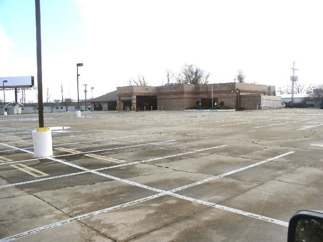
Property Record
2500 Louisville Ave, Monroe, LA 71201

Save to a Folder
{{folder.Name}}
{{folder.ListingIds.length}} Properties
{{folder.ListingIds.length}} Property
Create a New Folder
Property Detail
2500 Louisville Ave
54301
LOT BEG 515.55 FT, SO 115.68 FT, SE 119.1 FT, E OF NW COR SEC 74 T18N R4E SE 381.9 FT, NW 201.94 FT, NW 119.79 FT, SW 249.11
Commercialnec
OUACHITA
AE The base floodplain where base flood elevations are provided. AE Zones are now used on new format FIRMs instead of A1-A30 Zones.
Louisiana
2025
0.96 AC
2025
Other Market Areas
010800
Monroe, LA
NEARBY LISTINGS FOR SALE OR LEASE
DEMOGRAPHICS near 2500 Louisville Ave
1 mile
3 mile
5 mile
2025 Total Population
4,707
45,752
83,214
2030 Population
4,643
45,343
82,562
Pop Growth 2025-2030
(1.36%)
(0.89%)
(0.78%)
Average Age
39
38
39
2025 Total Households
2,054
18,667
33,722
HH Growth 2025-2030
(1.22%)
(0.96%)
(0.87%)
Median Household Inc
$40,296
$42,311
$44,384
Avg Household Size
2.20
2.30
2.30
2025 Avg HH Vehicles
1.00
1.00
1.00
Median Home Value
$196,133
$188,134
$175,022
Median Year Built
1970
1971
1975
Nearby Places
Map Layers
Map Styles
 Street
 Aerial
Layers
 Traffic
 Biking
Places
Listings with unknown addresses are not visible on the map
- Restaurants
- Banks
- Shops
- Fitness
- Groceries
PUBLIC TRANSPORTATION
AIRPORT
Monroe Regional
Drive
Walk
Distance
Monroe Regional
8 min
4.5 mi
Freight Ports
Port of Shreveport
Drive
Walk
Distance
Port of Shreveport
132 min
112.2 mi
Nearby Properties
Address
Land Use
TOTAL SIZE
Lot Size
Zoning
Address
Land Use
TOTAL SIZE
Lot Size
Zoning
2.23 AC
Address
Land Use
TOTAL SIZE
Lot Size
Zoning
Address
Land Use
TOTAL SIZE
Lot Size
Zoning
7.63 AC
Address
Land Use
TOTAL SIZE
Lot Size
Zoning
Address
Land Use
TOTAL SIZE
Lot Size
Zoning
Address
Land Use
TOTAL SIZE
Lot Size
Zoning
10.81 AC
Address
Land Use
TOTAL SIZE
Lot Size
Zoning
2.49 AC
Address
Land Use
TOTAL SIZE
Lot Size
Zoning
22.96 AC
Address
Land Use
TOTAL SIZE
Lot Size
Zoning
1.37 AC
Address
Land Use
TOTAL SIZE
Lot Size
Zoning
0.14 AC
Address
Land Use
TOTAL SIZE
Lot Size
Zoning
10.80 AC
Address
Land Use
TOTAL SIZE
Lot Size
Zoning
14.07 AC
Address
Land Use
TOTAL SIZE
Lot Size
Zoning
5.21 AC
Address
Land Use
TOTAL SIZE
Lot Size
Zoning
Address
Land Use
TOTAL SIZE
Lot Size
Zoning
12.11 AC
Address
Land Use
TOTAL SIZE
Lot Size
Zoning
Address
Land Use
TOTAL SIZE
Lot Size
Zoning
Address
Land Use
TOTAL SIZE
Lot Size
Zoning
6.42 AC
Address
Land Use
TOTAL SIZE
Lot Size
Zoning
Address
Land Use
TOTAL SIZE
Lot Size
Zoning
1.16 AC
Address
Land Use
TOTAL SIZE
Lot Size
Zoning
1.67 AC
Address
Land Use
TOTAL SIZE
Lot Size
Zoning
Address
Land Use
TOTAL SIZE
Lot Size
Zoning
37.47 AC
Address
Land Use
TOTAL SIZE
Lot Size
Zoning
4.54 AC
Address
Land Use
TOTAL SIZE
Lot Size
Zoning
0.52 AC
Address
Land Use
TOTAL SIZE
Lot Size
Zoning
Address
Land Use
TOTAL SIZE
Lot Size
Zoning
Address
Land Use
TOTAL SIZE
Lot Size
Zoning
Address
Land Use
TOTAL SIZE
Lot Size
Zoning
Address
Land Use
TOTAL SIZE
Lot Size
Zoning
17.07 AC
The World's #1 Commercial Real Estate Marketplace
Connect with us
© 2026 CoStar Group
The information above has been obtained from sources believed reliable. While we do not doubt its accuracy we have not verified it and make no guarantee, warranty or representation about it. It is your responsibility to independently confirm its accuracy and completeness. Any projections, opinions, assumptions, or estimates used are for example only and do not represent the current or future performance of the property. The value of this transaction to you depends on tax and other factors which should be evaluated by your tax, financial, and legal advisors. You and your advisors should conduct a careful, independent investigation of the property to determine to your satisfaction the suitability of the property for your needs.