Property Record
2500 Monument Rd, Jacksonville, FL 32225
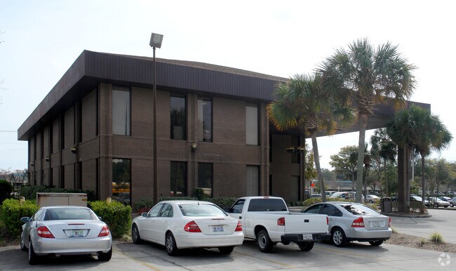


Property Detail
2500 Monument Rd
167447-0240
39-2S-28E 1.821 F RICHARD GRANT PT RECD O/R 19009-1551
Storemultistory
Duval
PUD
Florida
B and X Area of moderate flood hazard, usually the area between the limits of the 100-year and 500-year floods.
1.82 AC
2025
Arlington
2026
Jacksonville (Florida)
014328
Jacksonville, FL
13,753 SF
NEARBY LISTINGS FOR SALE OR LEASE
DEMOGRAPHICS near 2500 Monument Rd
1 mile
3 mile
5 mile
2025 Total Population
10,443
48,917
139,212
2030 Population
10,904
51,230
146,321
Pop Growth 2025-2030
+ 4.41%
+ 4.73%
+ 5.11%
Average Age
40
40
39
2025 Total Households
4,223
18,742
54,132
HH Growth 2025-2030
+ 4.74%
+ 5.04%
+ 5.40%
Median Household Inc
$82,309
$93,942
$80,447
Avg Household Size
2.50
2.60
2.50
2025 Avg HH Vehicles
2.00
2.00
2.00
Median Home Value
$318,261
$358,791
$341,433
Median Year Built
1986
1992
1991
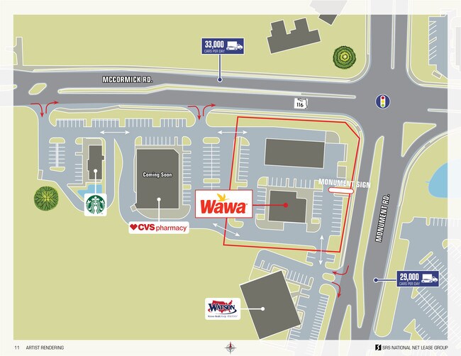
Nearby Places
Map Layers
Map Styles
 Street
 Aerial
Layers
 Traffic
 Biking
Places
Listings with unknown addresses are not visible on the map
- Restaurants
- Banks
- Shops
- Fitness
- Groceries
PUBLIC TRANSPORTATION
AIRPORT
Jacksonville International
Drive
Walk
Distance
Jacksonville International
30 min
18.6 mi
Nearby Properties
Address
Land Use
TOTAL SIZE
Lot Size
Zoning
Address
Land Use
TOTAL SIZE
Lot Size
Zoning
361,268 SF
15.27 AC
PUD
Address
Land Use
TOTAL SIZE
Lot Size
Zoning
277,959 SF
14.39 AC
PUD
Address
Land Use
TOTAL SIZE
Lot Size
Zoning
471,372 SF
1,067.68 AC
PUD
Address
Land Use
TOTAL SIZE
Lot Size
Zoning
266,120 SF
14.60 AC
PUD
Address
Land Use
TOTAL SIZE
Lot Size
Zoning
242,588 SF
15.04 AC
RMD-C
Address
Land Use
TOTAL SIZE
Lot Size
Zoning
210,829 SF
11.84 AC
RMD-D
Address
Land Use
TOTAL SIZE
Lot Size
Zoning
154,382 SF
8.67 AC
RMD-D
Address
Land Use
TOTAL SIZE
Lot Size
Zoning
166,588 SF
10.40 AC
RMD-D
Address
Land Use
TOTAL SIZE
Lot Size
Zoning
214,460 SF
19.77 AC
RMD-C
Address
Land Use
TOTAL SIZE
Lot Size
Zoning
267,103 SF
17.31 AC
RMD-C
Address
Land Use
TOTAL SIZE
Lot Size
Zoning
80,308 SF
12.07 AC
PUD
Address
Land Use
TOTAL SIZE
Lot Size
Zoning
122,854 SF
12.25 AC
PUD
Address
Land Use
TOTAL SIZE
Lot Size
Zoning
114.19 AC
IW
Address
Land Use
TOTAL SIZE
Lot Size
Zoning
118,026 SF
13.35 AC
PUD
Address
Land Use
TOTAL SIZE
Lot Size
Zoning
98,760 SF
5.66 AC
RMD-D
Address
Land Use
TOTAL SIZE
Lot Size
Zoning
45,642 SF
6.29 AC
PUD
Address
Land Use
TOTAL SIZE
Lot Size
Zoning
222,904 SF
17.32 AC
PUD
Address
Land Use
TOTAL SIZE
Lot Size
Zoning
67,060 SF
3.20 AC
PUD
Address
Land Use
TOTAL SIZE
Lot Size
Zoning
234,561 SF
20.13 AC
PUD
Address
Land Use
TOTAL SIZE
Lot Size
Zoning
190,755 SF
10.47 AC
PUD
Address
Land Use
TOTAL SIZE
Lot Size
Zoning
57,724 SF
6.56 AC
PUD
Address
Land Use
TOTAL SIZE
Lot Size
Zoning
55,664 SF
13.90 AC
PUD
Address
Land Use
TOTAL SIZE
Lot Size
Zoning
43,432 SF
27.71 AC
PUD
Address
Land Use
TOTAL SIZE
Lot Size
Zoning
63,490 SF
1.28 AC
PUD
Address
Land Use
TOTAL SIZE
Lot Size
Zoning
52,778 SF
9.44 AC
PUD
Address
Land Use
TOTAL SIZE
Lot Size
Zoning
73,102 SF
9.55 AC
RMD-A
Address
Land Use
TOTAL SIZE
Lot Size
Zoning
73,152 SF
2.95 AC
PUD
Address
Land Use
TOTAL SIZE
Lot Size
Zoning
60,098 SF
2.02 AC
PUD
Address
Land Use
TOTAL SIZE
Lot Size
Zoning
75,001 SF
8.86 AC
PUD
Address
Land Use
TOTAL SIZE
Lot Size
Zoning
117,829 SF
20.05 AC
PBF-1
The World's #1 Commercial Real Estate Marketplace
Connect with us
© 2026 CoStar Group
The information above has been obtained from sources believed reliable. While we do not doubt its accuracy we have not verified it and make no guarantee, warranty or representation about it. It is your responsibility to independently confirm its accuracy and completeness. Any projections, opinions, assumptions, or estimates used are for example only and do not represent the current or future performance of the property. The value of this transaction to you depends on tax and other factors which should be evaluated by your tax, financial, and legal advisors. You and your advisors should conduct a careful, independent investigation of the property to determine to your satisfaction the suitability of the property for your needs.