Property Record
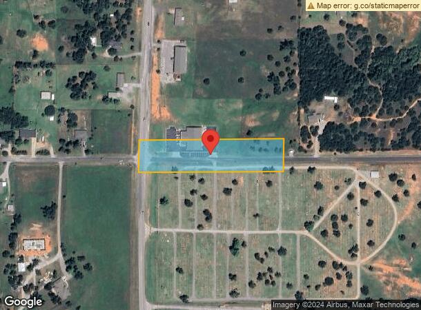
2500 N Council Rd, Blanchard, OK 73010

NEARBY LISTINGS FOR SALE OR LEASE
-
-
View all Blanchard listings for sale on LoopNet.com
Property Detail
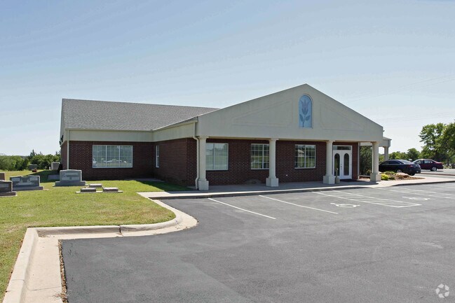
2500 N Council Rd
00001708N04W002900
333 Purcell
Crematorium
BEG AT SW COR OF TH SW TH N151.12 E660 S150.2 W660 TO POB
X
Mcclain
40051C0245E
Oklahoma
2024
2.28 AC
2025
Southwest Outlying
400104
Oklahoma City
6,900 SF
Oklahoma City, OK
DEMOGRAPHICS near 2500 N Council Rd
1 Mile
3 Mile
5 Mile
2024 Total Population
2,125
8,731
15,551
2029 Population
2,562
10,314
18,133
Pop Growth 2024-2029
+ 20.56%
+ 18.13%
+ 16.60%
Average Age
40
39
39
2024 Total Households
820
3,231
5,612
HH Growth 2024-2029
+ 20.61%
+ 18.17%
+ 16.61%
Median Household Inc
$84,038
$84,555
$86,700
Avg Household Size
2.50
2.70
2.70
2024 Avg HH Vehicles
2.00
2.00
2.00
Median Home Value
$253,305
$227,576
$229,632
Median Year Built
2004
2000
2001
Nearby Places
Map Layers
Map Styles
 Street
 Aerial
- Restaurants
- Banks
- Shops
- Fitness
- Groceries
PUBLIC TRANSPORTATION
AIRPORT
Will Rogers World
DRIVE
WALK
Distance
Will Rogers World
37 min
23.9 mi
Freight Ports
Tulsa Port Of Catoosa
DRIVE
WALK
Distance
Tulsa Port Of Catoosa
170 min
152.0 mi
Nearby Properties
Address
Land Use
TOTAL SIZE
Lot Size
Zoning
Address
Land Use
TOTAL SIZE
Lot Size
Zoning
15,096 SF
1.81 AC
Address
Land Use
TOTAL SIZE
Lot Size
Zoning
5,125 SF
6 AC
Address
Land Use
TOTAL SIZE
Lot Size
Zoning
1,920 SF
20.82 AC
Address
Land Use
TOTAL SIZE
Lot Size
Zoning
8,584 SF
1.95 AC
Address
Land Use
TOTAL SIZE
Lot Size
Zoning
4,456 SF
0.24 AC
Address
Land Use
TOTAL SIZE
Lot Size
Zoning
6,240 SF
2.87 AC
Address
Land Use
TOTAL SIZE
Lot Size
Zoning
5,000 SF
80 AC
TM
Address
Land Use
TOTAL SIZE
Lot Size
Zoning
7,564 SF
2.33 AC
Address
Land Use
TOTAL SIZE
Lot Size
Zoning
1,724 SF
2.89 AC
Address
Land Use
TOTAL SIZE
Lot Size
Zoning
5,765 SF
2.40 AC
Address
Land Use
TOTAL SIZE
Lot Size
Zoning
24,613 SF
1.99 AC
Address
Land Use
TOTAL SIZE
Lot Size
Zoning
1,080 SF
7.47 AC
Address
Land Use
TOTAL SIZE
Lot Size
Zoning
1,980 SF
6.40 AC
Address
Land Use
TOTAL SIZE
Lot Size
Zoning
10,880 SF
3.94 AC
Address
Land Use
TOTAL SIZE
Lot Size
Zoning
14,796 SF
0.40 AC
Address
Land Use
TOTAL SIZE
Lot Size
Zoning
3,420 SF
0.08 AC
Address
Land Use
TOTAL SIZE
Lot Size
Zoning
5,700 SF
9.40 AC
Address
Land Use
TOTAL SIZE
Lot Size
Zoning
13,704 SF
1.33 AC
Address
Land Use
TOTAL SIZE
Lot Size
Zoning
2,000 SF
1.16 AC
Address
Land Use
TOTAL SIZE
Lot Size
Zoning
3,350 SF
3.05 AC
Address
Land Use
TOTAL SIZE
Lot Size
Zoning
4,325 SF
2.61 AC
Address
Land Use
TOTAL SIZE
Lot Size
Zoning
4,493 SF
1.45 AC
The World's #1 Commercial Real Estate Marketplace
Connect with us
© 2026 CoStar Group
The information above has been obtained from sources believed reliable. While we do not doubt its accuracy we have not verified it and make no guarantee, warranty or representation about it. It is your responsibility to independently confirm its accuracy and completeness. Any projections, opinions, assumptions, or estimates used are for example only and do not represent the current or future performance of the property. The value of this transaction to you depends on tax and other factors which should be evaluated by your tax, financial, and legal advisors. You and your advisors should conduct a careful, independent investigation of the property to determine to your satisfaction the suitability of the property for your needs.