Property Record
2500 W Carrol St, Pahrump, NV 89060

NEARBY LISTINGS FOR SALE OR LEASE
-
-
View all Pahrump listings for sale on LoopNet.com
Property Detail
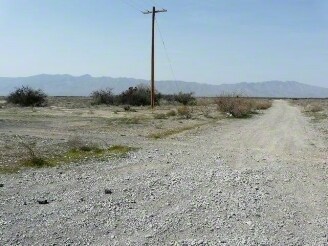
2500 W Carrol St
27-191-19
T19S R53E S5 W2 & S6 ALL & S7 W2 & S18 W2 & S19 NW
Parkplaygroundpicnicarea
Nye
AO
Nevada
32023C8750F
1.76 AC
0
Carson City/Nevada Area
2025
Other Market Areas
9604012620
Pahrump, NV
DEMOGRAPHICS near 2500 W Carrol St
1 Mile
3 Mile
5 Mile
2024 Total Population
774
5,601
12,939
2029 Population
903
6,568
15,145
Pop Growth 2024-2029
+ 16.67%
+ 17.26%
+ 17.05%
Average Age
51
50
49
2024 Total Households
353
2,416
5,275
HH Growth 2024-2029
+ 16.71%
+ 17.26%
+ 17.29%
Median Household Inc
$35,227
$59,810
$53,622
Avg Household Size
2.20
2.30
2.30
2024 Avg HH Vehicles
2.00
2.00
2.00
Median Home Value
$185,134
$227,745
$214,753
Median Year Built
1995
1996
1996
Nearby Places
Map Layers
Map Styles
 Street
 Aerial
- Restaurants
- Banks
- Shops
- Fitness
- Groceries
SALE & LEASE HISTORY
LISTING DATE
SALE/LEASE

Sep 24, 2016
For Sale
Dec 09, 2019
For Sale
Nearby Properties
Address
Land Use
TOTAL SIZE
Lot Size
Zoning
Address
Land Use
TOTAL SIZE
Lot Size
Zoning
20.32 AC
R
Address
Land Use
TOTAL SIZE
Lot Size
Zoning
42,974 SF
3.08 AC
GC
Address
Land Use
TOTAL SIZE
Lot Size
Zoning
4,032 SF
0.61 AC
GC
Address
Land Use
TOTAL SIZE
Lot Size
Zoning
480 AC
R
Address
Land Use
TOTAL SIZE
Lot Size
Zoning
18.97 AC
CF
Address
Land Use
TOTAL SIZE
Lot Size
Zoning
75.56 AC
LI
Address
Land Use
TOTAL SIZE
Lot Size
Zoning
40 AC
LI
Address
Land Use
TOTAL SIZE
Lot Size
Zoning
40 AC
LI
Address
Land Use
TOTAL SIZE
Lot Size
Zoning
40 AC
LI
Address
Land Use
TOTAL SIZE
Lot Size
Zoning
40 AC
LI
Address
Land Use
TOTAL SIZE
Lot Size
Zoning
403 AC
RH-9.5
Address
Land Use
TOTAL SIZE
Lot Size
Zoning
75.76 AC
SPLIT
Address
Land Use
TOTAL SIZE
Lot Size
Zoning
240 AC
RH-9.5
Address
Land Use
TOTAL SIZE
Lot Size
Zoning
40 AC
HI
Address
Land Use
TOTAL SIZE
Lot Size
Zoning
40 AC
RH-9.5
Address
Land Use
TOTAL SIZE
Lot Size
Zoning
10.61 AC
GC
Address
Land Use
TOTAL SIZE
Lot Size
Zoning
20.83 AC
LI
Address
Land Use
TOTAL SIZE
Lot Size
Zoning
4.31 AC
CF
Address
Land Use
TOTAL SIZE
Lot Size
Zoning
15 AC
LI
Address
Land Use
TOTAL SIZE
Lot Size
Zoning
9.74 AC
LI
Address
Land Use
TOTAL SIZE
Lot Size
Zoning
9.72 AC
LI
Address
Land Use
TOTAL SIZE
Lot Size
Zoning
39.25 AC
RH-9.5
Address
Land Use
TOTAL SIZE
Lot Size
Zoning
40 AC
RH-9.5
Address
Land Use
TOTAL SIZE
Lot Size
Zoning
40 AC
RH-4.5
Address
Land Use
TOTAL SIZE
Lot Size
Zoning
82.10 AC
RH-9.5
Address
Land Use
TOTAL SIZE
Lot Size
Zoning
80 AC
RH-9.5
Address
Land Use
TOTAL SIZE
Lot Size
Zoning
80 AC
RH-9.5
Address
Land Use
TOTAL SIZE
Lot Size
Zoning
80 AC
RH-9.5
Address
Land Use
TOTAL SIZE
Lot Size
Zoning
1,600 SF
2.10 AC
RE-2
The World's #1 Commercial Real Estate Marketplace
Connect with us
© 2025 CoStar Group
The information above has been obtained from sources believed reliable. While we do not doubt its accuracy we have not verified it and make no guarantee, warranty or representation about it. It is your responsibility to independently confirm its accuracy and completeness. Any projections, opinions, assumptions, or estimates used are for example only and do not represent the current or future performance of the property. The value of this transaction to you depends on tax and other factors which should be evaluated by your tax, financial, and legal advisors. You and your advisors should conduct a careful, independent investigation of the property to determine to your satisfaction the suitability of the property for your needs.